Atlas of Syria

From Wikimedia Commons, the free media repository
Jump to navigation Jump to search
Wikimedia Commons Atlas of the World

The Wikimedia Atlas of the World is an organized and commented collection of geographical, political and historical maps available at Wikimedia Commons.
Discussion • Update the atlas • Index of the Atlas • Atlas in categories • Other atlases on line
The introductions of the country, dependency and region entries are in the native languages and in English. The other introductions are in English.
 
Atlas-country
Syria


سوريا

العربية [1]سوريا - الجمهورية العربية السورية
تقع الجمهورية العربية السورية في جنوب غرب آسيا على الساحل الشرقي للبحر المتوسط. يحدها من الشمال تركيا، من الشرق العراق، من الجنوب الأردن وإسرائيل ومن الغرب لبنان والبحر المتوسط على امتداد 183 كم من الساحل.}
English Syria - Syrian Arab Republic

The Syrian Arab Republic is a country in the Middle East, bordering ► Lebanon to the west, ► Israel to the southwest, ► Jordan to the south, ► Iraq (with ► Kurdistan) to the east, and ► Turkey to the north. The modern state of Syria attained independence from the French mandate of Syria in 1936, but can trace its historical roots to the fourth millenium BC; its capital city, Damascus, was the seat of the Umayyad Empire and a provincial capital of the Mameluke Empire.

Other languages Français: La Syrie est un pays arabe du Moyen-Orient, situé géographiquement en Asie occidentale. Son nom officiel est République Arabe Syrienne. La Syrie se nommait au siècle passé, chez certains habitants de la région, Bilad al-Cham. Cette région fut un temps regroupée et comprenait la Syrie actuelle, le Liban actuel, la Jordanie actuelle, la Palestine (actuels territoires palestiniens et israéliens). Auparavant encore, ces pays étaient distinctement l’antique Phénicie, l'antique Royaume d'Israël (jusqu'à l'Euphrate), la Palestine, l’Assyrie et une partie de la Mésopotamie occidentale.

Kurdî/كورد: Sûrî, welat û dewletek di rojhilata navîn de e. Li wir nêzîkî 18 milyon kes hene.

հայերեն լեզու: Սիրիա (արաբերեն՝ سوريا Սուրիա, կամ سوري Սուրիահ), կամ Սիրիական Արաբական Հանրապետությունը (արաբերեն՝ الجمهورية العربية السورية Ալ-Ջումհուրիահ ալ-Արաբիյահ աս-Սուրիահ) երկիր մըն է Ասիայի հարավ-արևմտքում, Միջերկրականի ափում: Արևմտքում նա սահմանակից է Լիբանանի, հարավ-արևմտքում՝ Իսրայելի, հարավում՝ Հորդանանի, արևելքում՝ Իրաքի եւ հյուսիսում՝ Թուրքիայի: Սիրիայի արդիական երկիրը նախապես Ֆրանսիական հպատակության տակ կը լիներ ու ստացաւ անկախություն 1946 թվում: Սակայն, ան ունի շուրջ 6000 տարվու արմատներ: Սիրիայի մայրաքաղաքը՝ Դամասկոսը, կարևորագոյն քաղաք կը դվեր նախկին իսլամական կայսրություններից:

Short name  Syria
Official name Syrian Arab Republic
Status Independent country since 1936, recognized 1946
Location Middle East
Capital [2] دمشق (Damascus)
Population 25,000,753 inhabitants
Area 185,180 square kilometres (71,500 sq mi)
Major languages Arabic (official), Kurdish
Major religions Islam
More information Syria, Geography of Syria, History of Syria and Politics of Syria
More images Syria - Syria (Category).

General maps

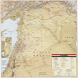
Topographic Map of Syria
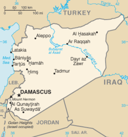
Map of Syria
Map of Syria in Arabic
Map of Syria in French
Map of Syria, 2011
Ethnoreligious distribution, 2011
Population density, 2011
Map of Syria, 2004
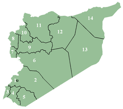
Governorates of Syria
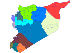
Districts of Syria
Map of the Golan Heights, 2011
Map of the Golan Heights, 1992
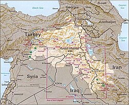
Map of Kurdish inhabited areas, 1992

History maps

This section holds a short summary of the history of the area of present-day Syria, illustrated with maps, including historical maps of former countries and empires that included present-day Syria.

Fertile Crescent (around 4000 BCE)

Fertile Crescent
Akkadian Empire around 2000 BCE
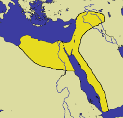
The Hittite Empire (red) at the height of its power in ca. 1290 BC, bordering on the Egyptian Empire (green)
Hittite Empire
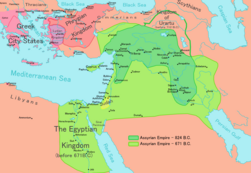
The Assyrian Empire in the 9th to 7th centuries BC
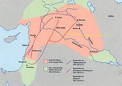
Deportation of the Jews by the Assyrian Empire
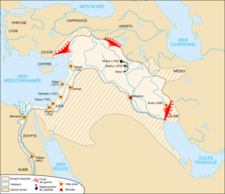
Neo-Assyrian Empire
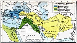
The Chaldean Empire around 600 BCE)
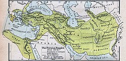
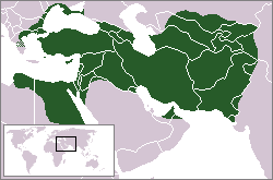
The Achaemid Empire (Persia (648–330 BCE) at its greatest extent
The Persian Achaemenid Empire
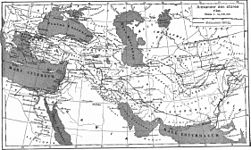
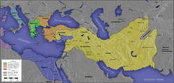
The Expedition of Alexander the Great 334-323 BCE
Map of the Empire of Alexander
Map of the Empire of Alexander 334-323 BCE
Map of the Empire of Alexander (Norwegian)
Hellenistic successor states:
 
Kingdom of Ptolemy
 
Kingdom of Cassander
 
Kingdom of Lysimachus
 
Kingdom of Seleucus
Other states:
 
Rome
Hellenistic world in 200 BCE
The Parthian Empire (250 BCE-226 CE)
Map of Parthia 100 BC
Territorial development of the Roman Empire 264 BC-192, including the conquest of present
Roman conquest of Minor Asia
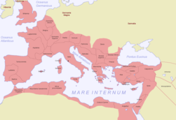
Map of the Roman Empire in 50
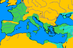
The extent of the Roman Republic and Roman Empire;
 
133 BC
 
44 BC (late Republic, after conquests by republican generals)
 
AD 14 (death of Augustus)
 
117 (maximum extension)
Northern part of present-day Syria (as of 31 BC)
Roman province of Syria
Camps of the Roman Legions in 80
Map of the Roman Empire in 116
Roman Empire in 117
Roman Empire divided 395, showing the dioceses and praetorian prefectures of Gaul, Italy, Illyricum and Oriens (east), roughly analogous to the four Tetrarch zones of influence after Diocletian's reforms.
The division of the Empire after the death of Theodosius I, ca.395 AD superimposed on modern borders.
Division of the Roman Empire in 406
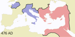
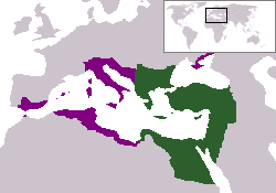
Eastern Roman Empire and Western Roman Empire Roman Empires, c.476
Eastern Roman Empire
Eastern Roman Empire under emperor Justinianus
Byzantine Empire 550
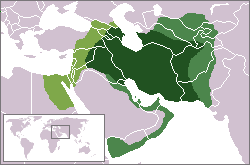
Indo-Sassanide Empire
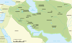
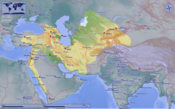
The Persian Sassanian Empire (226-650) in 602 to 629, Strokes: Under Sassanid military control.
Sassanide Empire
Sassanide Empire
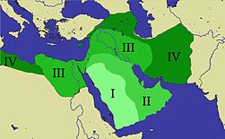
Expansion of the Caliphate: I: Muhammad; II: Abu Bakr; III: Omar and IV: Othman
Age of the Caliphs
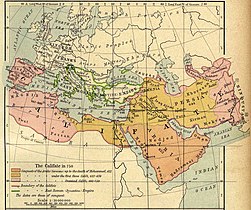
Caliphate around 750
The Seljuq Empire 1037-1194

Crusaders (around 1200)

The Crusader States
Ayyubid dynasty in 1189
The Ayyubid Empire of Saladin around 1190
Growth of the Ottoman Empire
[[|border|251x400px]] Map of the Ottoman Empire 1566
Location of the Ottoman Empire in 1683
Map of the Ottoman Empire 1801
Federation of Arab Republics (Egypt, Libya and Syria)
United Arab Republic
1967 Six Day War
Yom Kippur War 1973
Golan Heights

Syrian civil war (2011-present)

Map showing the Syrian War

Satellite maps

Satellite map

Notes and references

General remarks:

  • The WIKIMEDIA COMMONS Atlas of the World is an organized and commented collection of geographical, political and historical maps available at Wikimedia Commons. The main page is therefore the portal to maps and cartography on Wikimedia. That page contains links to entries by country, continent and by topic as well as general notes and references.
  • Every entry has an introduction section in English. If other languages are native and/or official in an entity, introductions in other languages are added in separate sections. The text of the introduction(s) is based on the content of the Wikipedia encyclopedia. For sources of the introduction see therefore the Wikipedia entries linked to. The same goes for the texts in the history sections.
  • Historical maps are included in the continent, country and dependency entries.
  • The status of various entities is disputed. See the content for the entities concerned.
  • The maps of former countries that are more or less continued by a present-day country or had a territory included in only one or two countries are included in the atlas of the present-day country. For example the Ottoman Empire can be found in the Atlas of Turkey.
  1. Romanization: al-Sūriyyah - Al-Jumhūriyyah al-ʿArabiyyah as-Sūriyyah.
  2. Romanization: Dimashq.

Entries available in the atlas

General pages
World
Continents and oceans
Themes
Historical eras
States with wide recognition
States with limited recognition
Dependencies and other overseas territories
Country subdivisions
Belgium
China (mainland)
India
Pakistan
Spain
United Kingdom
United States
Russia
Other
Disputed subnational territories
Other regions
Cities
Former sovereign states
Former dependencies and overseas territories
Former disputed territories


References