
Atlas of Lithuania

|
Wikimedia Commons Atlas of the World The Wikimedia Atlas of the World is an organized and commented collection of geographical, political and historical maps available at Wikimedia Commons. Discussion • Update the atlas • Index of the Atlas • Atlas in categories • Other atlases on line |
|
| ||||||||||||||||||||||||||||||||||||||||||||


In Lithuanian
General maps

|
Map of Lithuania |

|
Map of Lithuania (German)[1] |

|
High resolution map of Lithuania (blank or German language available)[2][3][4] |

|

|
Physical map of Lithuania |

|
Physical map |

|
Physical map |
Maps of divisions
This section holds maps of the administrative divisions.

|
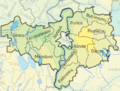
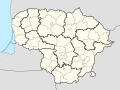
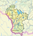
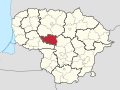
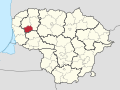
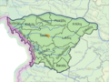
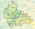
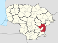
Counties of Lithuania |

|
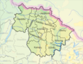
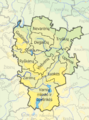
Counties and municipalities of Lithuania |

|
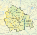
Elderships of Lithuania |
-
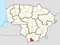
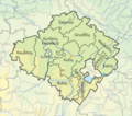
 Alytus County
 -
 Utena County
 -
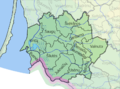
 Šiauliai County
 -
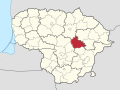
 Panevėžys County
 -
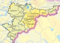
 Telšiai County
 -
 Tauragė County
 -
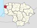
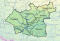
 Klaipėda County
 -
 Marijampolė County
 -
 Kaunas County
 -
 Vilnius County


-
 Akmenė District Municipality
 -
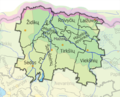
 Elderships of Akmenė District Municipality
 -
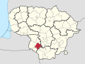
 Alytus City Municipality
 -
 Alytus District Municipality
 -
 Elderships of Alytus District Municipality
 -
 Anykščiai District Municipality
 -
 Elderships of Anykščiai District Municipality
 -
 Birštonas Municipality
 -
 Elderships of Birštonas Municipality
 -
 Biržai District Muncipality
 -
 Elderships of Biržai District Municipality
 -
 Druskininkai Municipality
 -
 Elderships of Druskininkai Municipality
 -
 Elektrėnai Municipality
 -
 Elderships of Elektrėnai Municipality
 -
 Ignalina District Municipality
 -
 Elderships of Ignalina District Municipality
 -
 Jonava District Municipality
 -
 Elderships of Jonava District Municipality
 -
 Joniškis District Municipality
 -
 Elderships of Joniškis District Municipality
 -
 Jurbarkas District Municipality
 -
 Elderships of Jurbarkas District Municipality
 -
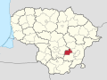
 Kaišiadorys District Municipality
 -
 Elderships of Kaišiadorys District Municipality
 -
 Kalvarija Municipality
 -
 Elderships of Kalvarija Municipality
 -
 Kaunas City Municipality
 -
 Aleksotas and other elderships of Kaunas City Municipality
 -
 Kaunas District Municipality
 -
 Elderships of Kaunas District Municipality
 -
 Kazlų Rūda Municipality
 -
 Elderships of Kazlų Rūda Municipality
 -
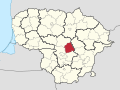
 Kėdainiai District Municipality
 -
 Elderships of Kėdainiai District Municipality
 -
 Kelmė District Municipality
 -
 Elderships of Kelmė District Municipality
 -
 Klaipėda City Municipality
 -
 Klaipėda District Municipality
 -
 Elderships of Klaipėda District Municipality
 -
 Kretinga District Municipality
 -
 Elderships of Kretinga District Municipality
 -
 Kupiškis District Municipality
 -
 Elderships of Kupiškis District Municipality
 -
 Lazdijai District Municipality
 -
 Elderships of Lazdijai District Municipality
 -
 Marijampolė Municipality
 -
 Elderships of Marijampolė District Municipality
 -
 Mažeikiai District Municipality
 -
 Elderships of Mažeikiai District Municipality
 -
 Molėtai District Municipality
 -
 Elderships of Molėtai District Municipality
 -
 Neringa Municipality
 -
 Pagėgiai Municipality
 -
 Elderships of Pagėgiai Municipality
 -
 Pakruojis District Municipality
 -
 Elderships of Pakruojis District Municipality
 -
 Palanga City Municipality
 -
 Panevėžys City Municipality
 -
 Panevėžys District Municipality
 -
 Elderships of Panevėžys District Municipality
 -
 Pasvalys District Municipality
 -
 Elderships of Pasvalys District Municipality
 -
 Plungė District Municipality
 -
 Elderships of Plungė District Municipality
 -
 Prienai District Municipality
 -
 Elderships of Prienai District Municipality
 -
 Radviliškis District Municipality
 -
 Elderships of Radviliškis District Muncipality
 -
 Raseiniai District Municipality
 -
 Elderships of Raseiniai District Municipality
 -
 Rietavas Municipality
 -
 Elderships of Rietavas Municipality
 -
 Rokiškis District Municipality
 -
 Elderships of Rokiškis District Municipality
 -
 Skuodas District Municipality
 -
 Elderships of Skuodas District Municipality
 -
 Šakiai District Municipality
 -
 Elderships of Šakiai District Municipality
 -
 Šalčininkai District Municipality
 -
 Elderships of Šalčininkai District Municipality
 -
 Šiauliai City Municipality
 -
 Šiauliai District Municipality
 -
 Elderships of Šiauliai District Municipality
 -
 Šilalė District Municipality
 -
 Elderships of Šilalė District Municipality
 -
 Šilutė District Municipality
 -
 Elderships of Šilutė District Municipality
 -
 Širvintos District Municipality
 -
 Elderships of Širvintos District Municipality
 -
 Švenčionys District Municipality
 -
 Elderships of Švenčionys District Municipality
 -
 Tauragė District Municipality
 -
 Elderships of Tauragė District Municipality
 -
 Telšiai District Municipality
 -
 Elderships of Telšiai District Municipality
 -
 Trakai District Municipality
 -
 Elderships of Trakai District Municipality
 -
 Ukmergė District Municipality
 -
 Elderships of Ukmergė District Municipality
 -
 Utena District Municipality
 -
 Elderships of Utena District Municipality
 -
 Varėna District Municipality
 -
 Elderships of Varėna District Municipality
 -
 Vilkaviškis District Municipality
 -
 Elderships of Vilkaviškis District Municipality
 -
 Vilnius City Municipality
 -
 Elderships of Vilnius City Municipality
 -
 Vilnius District Municipality
 -
 Elderships of Vilnius District Municipality
 -
 Visaginas Municipality
 -
 Zarasai District Municipality
 -
 Elderships of Visaginas District Municipality


.svg)


History maps
This section holds a short summary of the history of the area of present-day Lithuania, illustrated with maps, including historical maps of former countries and empires that included present-day Lithuania.
Early history

|
Map of the distribution of hydronymes of Baltic origin. The main area is dark blue, the peripheral area is light blue. |

|
Balts during IV-III centuries B.C. |

|
Baltic Tribes around 1200 |

|
The Monastic state of the Teutonic Knights 1225-1250 |
Independent Lithuania

|
Map showing changes in the territory of Lithuania from the 13th century to the present day:
|

|
Historical map of Lithuania at 1240-1263 |

|
Historical map of Lithuania at 1316-1341 |

|
Historical map of Lithuania at 1345-1377 |

|
Lithuania in the 13th and 15th century |

|
The Monastic state of the Teutonic Knights 1308–1455 |

|
The Monastic state of the Teutonic Knights 1466 |

|
In 1386 Poland and Lithuania formed a Polish-Lithuanian personal union, succeeded in 1569 by the Polish-Lithuanian Commonwealth. Large parts of present-day Belarus and Ukraine were part of Poland-Lithuania. This map shows the borders in 1466 |

|
Lithuania and Poland in 1387 |

|
Administrative divisions of Lithuania in 1430 |

|
Lithuanian language areas in the 16th century |
Polish Lithuanian Commonwealth

|
1569-1795: Polish-Lithuanian Commonwealth - Independent country, including present-day Lithuania ► Poland In 1569 the personal union is succeeded by the Polish-Lithuanian Commonwealth, a state that existed until the 3rd partition of 1795. |

|
Map of the Commonwealth in 1569 |
.jpg)
|
Grand Duchy of Lithuania in 1613 |
Incorporation into the Russian Empire

|
The third partition meant the end of the Polish-Lithuanian Commonwealth and the final division between Prussia, Russia and Austria after 3rd partition |

|
Lithuania's administrative divisions in the 17th century |

|
Lithuania after 3rd partitions (1795) |

|
Russian Empire |

|
The Russian Empire in 1866 |

|
History of the Russian Empire (in German) |

|
Ethnographic map of Lithuanians and Latvians in 1847 |
.jpg)
|
Ethnic map of the former Polish-Lithuanian Commonwealth in 1863 |
.jpg)
|
Ethnological map of Lithuania and Belarus |

|
Lithuania in the Russian Empire (1867-1914) |

|
The map of the Lithuanian - Latvian land, 1900 |

|
Russia in 1912 |
Independent Lithuania in the interbellum

|
Lithuanian claims in Poland in 1920 |

|
Republic of ► Central Lithuania. |

|
Lithuania claims and the Republic of Central Lithuania |

|
Changing border between Lithuania and Poland. In 1923 Lithuania occupies and annexes the ► Memel Territory in the "Klaipeda Revolt". The Memel Territory was a former ► German territory under protection of the League of Nations since 1920. |
,_with_the_territory_occupied_by_Poland,_ca_1930s.jpg)
|
Map of Lithuania (Carte de Lithuanie), with the territory occupied by Poland in the 1930s |
Soviet annexation

|
Lithuania is annexed by the Soviet Union in 1940. Location of the USSR |

|
Evolution of the Soviet Union |

|
The republics of the USSR |

|
Soviet Lithuania |

|
Map of the 1949 geographic location of various ethnic groups within the Soviet Union |

|
Soviet Union administrative divisions, 1989 |
Restored independence
History of other entities
Central Lithuania
| 1920-1922: Republic of Central Lithuania (Vidurio Lietuvos Respublika, Republika Litwy Środkowej, Рэспубліка Сярэдняе Літвы - Respublika Siaredniaje Litvy) - |
|
|
Republic of Central Lithuania |
|
|
Lithuania claims and the Republic of Central Lithuania |
Klaipėda
| 1920-1923: Memel Territory (Memelgebiet, Klaipėdos kraštas) - territory under protection of the League of Nations |

|
The Memel Territory Klaipėda Region (Lithuanian: Klaipėdos kraštas) or Memel Territory (German: Memelland or Memelgebiet; French: Territoire de Memel) was defined by the Treaty of Versailles in 1920 when it was put under the administration of the Council of Ambassadors. The Memel Territory, situated between the river and the town of that name, was occupied by Lithuania in the "Klaipeda Revolt" of 1923, returned to Germany in 1939, and made a part of the Lithuanian SSR in 1944. |

|
Memel Territory annexed by Germany |
Other maps

|
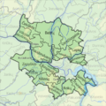
Population density |

|
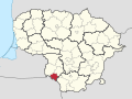
Ethnographic map |

|
Litauische Ostseeküste |

|
Lithuania-Latvia interconnection |
Satellite maps

|
Satellite map |
Notes and references
|
General remarks:
|