
Category:SVG maps of the Czech Republic
These are SVG (Scaleable Vector Graphics) of various locations in the Czech Republic created by Caroig using Inkscape. They are based on various paper maps which have been scanned and the layers aligned. These sources cannot be posted here as they are copyrighted materials but can by asked for by writing to the author.
Subcategories
This category has the following 11 subcategories, out of 11 total.
Media in category "SVG maps of the Czech Republic"
The following 146 files are in this category, out of 146 total.
-
 Czechia - outline map.svg 5,342 × 3,123; 127 KB
-
 2004 Czech European Parliament election.svg 1,060 × 530; 756 KB
-
 2009 Czech European Parliament election.svg 1,060 × 530; 729 KB
-
 2014 Czech European Parliament election.svg 1,060 × 530; 753 KB
-
 2019 Czech European Parliament election.svg 1,060 × 530; 753 KB
-
 2024 Czech European Parliament election.svg 1,060 × 530; 689 KB
-
 Czech Republic - blank map.svg 5,342 × 3,123; 131 KB
-
 Bavarian succession new-01.svg 512 × 311; 366 KB
-
 Berounka (CZE) - location map.svg 5,342 × 3,123; 143 KB
-
 Bečva River (CZE) - location and watershed.svg 5,342 × 3,123; 138 KB
-
 Blank map of the Czech Republic.svg 5,338 × 3,056; 77 KB
-
 Bohemia in Czechland.svg 3,433 × 1,973; 232 KB
-
 Cesko-kraje.svg 3,433 × 1,973; 195 KB
-
 Beskydy Landscape Protected Area (CZE) - location map.svg 5,342 × 3,123; 131 KB
-
 CHKO Český les (CZE) - location map.svg 5,342 × 3,123; 133 KB
-
 CHKO Křivoklátsko (CZE) - location map.svg 5,342 × 3,123; 131 KB
-
 CR-okresy-general-Model.svg 512 × 384; 1 MB
-
 CZ-cleneni-Slezsko-wl.svg 3,433 × 1,973; 127 KB
-
 CZ-cleneni.svg 3,433 × 1,973; 208 KB
-
 Czech general election 2017 - Results by Region.svg 2,097 × 943; 580 KB
-
 Czech kraje and historic regions.svg 800 × 460; 53 KB
-
 Czech parliament elections 2002 - region winners.svg 3,417 × 1,956; 116 KB
-
 Czech parliament elections 2006 - region winners.svg 3,417 × 1,956; 116 KB
-
 Czech parliament elections 2010 - districts, turnout.svg 512 × 384; 693 KB
-
 Czech parliament elections 2010 - regions winners map.svg 3,417 × 1,956; 257 KB
-
 Czech parliament elections 2013 - regions winners map.svg 3,417 × 1,956; 257 KB
-
 Czech parliament elections districts winner map 2010.svg 1,021 × 587; 225 KB
-
 Czech RegionalEl 2008.svg 3,417 × 1,956; 116 KB
-
 Czech RegionalEl 2012.svg 3,417 × 1,956; 116 KB
-
 Czech Republic - Czechomoravia - geographic map - cz.svg 1,949 × 1,200; 14.99 MB
-
 Czech Republic adm location map.svg 1,004 × 611; 184 KB
-
 Czech Republic districts 2007 blank for elections.svg 1,045 × 604; 596 KB
-
 Czech Republic Köppen.svg 765 × 720; 537 KB
-
 Czech Republic map.svg 730 × 782; 244 KB
-
 Czech Republic railway 240 diagram.svg 1,035 × 523; 23 KB
-
 Czech Republic regions.svg 3,433 × 1,973; 232 KB
-
 Czech Republic relief location map.svg 932 × 567; 3.37 MB
-
 Czechia Köppen.svg 765 × 720; 488 KB
-
 Czechia-geographic map-cz.svg 1,949 × 1,200; 14.99 MB
-
 Czechia-geographic map-en.svg 1,949 × 1,200; 14.56 MB
-
 Czechia-geographic map-eo.svg 1,949 × 1,200; 14.56 MB
-
 Czechia-geographic map-fr.svg 1,949 × 1,200; 14.56 MB
-
 Czechomoravia-geographic map-en.svg 1,949 × 1,200; 14.56 MB
-
 CzechRepublic-geographic map-cz.svg 1,949 × 1,200; 14.99 MB
-
 CzechRepublic-geographic map-en.svg 1,949 × 1,200; 14.56 MB
-
 CzechRepublic-geographic map-fr.svg 1,949 × 1,200; 14.56 MB
-
 D1 Highway (Czech Republic) update.svg 640 × 370; 117 KB
-
 D1 Highway (Czech Republic).svg 640 × 370; 21 KB
-
 D11 Highway (Czech Republic).svg 640 × 370; 111 KB
-
 D2 Highway (Czech Republic).svg 640 × 370; 116 KB
-
 D3 Highway (Czech Republic).svg 640 × 370; 14 KB
-
 D5 Highway (Czech Republic).svg 640 × 370; 117 KB
-
 D8 Highway (Czech Republic).svg 640 × 370; 111 KB
-
 Pilsen Little District (CZE) - location map.svg 5,342 × 3,123; 132 KB
-
 Tachov Little District (CZE) - location map.svg 5,342 × 3,123; 134 KB
-
 Districts of Czech Republic vector line model.svg 1,021 × 587; 231 KB
-
 Dlouhopolsko (NPP) (CZE) - location map.svg 6,678 × 3,904; 54 KB
-
 ETRS89CZ-NULRAD+DOPNUL-geodetická síť Česká republika.svg 3,189 × 1,826; 1,018 KB
-
 EU location CZE.svg 1,600 × 1,200; 2.47 MB
-
 EU-Czech Republic.svg 2,045 × 1,720; 7.33 MB
-
 Europe cz.svg 680 × 520; 795 KB
-
 GADM CZE Administrative Divisions.svg 630 × 362; 610 KB
-
 Hostýnsko-vsetínská hornatina (CZE) - location map.svg 5,342 × 3,123; 129 KB
-
 Hultschiner Ländchen.svg 512 × 382; 46 KB
-
 IC trains network Czechia 2020.svg 5,800 × 3,750; 188 KB
-
 Jablunkovská brázda (CZE) - location map.svg 5,342 × 3,123; 327 KB
-
 Jarní prázdniny.svg 1,021 × 587; 1.07 MB
-
 Jihocesky kraj.svg 3,417 × 1,956; 180 KB
-
 Jihomoravsky kraj.svg 3,417 × 1,956; 181 KB
-
 Karlovarsky kraj.svg 3,417 × 1,956; 178 KB
-
 Kernenergie in Tschechien.svg 819 × 567; 30 KB
-
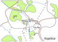 Kojetice map.svg 1,050 × 756; 86 KB
-
 Kraj Vysocina old colors.svg 3,417 × 1,956; 110 KB
-
 Kraj Vysocina.svg 3,417 × 1,956; 177 KB
-
 Kralovehradecky kraj.svg 3,417 × 1,956; 182 KB
-
 Liberecky kraj.svg 3,417 × 1,956; 183 KB
-
 Locator map Czech Socialist Republic.svg 1,260 × 670; 142 KB
-
 Locator map of the Czech Republic.svg 680 × 520; 657 KB
-
 Malé Karlovice.svg 1,154 × 697; 13 KB
-
 Map of the Czech Republic clip art.svg 571 × 322; 544 KB
-
 Mapa CHKO České středohoří.svg 3,307 × 2,846; 156 KB
-
 Mapa da Chéquia (OCHA).svg 254 × 254; 973 KB
-
 Morava, židovské osídlení 1300.svg 1,800 × 1,330; 41 KB
-
 Morava, židovské osídlení 1835.svg 1,801 × 1,301; 96 KB
-
 Morava, židovské osídlení do 1420.svg 1,800 × 1,330; 68 KB
-
 Moravia in Czechland.svg 3,433 × 1,973; 232 KB
-
 Moravian-Silesian Region - outline location map.svg 5,342 × 3,123; 134 KB
-
 Moravian-Silesian Region - outline map.svg 1,440 × 1,265; 167 KB
-
 Moravskoslezsky kraj.svg 3,417 × 1,956; 180 KB
-
 Motorway D0-CZ map.svg 780 × 450; 51 KB
-
 Motorway D1-CZ map.svg 780 × 450; 48 KB
-
 Motorway D10-CZ map.svg 780 × 450; 51 KB
-
 Motorway D11-CZ map.svg 780 × 450; 46 KB
-
 Motorway D2-CZ map.svg 780 × 450; 48 KB
-
 Motorway D3-CZ map.svg 780 × 450; 56 KB
-
 Motorway D35-CZ map.svg 780 × 450; 47 KB
-
 Motorway D4-CZ map.svg 780 × 450; 46 KB
-
 Motorway D43-CZ map.svg 776 × 446; 150 KB
-
 Motorway D46-CZ map.svg 780 × 450; 52 KB
-
 Motorway D48-CZ map.svg 780 × 450; 56 KB
-
 Motorway D49-CZ map.svg 780 × 450; 54 KB
-
 Motorway D5-CZ map.svg 780 × 450; 52 KB
-
 Motorway D52-CZ map.svg 780 × 450; 51 KB
-
 Motorway D55-CZ map.svg 780 × 450; 59 KB
-
 Motorway D56-CZ map.svg 780 × 450; 50 KB
-
 Motorway D6-CZ map.svg 780 × 450; 57 KB
-
 Motorway D7-CZ map.svg 780 × 450; 53 KB
-
 Motorway D8-CZ map.svg 780 × 450; 51 KB
-
 Motorways in Czechia map.svg 776 × 446; 156 KB
-
 MotorwaysCZmap.svg 776 × 446; 198 KB
-
 Nerealizované země ČR - Drápela Sýkora.svg 1,021 × 587; 234 KB
-
 Krkonoše National Park (CZE) - location map.svg 5,342 × 3,123; 134 KB
-
 Podyjí National Park (CZE) - location map.svg 5,342 × 3,123; 135 KB
-
 Šumava National Park and Landscape protected Area (CZE) - location map.svg 5,342 × 3,123; 148 KB
-
 Návrh země ČR Malík.svg 1,021 × 587; 244 KB
-
 Okresy CR mirne generalizovane.svg 512 × 293; 169 KB
-
 Olomoucky kraj.svg 3,417 × 1,956; 183 KB
-
 Pardubicky kraj.svg 3,417 × 1,956; 185 KB
-
 Pałac Bílá Voda - plan.svg 472 × 611; 296 KB
-
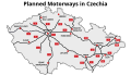 Planned Motorways in Czechia.svg 728 × 418; 139 KB
-
 PlannedMotorwaysCZ.svg 728 × 418; 198 KB
-
 Plzensky kraj.svg 3,417 × 1,956; 182 KB
-
 Podbeskydská pahorkatina (CZE) - location map.svg 5,342 × 3,123; 132 KB
-
 Railway network Czech Republic.svg 3,389 × 1,940; 263 KB
-
 Moravian-Silesian Beskids - location map in Moravian-Silesian Region.svg 1,440 × 1,265; 170 KB
-
 Moravskoslezské Beskydy (CZE) - location map.svg 5,342 × 3,123; 130 KB
-
 České Středohoří - location map.svg 5,342 × 3,123; 130 KB
-
 República Checa-Cheqomoravia-geographic map-es.svg 1,949 × 1,200; 17.03 MB
-
 Lužnice River (CZE) - location and watershed map.svg 5,342 × 3,123; 142 KB
-
 River Ostravice (CZE) - location map.svg 5,342 × 3,123; 173 KB
-
 Sázava River (CZE) - location and watershed.svg 5,342 × 3,123; 143 KB
-
 Rožnovská brázda (CZE) - location map.svg 5,342 × 3,123; 327 KB
-
 République tcheque-Tchécomoravie-geographic map-fr.svg 1,949 × 1,200; 14.56 MB
-
 Semafor of COVID-19 disease at 2020-09-04 at Czech Republic.svg 512 × 293; 170 KB
-
 Senatni obvody 2+3n.svg 3,845 × 2,991; 307 KB
-
 Senatni obvody 3n.svg 3,845 × 2,991; 307 KB
-
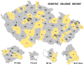 Senátní volební obvody 1. třetina.svg 3,845 × 2,991; 387 KB
-
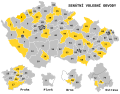
 Senátní volební obvody.svg 3,845 × 2,991; 307 KB
-
 Silesia in Czechland.svg 3,433 × 1,973; 232 KB
-
 SilniceI2 map.svg 1,318 × 757; 288 KB
-
 Slepá mapa okresu Hradec Králové.svg 300 × 174; 111 KB
-
 Stredocesky kraj.svg 3,417 × 1,956; 185 KB
-
 Ustecky kraj.svg 3,417 × 1,956; 180 KB
-
 Vltava River (CZE) - location and watershed.svg 5,342 × 3,123; 149 KB
-
 Zlinsky kraj.svg 3,417 × 1,956; 184 KB
-
 Čeladenka River - location and watershed map.svg 5,342 × 3,123; 130 KB


_-_location_map.svg)
_-_location_and_watershed.svg)


_-_location_map.svg)
_-_location_map.svg)
_-_location_map.svg)


_update.svg)
.svg)
.svg)
.svg)
.svg)
.svg)
.svg)
_-_location_map.svg)
_-_location_map.svg)

_(CZE)_-_location_map.svg)


_-_location_map.svg)


_-_location_map.svg)


.svg)


_-_location_map.svg)
_-_location_map.svg)
_-_location_map.svg)


_-_location_map.svg)


_-_location_map.svg)


_-_location_and_watershed_map.svg)
_-_location_map.svg)
_-_location_and_watershed.svg)
_-_location_map.svg)


_-_location_and_watershed.svg)

