Category:SVG maps of Croatia
Jump to navigation
Jump to search
Subcategories
This category has the following 6 subcategories, out of 6 total.
Media in category "SVG maps of Croatia"
The following 112 files are in this category, out of 112 total.
-
2019 European Parliament election in Croatia - parties with most votes by county.svg 1,097 × 1,062; 634 KB
-
Balkan floods May 2014.svg 850 × 600; 239 KB
-
Bay-of-Piran maritime-boundary-dispute-hr.svg 789 × 735; 30 KB
-
Bay-of-Piran maritime-boundary-dispute-hu.svg 789 × 735; 36 KB
-
Bay-of-Piran maritime-boundary-dispute-mk.SVG 789 × 735; 107 KB
-
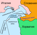
Bay-of-Piran maritime-boundary-dispute-ru.svg 789 × 735; 136 KB
-
Bay-of-Piran maritime-boundary-dispute-sr.svg 789 × 735; 36 KB
-
Bay-of-Piran maritime-boundary-dispute.svg 789 × 735; 35 KB
-
Cadastral municipalities of Croatia.svg 900 × 900; 8.28 MB
-
Counties of Croatia by HDI (2018).svg 512 × 514; 254 KB
-
Counties of Croatia-fr.svg 1,097 × 1,062; 772 KB
-
Counties of Croatia-mk.svg 1,097 × 1,062; 1.03 MB
-
Counties of Croatia-numerados.svg 1,097 × 1,062; 669 KB
-
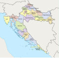
Counties of Croatia.svg 1,097 × 1,062; 759 KB
-
Croatia Bjelovar-Bilogora County adm location map.svg 1,050 × 932; 329 KB
-
Croatia Brod-Posavina County adm location map.svg 1,336 × 670; 252 KB
-
Croatia Dubrovnik-Neretva County adm location map.svg 1,472 × 904; 425 KB
-
Croatia Istria County adm location map.svg 1,093 × 1,121; 405 KB
-
Croatia Karlovac County adm location map.svg 1,108 × 1,218; 543 KB
-
Croatia Koprivnica-Križevci County adm location map.svg 1,427 × 1,033; 288 KB
-
Croatia Krapina-Zagorje County adm location map.svg 1,113 × 908; 451 KB
-
Croatia Lika-Senj County adm location map.svg 1,238 × 1,012; 574 KB
-
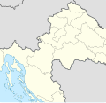
Croatia location map - Central Croatia.svg 548 × 526; 207 KB
-
Croatia location map - Dalmatia.svg 650 × 592; 207 KB
-
Croatia location map - East Croatia.svg 453 × 362; 207 KB
-
Croatia location map - West Croatia.svg 440 × 359; 207 KB
-
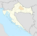
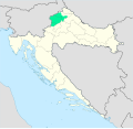
Croatia location map, Bjelovar-Bilogora county.svg 1,097 × 1,062; 452 KB
-
Croatia location map, Brod-Posavina county.svg 1,097 × 1,062; 452 KB
-
Croatia location map, City of Zagreb county.svg 1,097 × 1,062; 448 KB
-
Croatia location map, Dubrovnik-Neretva county.svg 1,097 × 1,062; 468 KB
-
Croatia location map, Istria county.svg 1,097 × 1,062; 526 KB
-
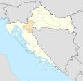
Croatia location map, Karlovac county.svg 1,097 × 1,062; 453 KB
-
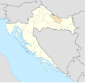
Croatia location map, Koprivnica-Krizevci county.svg 1,097 × 1,062; 452 KB
-
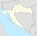
Croatia location map, Krapina-Zagorje county.svg 1,097 × 1,062; 449 KB
-
Croatia location map, Lika-Senj county.svg 1,097 × 1,062; 498 KB
-
Croatia location map, Medimurje county.svg 1,097 × 1,062; 449 KB
-
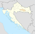
Croatia location map, Osijek-Baranja county.svg 1,097 × 1,062; 455 KB
-
Croatia location map, Pozega-Slavonia county.svg 1,097 × 1,062; 452 KB
-
Croatia location map, Primorje-Gorski Kotar county.svg 1,097 × 1,062; 471 KB
-
Croatia location map, Sibenik-Knin county.svg 1,097 × 1,062; 519 KB
-
Croatia location map, Sisak-Moslavina county.svg 1,097 × 1,062; 454 KB
-
Croatia location map, Split-Dalmatia county.svg 1,097 × 1,062; 468 KB
-
Croatia location map, Varazdin county.svg 1,097 × 1,062; 450 KB
-
Croatia location map, Virovitica-Podravina county.svg 1,097 × 1,062; 452 KB
-
Croatia location map, Vukovar-Syrmia county.svg 1,097 × 1,062; 454 KB
-
Croatia location map, Zadar county.svg 1,097 × 1,062; 476 KB
-
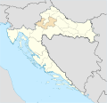
Croatia location map, Zagreb county.svg 1,097 × 1,062; 498 KB
-
Croatia location map.svg 1,097 × 1,062; 480 KB
-
Croatia map blank standard colors.svg 1,000 × 1,000; 1.12 MB
-
Croatia Međimurje County adm location map.svg 1,449 × 1,063; 245 KB
-
Croatia Osijek-Baranja County adm location map.svg 1,328 × 1,131; 405 KB
-
Croatia Požega-Slavonia County adm location map.svg 1,387 × 919; 225 KB
-
Croatia Primorje-Gorski Kotar County adm location map.svg 1,092 × 1,216; 767 KB
-
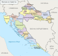
Croatia Regions map ru.svg 745 × 552; 511 KB
-
Croatia Regions map.svg 990 × 765; 1.24 MB
-
Croatia Sisak-Moslavina County adm location map.svg 1,661 × 1,141; 715 KB
-
Croatia Split-Dalmatia County adm location map.svg 1,295 × 1,288; 790 KB
-
Croatia Varaždin County adm location map.svg 1,254 × 899; 326 KB
-
Croatia Virovitica-Podravina County adm location map.svg 1,198 × 952; 202 KB
-
Croatia Vukovar-Srijem County adm location map.svg 1,346 × 1,156; 247 KB
-
Croatia Zadar County adm location map.svg 1,467 × 1,031; 729 KB
-
Croatia Zagreb County adm location map.svg 1,192 × 788; 478 KB
-
Croatia Šibenik-Knin County adm location map.svg 1,405 × 1,114; 618 KB
-
Croatia, Bjelovar-Bilogora County.svg 600 × 551; 820 KB
-
Croatia, Brod-Posavina County.svg 600 × 551; 820 KB
-
Croatia, City of Zagreb County.svg 600 × 551; 820 KB
-
Croatia, Dubrovnik-Neretva County.svg 600 × 551; 820 KB
-
Croatia, Istria County.svg 600 × 551; 820 KB
-
Croatia, Karlovac County.svg 600 × 551; 820 KB
-
Croatia, Koprivnica-Krizevci County.svg 600 × 551; 820 KB
-
Croatia, Krapina-Zagorje County.svg 600 × 551; 820 KB
-
Croatia, Lika-Senj County.svg 600 × 551; 820 KB
-
Croatia, Medimurje County.svg 600 × 551; 820 KB
-
Croatia, Osijek-Baranja County.svg 600 × 551; 820 KB
-
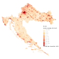
Croatia, population density.svg 900 × 900; 18.78 MB
-
Croatia, Pozega-Slavonia County.svg 600 × 551; 820 KB
-
Croatia, Primorje-Gorski Kotar County.svg 600 × 551; 820 KB
-
Croatia, Sibenik-Knin County.svg 600 × 551; 820 KB
-
Croatia, Sisak-Moslavina County.svg 600 × 551; 820 KB
-
Croatia, Split-Dalmatia County.svg 600 × 551; 820 KB
-
Croatia, Varazdin County.svg 600 × 551; 820 KB
-
Croatia, Virovitica-Podravina County.svg 600 × 551; 820 KB
-
Croatia, Vukovar-Syrmia County.svg 600 × 551; 820 KB
-
Croatia, Zadar County.svg 600 × 551; 820 KB
-
Croatia, Zagreb County.svg 600 × 551; 820 KB
-
Croatian Counties, Plain Map Colored.svg 600 × 551; 815 KB
-
Croatian Counties, Plain Map.svg 600 × 551; 820 KB
-
Europe-Croatia.svg 2,045 × 1,720; 2.7 MB
-
Historical regions of Croatia.svg 1,098 × 1,063; 773 KB
-
Independent State Of Croatia 1941 Locator Map.svg 748 × 736; 1,014 KB
-
Istria in Croatia.svg 1,098 × 1,063; 788 KB
-
Istria map.svg 1,098 × 1,063; 794 KB
-
Kingdom of Hungary counties (sk-Bjelovarsko-križevetská).svg 1,772 × 1,166; 314 KB
-
Kingdom of Hungary counties (sk-Licko-krbavská).svg 1,772 × 1,166; 314 KB
-
Kingdom of Hungary counties (sk-Marmarošská).svg 1,772 × 1,166; 1.21 MB
-
Kingdom of Hungary counties (sk-Modrušsko-skorjecká).svg 1,772 × 1,166; 314 KB
-
Koppen-Geiger Map HRV present.svg 1,551 × 850; 2.04 MB
-
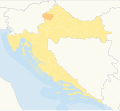
Location of Hrvatsko zagorje inside Croatia.svg 1,097 × 1,062; 510 KB
-
Locator map of Croatia.svg 680 × 520; 660 KB
-
Map of Croatia UN.svg 592 × 435; 561 KB
-
Municipalities of Croatia.svg 900 × 900; 3.29 MB
-
Religious belief in Croatia, 2011.svg 1,097 × 1,061; 530 KB
-
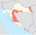
RSK and Yugoslav Army-held areas in Croatia in early 1992.svg 512 × 496; 233 KB
-
Split-Dalmatia County OpenStreetMap.svg 2,843 × 2,158; 45.36 MB
-
Un-croatia mk.svg 900 × 666; 1.59 MB
-
Un-croatia ru.svg 900 × 666; 895 KB
-
Un-croatia v1.svg 900 × 666; 881 KB
-
Un-croatia.svg 900 × 666; 892 KB
-
UN-Karte Kroatiens.svg 900 × 662; 493 KB
-
Wine regions and sub-regions of Croatia.svg 1,085 × 1,060; 827 KB
-
Zagreb County OpenStreetMap.svg 1,335 × 866; 97.46 MB
-
Zaprešić district map.svg 416 × 599; 52 KB


