Category:SVG maps of Iceland
Jump to navigation
Jump to search
Subcategories
This category has the following 4 subcategories, out of 4 total.
Media in category "SVG maps of Iceland"
The following 31 files are in this category, out of 31 total.
-
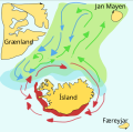
Capelin-iceland.svg 509 × 503; 93 KB
-
Colombia-EFTA locator.svg 940 × 415; 1.69 MB
-
EU-Iceland.svg 2,045 × 1,720; 2.61 MB
-
Eyjafjarðarsýsla kort.svg 906 × 2,649; 367 KB
-
Flag map of the Nordic countries.svg 512 × 486; 247 KB
-
Forsetakosningar á Íslandi 2016.svg 830 × 700; 194 KB
-
Forsetakosningar á Íslandi 2020.svg 830 × 700; 126 KB
-
Hunafloi.svg 1,391 × 2,049; 20 KB
-
Iceland adm location map.svg 1,186 × 841; 145 KB
-
Iceland capital region municipalities-HE.svg 500 × 365; 215 KB
-
Iceland capital region municipalities.svg 500 × 365; 210 KB
-
Iceland fishing grounds.svg 800 × 594; 242 KB
-
Iceland Köppen.svg 765 × 765; 699 KB
-
Iceland-bays.svg 238 × 151; 32 KB
-
Iceland.svg 486 × 344; 68 KB
-
Iceland2.svg 222 × 138; 21 KB
-
Icelandic general election 2017 - Results by Constituency.svg 1,100 × 629; 443 KB
-
Kjördæmaskipting Íslands.svg 842 × 595; 4.3 MB
-
Locator map of Iceland.svg 680 × 520; 661 KB
-
Parishes of Catholic Diocese of Reykjavík.svg 445 × 320; 251 KB
-
Parlamentswahl in Island 2003.svg 772 × 593; 197 KB
-
Parlamentswahl in Island 2007.svg 772 × 593; 196 KB
-
Parlamentswahl in Island 2009.svg 772 × 593; 196 KB
-
Parlamentswahl in Island 2013.svg 772 × 593; 197 KB
-
Parlamentswahl in Island 2016.svg 772 × 593; 197 KB
-
Parlamentswahl in Island 2017.svg 772 × 593; 197 KB
-
Pseudocrater Skútusstaðir map.svg 606 × 458; 143 KB
-
Settlement of Iceland-de.svg 1,006 × 675; 181 KB
-
Volcanic system of Iceland-Map-uk.svg 726 × 588; 345 KB
-
Wahlkreise in Island.svg 815 × 499; 206 KB
-
Ísland með sveitarfélögum.svg 799 × 560; 118 KB


