
Category:SVG maps of England
Subcategories
This category has the following 5 subcategories, out of 5 total.
Media in category "SVG maps of England"
The following 200 files are in this category, out of 242 total.
(previous page) (next page)-
 Flag map of England.svg 485 × 601; 101 KB
-
 2011-liverpool-marathon-course.svg 1,025 × 851; 46 KB
-
 2015UKElectionMapEngland.svg 1,500 × 1,200; 6.26 MB
-
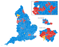
 2017 UK Election map England.svg 1,500 × 1,200; 6.29 MB
-
 2019 UK Election map England.svg 1,500 × 1,200; 6.25 MB
-
 2024 UK general election in England.svg 1,248 × 801; 5.21 MB
-
 A1(M) motorway (Great Britain) map.svg 1,038 × 1,279; 457 KB
-
 A370 road map.svg 2,213 × 1,050; 2.13 MB
-
 Afghan population centres UK.svg 1,108 × 1,345; 366 KB
-
 Amber Valley District, Derbyshire.svg 427 × 691; 29 KB
-
 Around Liverpool railway map 1921.svg 1,226 × 1,334; 155 KB
-
 Around Manchester railway map 1921.svg 1,398 × 986; 279 KB
-
 Avogadro number cube visualisation.svg 512 × 768; 124 KB
-
 Barnby Moor parish, Bassetlaw, England.svg 513 × 561; 78 KB
-
 Blank map of England only in svg format.svg 2,400 × 2,736; 25 KB
-
 BlankMap-EnglandNUTS3Areas.svg 2,121 × 2,629; 234 KB
-
 BlankMap-EnglandSubdivisions.svg 2,165 × 2,670; 221 KB
-
 BlankMap-Kent.svg 937 × 632; 10 KB
-
 BlankMap-LondonBoroughs.svg 962 × 744; 22 KB
-
 Bolsover District, Derbyshire.svg 427 × 691; 29 KB
-
 Boroughs of London City of London.svg 900 × 695; 42 KB
-
 Boroughs of London City of Westminster.svg 900 × 695; 42 KB
-
 Boroughs of London Greenwich.svg 900 × 695; 42 KB
-
 Boroughs of London Islington.svg 900 × 695; 42 KB
-
 Boroughs of London.svg 900 × 695; 107 KB
-
 British Isles 802 vectormap-es.svg 868 × 1,015; 551 KB
-
 British Isles England.svg 675 × 1,180; 150 KB
-
 Broxtowe Parish map.svg 239 × 407; 7 KB
-
 Cambridge-OpenStreetMap-2008-06-13.svg 644 × 576; 404 KB
-
 Ceremonial counties of England labeled.svg 1,129 × 1,385; 132 KB
-
 Ceremonial counties of England.svg 1,129 × 1,385; 107 KB
-
 Chesterfield District, Derbyshire.svg 427 × 691; 29 KB
-
 Course Channeltunnel ar.svg 472 × 387; 44 KB
-
 Course Channeltunnel az.svg 472 × 387; 28 KB
-
 Course Channeltunnel bn.svg 472 × 387; 80 KB
-
 Course Channeltunnel br.svg 472 × 387; 47 KB
-
 Course Channeltunnel et.svg 472 × 387; 29 KB
-
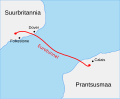
 Course Channeltunnel fi.svg 472 × 387; 28 KB
-
 Course Channeltunnel fr.svg 472 × 387; 28 KB
-
 Course Channeltunnel ga.svg 472 × 387; 28 KB
-
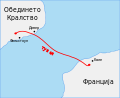 Course Channeltunnel mk.svg 474 × 389; 29 KB
-
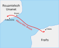
 Course Channeltunnel sco.svg 472 × 387; 27 KB
-
 Course Channeltunnel sv.svg 512 × 420; 56 KB
-
 Course Channeltunnel yue.svg 472 × 387; 27 KB
-
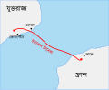
 Course Channeltunnel.svg 472 × 387; 43 KB
-
 Derbyshire Dales District, Derbyshire.svg 427 × 691; 29 KB
-
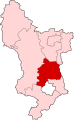
 Derbyshire Electoral Divisions.svg 401 × 650; 39 KB
-
 East Sussex UK constituency map (blank).svg 1,425 × 928; 852 KB
-
 East Sussex UK electoral division map (blank).svg 1,425 × 928; 1.19 MB
-
 East Sussex UK electoral division map 2017 (blank).svg 1,425 × 928; 1.41 MB
-
 East Sussex UK parish map (blank).svg 1,425 × 928; 1.51 MB
-
 East Sussex UK ward map (blank).svg 1,425 × 928; 1.52 MB
-
 Eng County.svg 1,129 × 1,385; 108 KB
-
 England (orthographic projection).svg 792 × 792; 2.95 MB
-
 England and Wales population cartogram districts.svg 1,022 × 1,166; 805 KB
-
 England COVID-19 step levels by district.svg 512 × 621; 257 KB
-
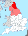
 England locator map with North East England highlighted.svg 816 × 991; 469 KB
-
 England Police and Crime Commission elections 2016 England map.svg 540 × 668; 93 KB
-
 England Police Forces (Avon and Somerset).svg 1,108 × 1,345; 312 KB
-
 England Police Forces (Bedfordshire).svg 1,108 × 1,345; 312 KB
-
 England Police Forces (Cambridgeshire).svg 1,108 × 1,345; 312 KB
-
 England Police Forces (Cheshire).svg 1,108 × 1,345; 312 KB
-
 England Police Forces (Cleveland).svg 1,108 × 1,345; 312 KB
-
 England Police Forces (Cumbria).svg 1,108 × 1,345; 312 KB
-
 England Police Forces (Derbyshire).svg 1,108 × 1,345; 312 KB
-
 England Police Forces (Devon and Cornwall).svg 1,108 × 1,345; 312 KB
-
 England Police Forces (Dorset).svg 1,108 × 1,345; 312 KB
-
 England Police Forces (Durham).svg 1,108 × 1,345; 312 KB
-
 England Police Forces (Essex).svg 1,108 × 1,345; 312 KB
-
 England Police Forces (Gloucestershire).svg 1,108 × 1,345; 312 KB
-
 England Police Forces (Greater Manchester).svg 1,108 × 1,345; 312 KB
-
 England Police Forces (Hampshire).svg 1,108 × 1,345; 312 KB
-
 England Police Forces (Hertfordshire).svg 1,108 × 1,345; 312 KB
-
 England Police Forces (Humberside).svg 1,108 × 1,345; 312 KB
-
 England Police Forces (Kent).svg 1,108 × 1,345; 312 KB
-
 England Police Forces (Lancashire).svg 1,108 × 1,345; 312 KB
-
 England Police Forces (Leicestershire).svg 1,108 × 1,345; 312 KB
-
 England Police Forces (Lincolnshire).svg 1,108 × 1,345; 312 KB
-
 England Police Forces (Merseyside).svg 1,108 × 1,345; 312 KB
-
 England Police Forces (Metropolitan).svg 1,108 × 1,345; 312 KB
-
 England Police Forces (Norfolk).svg 1,108 × 1,345; 312 KB
-
 England Police Forces (North Yorkshire).svg 1,108 × 1,345; 312 KB
-
 England Police Forces (Northamptonshire).svg 1,108 × 1,345; 312 KB
-
 England Police Forces (Northumbria).svg 1,108 × 1,345; 312 KB
-
 England Police Forces (Nottinghamshire).svg 1,108 × 1,345; 312 KB
-
 England Police Forces (South Yorkshire).svg 1,108 × 1,345; 312 KB
-
 England Police Forces (Staffordshire).svg 1,108 × 1,345; 312 KB
-
 England Police Forces (Suffolk).svg 1,108 × 1,345; 312 KB
-
 England Police Forces (Surrey).svg 1,108 × 1,345; 312 KB
-
 England Police Forces (Sussex).svg 1,108 × 1,345; 312 KB
-
 England Police Forces (Thames Valley).svg 1,108 × 1,345; 312 KB
-
 England Police Forces (Warwickshire).svg 1,108 × 1,345; 312 KB
-
 England Police Forces (West Mercia).svg 1,108 × 1,345; 312 KB
-
 England Police Forces (West Midlands).svg 1,108 × 1,345; 312 KB
-
 England Police Forces (West Yorkshire).svg 1,108 × 1,345; 312 KB
-
 England Police Forces (Wiltshire).svg 1,108 × 1,345; 312 KB
-
 England Region - East England.svg 525 × 650; 83 KB
-
 England Region - East Midlands.svg 525 × 650; 83 KB
-
 England Region - London.svg 525 × 650; 83 KB
-
 England Region - North East.svg 525 × 650; 83 KB
-
 England Region - North West.svg 525 × 650; 83 KB
-
 England Region - South East.svg 525 × 650; 83 KB
-
 England Region - South West.svg 525 × 650; 83 KB
-
 England Region - West Midlands.svg 525 × 650; 83 KB
-
 England Region - Yorkshire and Humber.svg 525 × 650; 83 KB
-
 England Regions - Blank.svg 525 × 650; 83 KB
-
 England Regions - Labelled.svg 525 × 650; 89 KB
-
 England Regions - Numbered.svg 525 × 650; 90 KB
-
 England traditional counties.svg 611 × 787; 128 KB
-
 English administrative divisions 2009.svg 1,108 × 1,345; 520 KB
-
 English administrative divisions by type 2009.svg 1,108 × 1,345; 504 KB
-
 English administrative divisions coloured map 2019.svg 1,108 × 1,345; 520 KB
-
 English administrative divisions coloured map 2021.svg 1,108 × 1,345; 521 KB
-
 English administrative divisions coloured map 2023.svg 1,108 × 1,345; 524 KB
-
 English administrative divisions map 2019.svg 1,108 × 1,345; 367 KB
-
 English administrative divisions map 2021.svg 1,108 × 1,345; 368 KB
-
 English administrative divisions map 2023.svg 1,108 × 1,345; 371 KB
-
 English administrative divisions map coloured by type 2019.svg 1,108 × 1,345; 496 KB
-
 English administrative divisions map coloured by type 2020.svg 1,108 × 1,345; 496 KB
-
 English administrative divisions map coloured by type 2021.svg 1,108 × 1,345; 498 KB
-
 English administrative divisions map coloured by type 2023.svg 1,108 × 1,345; 502 KB
-
 English county tops map.svg 1,108 × 1,345; 305 KB
-
 English metropolitan boroughs 2009.svg 1,108 × 1,345; 376 KB
-
 English regions 2009 (named).svg 1,108 × 1,345; 379 KB
-
 English regions 2009 (numbered).svg 1,108 × 1,345; 373 KB
-
 English regions 2009.svg 1,108 × 1,345; 365 KB
-
 English regions and counties by type 2009.svg 1,108 × 1,345; 483 KB
-
 English regions and counties coloured by type map 2019.svg 1,108 × 1,345; 476 KB
-
 English regions and counties coloured by type map 2020.svg 1,108 × 1,345; 476 KB
-
 English regions and counties coloured by type map 2021.svg 1,039 × 1,261; 460 KB
-
 English regions and counties coloured by type map 2023.svg 1,108 × 1,345; 482 KB
-
 Erewash District, Derbyshire.svg 427 × 691; 29 KB
-
 Geologic map SE England & Channel EN.svg 1,374 × 890; 1.65 MB
-
 Geologic map SE England & NW France BR.svg 1,374 × 890; 1.44 MB
-
 Geologic map SE England & NW France FR.svg 1,374 × 890; 1.44 MB
-
 Geologic map Wales & SW England EN.svg 2,220 × 1,940; 1.74 MB
-
 Geologic map Wales & SW England es.svg 2,220 × 1,940; 1.87 MB
-
 Grammar school ballots in England.svg 1,108 × 1,345; 366 KB
-
 Greater Manchester railway map 2014.svg 1,398 × 986; 818 KB
-
 GVA of ceremonial counties in England (2007).svg 1,200 × 1,385; 119 KB
-
 Map of NUTS 3 areas in England by GVA per capita (1995).svg 2,121 × 2,629; 243 KB
-
 Map of NUTS 3 areas in England by GVA per capita (1996).svg 2,121 × 2,629; 243 KB
-
 Map of NUTS 3 areas in England by GVA per capita (1997).svg 2,121 × 2,629; 243 KB
-
 Map of NUTS 3 areas in England by GVA per capita (1998).svg 2,121 × 2,629; 243 KB
-
 Map of NUTS 3 areas in England by GVA per capita (1999).svg 2,121 × 2,629; 243 KB
-
 Map of NUTS 3 areas in England by GVA per capita (2000).svg 2,121 × 2,629; 243 KB
-
 Map of NUTS 3 areas in England by GVA per capita (2001).svg 2,121 × 2,629; 243 KB
-
 Map of NUTS 3 areas in England by GVA per capita (2002).svg 2,121 × 2,629; 243 KB
-
 Map of NUTS 3 areas in England by GVA per capita (2003).svg 2,121 × 2,629; 242 KB
-
 Map of NUTS 3 areas in England by GVA per capita (2004).svg 2,121 × 2,629; 242 KB
-
 Map of NUTS 3 areas in England by GVA per capita (2005).svg 2,121 × 2,629; 239 KB
-
 Map of NUTS 3 areas in England by GVA per capita (2006).svg 2,121 × 2,629; 246 KB
-
 Map of NUTS 3 areas in England by GVA per capita (2007).svg 2,121 × 2,629; 246 KB
-
 High Peak, Derbyshire.svg 427 × 691; 29 KB
-
 Holborn-viaduct-map.svg 671 × 615; 269 KB
-
 Isabella invasion 1326.svg 619 × 268; 498 KB
-
 Isabella's invasion route (1326).svg 650 × 400; 469 KB
-
 Isles of Scilly UK location map.svg 1,340 × 1,187; 558 KB
-
 Lancashire railway map.svg 1,116 × 1,305; 1.53 MB
-
 Leicestershire districts transparent overlay.svg 355 × 380; 177 KB
-
 Lincoln Cliff Map-topographic.svg 1,320 × 1,201; 2.04 MB
-
 Liverpool City Council Wards - Numbered.svg 521 × 718; 62 KB
-
 LMS final.svg 860 × 235; 19 KB
-
 M1 motorway (Great Britain) map.svg 1,038 × 1,279; 457 KB
-
 M11 dualling.svg 912 × 639; 7 KB
-
 M11 motorway (Great Britain) map.svg 1,038 × 1,279; 457 KB
-
 M18 motorway (Great Britain) map.svg 1,038 × 1,279; 457 KB
-
 M180 motorway (Great Britain) map.svg 1,038 × 1,279; 457 KB
-
 M2 motorway (Great Britain) map.svg 1,038 × 1,279; 457 KB
-
 M20 motorway (Great Britain) map.svg 1,038 × 1,279; 457 KB
-
 M23 motorway (Great Britain) map.svg 1,038 × 1,279; 457 KB
-
 M25 motorway (Great Britain) map.svg 1,038 × 1,279; 457 KB
-
 M27 motorway (Great Britain) map.svg 1,038 × 1,279; 457 KB
-
 M3 motorway (Great Britain) map.svg 1,038 × 1,279; 457 KB
-
 M40 motorway (Great Britain) map.svg 1,038 × 1,279; 457 KB
-
 M42 motorway (Great Britain) map.svg 1,038 × 1,279; 457 KB
-
 M5 motorway (Great Britain) map.svg 1,038 × 1,279; 457 KB
-
 M50 motorway (Great Britain) map.svg 1,038 × 1,279; 457 KB
-
 M53 motorway (Great Britain) map.svg 1,038 × 1,279; 457 KB
-
 M54 motorway (Great Britain) map.svg 1,038 × 1,279; 457 KB
-
 M55 motorway (Great Britain) map.svg 1,038 × 1,279; 457 KB
-
 M56 motorway (Great Britain) map.svg 1,038 × 1,279; 457 KB
-
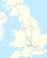
 M6 motorway (Great Britain) map.svg 1,038 × 1,279; 457 KB
-
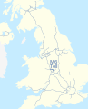 M6 Toll motorway (Great Britain) map.svg 1,038 × 1,279; 457 KB
-
 M60 motorway (Great Britain) map.svg 1,038 × 1,279; 457 KB
-
 M61 motorway (Great Britain) map.svg 1,038 × 1,279; 457 KB
-
 M62 motorway (Great Britain) map.svg 1,038 × 1,279; 457 KB
-
 M65 motorway (Great Britain) map.svg 1,038 × 1,279; 457 KB
-
 M69 motorway (Great Britain) map.svg 1,038 × 1,279; 457 KB
-
 Map of Northumbria in England.svg 809 × 1,025; 933 KB
-
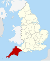
 Map of south-west England shown within England (Met Office region).svg 2,400 × 2,736; 70 KB
-
 Map of the Rate-Capping Rebellion.svg 698 × 796; 3.32 MB
-
 Merseyrail map 2010.svg 1,226 × 1,334; 735 KB
-
 Metropolitan and non-metropolitan counties of England 2009 (numbered).svg 1,108 × 1,345; 557 KB
-
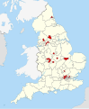
 MiddleSchoolsinEngland.svg 2,708 × 3,339; 235 KB
-
 Middlesex former postal county.svg 1,099 × 995; 752 KB
-
 MLC catchment boundary.svg 744 × 1,052; 379 KB
-
 North Humberside former postal county.svg 958 × 709; 535 KB
-
 North-South divide in England.svg 525 × 650; 63 KB
-
 Norwich whitlingham w.svg 913 × 676; 4 KB


_motorway_(Great_Britain)_map.svg)


.svg)


.svg)
.svg)
.svg)
.svg)
.svg)
.svg)
.svg)
.svg)
.svg)
.svg)
.svg)
.svg)
.svg)
.svg)
.svg)
.svg)
.svg)
.svg)
.svg)
.svg)
.svg)
.svg)
.svg)
.svg)
.svg)
.svg)
.svg)
.svg)
.svg)
.svg)
.svg)
.svg)
.svg)
.svg)
.svg)
.svg)
.svg)
.svg)


.svg)
.svg)


.svg)
.svg)
.svg)
.svg)
.svg)
.svg)
.svg)
.svg)
.svg)
.svg)
.svg)
.svg)
.svg)
.svg)


.svg)


_map.svg)

_map.svg)
_map.svg)
_map.svg)
_map.svg)
_map.svg)
_map.svg)
_map.svg)
_map.svg)
_map.svg)
_map.svg)
_map.svg)
_map.svg)
_map.svg)
_map.svg)
_map.svg)
_map.svg)
_map.svg)
_map.svg)
_map.svg)
_map.svg)
_map.svg)
_map.svg)
_map.svg)
_map.svg)

.svg)


.svg)


.svg)
.svg)
.svg)
.svg)
.svg)