Category:SVG maps of Germany
Jump to navigation
Jump to search
Subcategories
This category has the following 12 subcategories, out of 12 total.
Media in category "SVG maps of Germany"
The following 105 files are in this category, out of 105 total.
-
1919 German federal election by Constituency.svg 793 × 648; 3.09 MB
-
1925 German presidential election by District (1st round) - Simple.svg 1,512 × 1,179; 4.4 MB
-
1925 German presidential election by District (1st round).svg 6,021 × 4,735; 3.4 MB
-
1925 German presidential election by District (2nd round) - Simple.svg 1,512 × 1,179; 4.38 MB
-
1928 German federal election by District - Simple.svg 1,512 × 1,179; 4.67 MB
-
1928 German federal election by District.svg 6,021 × 4,735; 3.54 MB
-
1929 German referendum - Petition.svg 726 × 572; 3.28 MB
-
1929 German referendum - Referendum.svg 726 × 572; 3.31 MB
-
1930 German federal election by District - Simple.svg 1,512 × 1,179; 4.6 MB
-
1930 German federal election by District.svg 6,021 × 4,735; 3.67 MB
-
1932 German presidential election by District (1st round) - Simple.svg 1,512 × 1,179; 4.4 MB
-
1932 German presidential election by District (1st round).svg 6,021 × 4,735; 3.68 MB
-
1932 German presidential election by District (2nd round) - Simple.svg 1,512 × 1,179; 4.35 MB
-
1932 German presidential election by District (2nd round).svg 6,021 × 4,735; 3.68 MB
-
1949 German federal election - Results by constituency.svg 512 × 595; 1.5 MB
-
1953 German federal election - Results by constituency.svg 512 × 595; 1.49 MB
-
1957 German federal election - Results by constituency.svg 512 × 595; 1.47 MB
-
1961 German federal election - Results by constituency.svg 512 × 595; 1.46 MB
-
1980 German federal election - Results by constituency.svg 512 × 595; 1.29 MB
-
1983 German federal election - Results by constituency.svg 512 × 595; 1.3 MB
-
1987 German federal election - Results by constituency.svg 512 × 595; 1.3 MB
-
1990 German federal election - Results by constituency.svg 4,135 × 4,807; 1.88 MB
-
1994 German federal election - Results by constituency.svg 4,135 × 4,807; 1.87 MB
-
1998 German federal election - Results by constituency.svg 4,135 × 4,807; 1.89 MB
-
2002 German federal election - Results by constituency.svg 4,135 × 4,806; 1.81 MB
-
2005 German federal election - Results by constituency.svg 4,135 × 4,806; 1.81 MB
-
2009 German federal election - Results by constituency.svg 4,135 × 4,807; 1.94 MB
-
2021 German federal election - Greens result.svg 1,469 × 1,708; 1.21 MB
-
BayreuthMap.svg 1,715 × 1,216; 244 KB
-
Bonding Standorte.svg 595 × 842; 185 KB
-
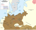
Cambios territoriales de Alemania (1919-1990).svg 976 × 818; 379 KB
-
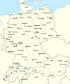
D-A-CH beschriftet.svg 1,257 × 1,514; 715 KB
-
De-map sv.svg 351 × 377; 34 KB
-
December 1924 German federal election by District - Simple.svg 1,512 × 1,179; 4.6 MB
-
Deportation d'Elsie Maréchal (janvier 1944 - avril 1945 ).svg 1,268 × 1,058; 514 KB
-
DeutscheLandverluste-HE.svg 730 × 550; 62 KB
-
Deutschland aus Berliner Sicht.svg 596 × 842; 445 KB
-
Deutschland Distanz zur Küste.svg 886 × 1,063; 1.27 MB
-
Deutschland Landeskirchen ev 2012.svg 500 × 646; 83 KB
-
Deutschland Landeskirchen ev neu.png 500 × 646; 9 KB
-
Deutschland Landeskirchen ev.svg 500 × 646; 88 KB
-
East Prussian Campaign (17—23 Aug 1914) - ru.svg 2,591 × 1,671; 1.8 MB
-
East Prussian Campaign (23—26 Aug 1914) - ru.svg 2,591 × 1,671; 1.79 MB
-
East Prussian Campaign (27—30 Aug 1914) - es.svg 2,591 × 1,671; 1.71 MB
-
East Prussian Campaign (27—30 Aug 1914) - ru.svg 2,591 × 1,671; 1.7 MB
-
EKD Hessen-Nassau.svg 500 × 646; 84 KB
-
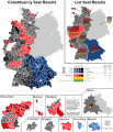
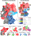
Elections fédérales allemandes de 2021 - Résultats par Circonscription & Sièges de liste.svg 1,469 × 1,708; 1.37 MB
-
Expropriation of the princes - Petition.svg 726 × 572; 3.15 MB
-
Expropriation of the princes - Referendum.svg 726 × 572; 3.13 MB
-
Federal Republic of Germany (since 1990).png 1,728 × 2,048; 404 KB
-
Frisia-Orientale.svg 800 × 600; 895 KB
-
GADM DEU Administrative Divisions.svg 465 × 630; 537 KB
-
Gauhauptstadtplanungen.svg 800 × 600; 102 KB
-
Gebietskarte BOS Leitstellen Deutschland.svg 800 × 1,083; 1.39 MB
-
German Democratic Republic - East Germany (1949-1990).png 1,728 × 2,048; 385 KB
-
German Federal Election 2017 - Results by Constituency & Regional Seats.svg 1,469 × 1,708; 1.21 MB
-
German Federal Election 2021 - Results by Constituency & Regional Seats.svg 1,469 × 1,708; 1.45 MB
-
German Federal Election, 1919.svg 909 × 708; 1.46 MB
-
German Federal Election, 1920.svg 900 × 713; 797 KB
-
German Federal Election, 1928.svg 900 × 713; 789 KB
-
German Federal Election, 1930.svg 900 × 713; 786 KB
-
German Federal Election, December, 1924.svg 900 × 713; 790 KB
-
German Federal Election, July, 1932.svg 900 × 713; 791 KB
-
German Federal Election, March, 1933.svg 900 × 713; 791 KB
-
German Federal Election, May, 1924.svg 900 × 713; 791 KB
-
German Federal Election, November, 1932.svg 900 × 713; 791 KB
-
German state government compositions.svg 750 × 850; 90 KB
-
German states by GRP in 2018.svg 600 × 810; 189 KB
-
German territorial losses 1919 and 1945.svg 512 × 429; 380 KB
-
Germany Eishockey Oberliga 2008-09.svg 1,073 × 1,272; 698 KB
-
Germany Köppen.svg 765 × 1,179; 889 KB
-
Germany Missing Saxony.svg 1,000 × 1,360; 101 KB
-
Germany population states hexagonal.svg 1,600 × 2,208; 43 KB
-
Germany, Hamburg locator map (2015.04.21).svg 600 × 813; 1.85 MB
-
Germany-New Zealand size comparison.svg 464 × 665; 357 KB
-
Infrastrukturatlas-Rufbus statt Geisterbus (Wittlich Shuttle).svg 620 × 472; 1.38 MB
-
July 1932 German federal election by District - Simple.svg 1,512 × 1,179; 4.49 MB
-
July 1932 German federal election by District.svg 6,021 × 4,735; 3.88 MB
-
Karte Innerdeutsche Grenze-pl.svg 744 × 1,052; 146 KB
-
Karte Innerdeutsche Grenze.svg 1,075 × 1,273; 333 KB
-
Landeskirchen der EKD.svg 908 × 1,228; 132 KB
-
Locator map of Germany.svg 680 × 520; 660 KB
-
Mainfranken locator.svg 1,073 × 1,272; 690 KB
-
March 1933 German federal election by District - Simple.svg 1,512 × 1,179; 4.4 MB
-
March 1933 German federal election by District.svg 6,021 × 4,735; 3.55 MB
-
May 1924 German federal election by District - Simple.svg 1,512 × 1,179; 4.63 MB
-
May 1924 German federal election by District.svg 6,021 × 4,735; 3.77 MB
-
Morgenthau Plan map.svg 671 × 442; 132 KB
-
NeueLaender.png 774 × 983; 90 KB
-
November 1932 German federal election by District - Simple.svg 1,512 × 1,179; 4.42 MB
-
Occupation in Germany by district, 1925.svg 6,021 × 4,735; 3.85 MB
-
Population density in Germany by district, 1925.svg 1,512 × 1,179; 4.32 MB
-
Regionen des AVR-Caritas in Deutschland.svg 1,897 × 2,549; 653 KB
-
Religion in Germany by district, 1925.svg 6,021 × 4,735; 3.68 MB
-
Restricted Zones SOXMIS.svg 657 × 776; 951 KB
-
States and City-States of Germany.png 1,728 × 2,048; 605 KB
-
States and City-States of the Federal Republic of Germany - West Germany (1957-1990).png 1,728 × 2,048; 574 KB
-
States of Germany mk.svg 592 × 801; 289 KB
-
The possession of the Guelfs in the days of Henry the Lion-ru.svg 744 × 763; 91 KB
-
Verbreitungsgebiet Schnürsenkel-Schuhband.svg 1,000 × 1,200; 95 KB
-
Verbreitungsgebiet vorsagen-einsagen.svg 1,000 × 1,200; 95 KB
-
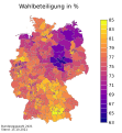
Wahlbeteiligung 2021.svg 540 × 586; 1.63 MB
-
Weimar Republic (1918-1933); Nazi Germany (1933-1938).png 2,560 × 2,035; 969 KB
-
WeinbaugebieteDeutschland.svg 1,300 × 1,200; 352 KB
-
Z-Netz ZMapMap 1993 01.svg 512 × 600; 296 KB


