Category:SVG maps of Austria
Jump to navigation
Jump to search

States of Austria:  Burgenland ·
  Carinthia ·
  Lower Austria ·
  Salzburg ·
  Styria ·
  Tyrol ·
  Upper Austria ·
  Vienna ·
  Vorarlberg
Subcategories
This category has the following 16 subcategories, out of 16 total.
- SVG maps of Burgenland (15 F)
- SVG maps of Carinthia (26 F)
- SVG maps of Salzburg (state) (50 F)
- SVG maps of Tyrol (state) (22 F)
- SVG maps of Upper Austria (23 F)
- SVG maps of Vorarlberg (28 F)
*
B
- SVG blank maps of Austria (31 F)
F
- SVG flag maps of Austria (29 F)
L
T
Media in category "SVG maps of Austria"
The following 48 files are in this category, out of 48 total.
-
 1994 Austrian European Union membership referendum.svg 512 × 278; 249 KB
-
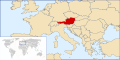
 Austria adm location map.svg 1,256 × 700; 183 KB
-
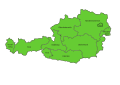
 Austria all.svg 2,000 × 1,125; 160 KB
-
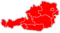
 Austria bld.svg 2,000 × 1,125; 165 KB
-
 Austria Freeway System.svg 680 × 358; 21 KB
-
 Austria Köppen.svg 990 × 810; 741 KB
-
 Austria locat-da.svg 2,375 × 1,625; 99 KB
-
 Austria locat.svg 2,375 × 1,625; 168 KB
-
 Austria states numbered.svg 418 × 220; 33 KB
-
 Austria Turkey Locator.svg 940 × 415; 1.66 MB
-
 Austrian states by HDI (2017).svg 512 × 278; 72 KB
-
 Austrujo.svg 2,166 × 1,364; 69 KB
-
 Autobahnen und Schnellstraßen in Österreich.svg 512 × 315; 174 KB
-
 Autriche hydro-de.svg 711 × 399; 164 KB
-
 Autriche hydro-fr.svg 711 × 399; 233 KB
-
 Bevoelkerungsdichte - Oesterreich.svg 1,052 × 744; 311 KB
-
 D-A-CH beschriftet.svg 1,257 × 1,514; 715 KB
-
 EU-Referendum in Österreich 1994 (2).svg 1,149 × 659; 62 KB
-
 EU-Referendum in Österreich 1994.svg 1,149 × 659; 124 KB
-
 Euro2008 venues de.svg 730 × 320; 104 KB
-
 Euro2008 venues pl.svg 730 × 320; 104 KB
-
 Euro2008 venues sv.svg 730 × 320; 99 KB
-
 Europe at.svg 680 × 520; 795 KB
-
 H1N1 Austria Map.svg 1,052 × 744; 258 KB
-
 HQL Plan 4C.svg 1,140 × 655; 289 KB
-
 JJ1 Route la.svg 2,400 × 1,163; 45 KB
-
 JJ1 Route PL.svg 2,000 × 990; 66 KB
-
 JJ1 Route.svg 2,400 × 1,163; 40 KB
-
 Karte Österreich Bundesländer.svg 1,052 × 744; 281 KB
-
 Location Austria.svg 250 × 115; 139 KB
-
 LocationAustria.svg 1,000 × 500; 2.76 MB
-
 Locator map of Austria.svg 680 × 520; 660 KB
-
 Länders autrichiens-es.svg 1,000 × 550; 59 KB
-
 Länders autrichiens-fr.svg 1,000 × 550; 59 KB
-
 Map of Austria (Lithuanian).svg 811 × 541; 536 KB
-
 Map of Austria de.svg 830 × 450; 45 KB
-
 Map of Austria.svg 830 × 450; 45 KB
-
 Postleitzahlen oesterreich.svg 2,000 × 1,047; 105 KB
-
 Religion map Austria 2001.svg 1,500 × 801; 156 KB
-
 Stand Denkmallisten Österreich Beschreibungen.svg 900 × 480; 495 KB
-
 Stand Denkmallisten Österreich Bilder.svg 900 × 480; 495 KB
-
 Stand Denkmallisten Österreich gesamt.svg 900 × 480; 495 KB
-
 Stand Denkmallisten Österreich Koordinaten.svg 900 × 480; 495 KB
-
 Stand Denkmallisten Österreich.svg 900 × 480; 547 KB
-
 Telefonvorwahlbereiche-Oesterreich.svg 2,175 × 1,125; 56 KB
-
 Telefonvorwahlbereiche-Österreich.svg 2,175 × 1,125; 56 KB
-
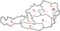
 The States of Austria Numbered.svg 512 × 280; 68 KB
-
 WLM Bezirke.svg 900 × 480; 529 KB


.svg)


.svg)


.svg)


