Category:SVG maps of Switzerland
Appearance
Subcategories
This category has the following 7 subcategories, out of 7 total.
Media in category "SVG maps of Switzerland"
The following 62 files are in this category, out of 62 total.
-
Aar bassin 1.svg 870 × 562; 473 KB
-
Aar bassin.svg 800 × 450; 474 KB
-
Aare.svg 800 × 450; 407 KB
-
Airport zurich vector 2008-07-27.svg 744 × 1,052; 275 KB
-
Alemannic language location map in 1950-fr.svg 1,400 × 1,000; 245 KB
-
Alemannic-Dialects-Map-English.svg 1,400 × 1,000; 472 KB
-
Alemannic-Dialects-Map-French.svg 1,493 × 1,067; 440 KB
-
Alemannic-Dialects-Map-German.svg 1,400 × 1,000; 472 KB
-
Alemannic-Dialects-Map-Hungarian.svg 1,400 × 1,000; 483 KB
-
Alemannic language location map in 1950-de.svg 1,400 × 1,000; 284 KB
-
Canton du Jura.svg 691 × 504; 47 KB
-
Cantons Suisses.svg 1,000 × 700; 2.86 MB
-
Carte centrales hydroélectriques Suisse (2020).svg 1,349 × 865; 1.49 MB
-
Carte des usines d'incinération des déchets Suisse (2020).svg 1,347 × 863; 1.1 MB
-
Colombia-EFTA locator.svg 940 × 415; 1.69 MB
-
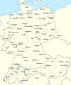
D-A-CH beschriftet.svg 1,257 × 1,514; 715 KB
-
Demographic map of Switzerland.svg 965 × 636; 4.74 MB
-
Euro2008 venues de.svg 730 × 320; 104 KB
-
Euro2008 venues fr.svg 730 × 320; 105 KB
-
Euro2008 venues pl.svg 730 × 320; 104 KB
-
Euro2008 venues sv.svg 730 × 320; 99 KB
-
Geneva-local-names-Inkscape-allgray.svg 809 × 923; 1.89 MB
-
Geneva-local-names-Inkscape.svg 809 × 923; 1.87 MB
-
Geneva-rade-Inkscape.svg 1,201 × 1,601; 1.94 MB
-
Genève Switzerland street map.svg 4,076 × 3,555; 36.76 MB
-
GlacierExpressMap.svg 1,337 × 918; 237 KB
-
Karte Transhelvetischer Kanal.svg 800 × 450; 438 KB
-
LakeLucernce Shape Generalized.svg 749 × 629; 7 KB
-
Large Hadron Collider at CERN map.svg 574 × 586; 792 KB
-
LocationSwitzerland.svg 1,000 × 500; 2.76 MB
-
Locator map of Switzerland.svg 680 × 520; 657 KB
-
Map of Switzerland-uk.svg 1,346 × 863; 144 KB
-
Nahrungsmittelspekulations-Initiative 2016.svg 1,092 × 727; 257 KB
-
Notary in Switzerland.svg 512 × 329; 106 KB
-
Pro service public-Initiative.svg 1,092 × 727; 254 KB
-
Regions of Switzerland by HDI (2018).svg 512 × 347; 169 KB
-
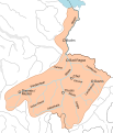
Rhin alpestre bassin.svg 343 × 401; 453 KB
-
Rhône supérieur bassin 1.svg 570 × 395; 452 KB
-
Rhône supérieur bassin 2.svg 380 × 240; 452 KB
-
Rhône supérieur bassin.svg 379 × 240; 452 KB
-
SBB 2016.svg 1,615 × 938; 2.73 MB
-
Schutz vor Waffengewalt-Initiative.svg 1,092 × 727; 781 KB
-
Schweiz Tabak Abgabealter nach Kanton.svg 1,011 × 645; 62 KB
-
Schweizer Karte mit Kantons- und Hauptstadtbezeichnungen (deutsch).svg 500 × 328; 285 KB
-
Sprachen CH 2000 es.svg 905 × 546; 294 KB
-
Suisse cantons.svg 1,123 × 794; 352 KB
-
Suisse hydrologie 1.svg 1,052 × 744; 431 KB
-
Suisse hydrologie.svg 1,052 × 744; 430 KB
-
Suisse Territorialregionen.svg 1,040 × 700; 321 KB
-
Swiss Nuclear powerplant 2010.svg 1,359 × 922; 628 KB
-
Switzerland adm location map.svg 1,347 × 864; 164 KB
-
Switzerland administrative divisions - colored unlabelled.svg 1,349 × 865; 282 KB
-
Switzerland Cantons Map with Names and Capitals (french).svg 1,052 × 744; 288 KB
-
Switzerland Cantons Map with Names and Capitals HE.svg 1,052 × 744; 318 KB
-
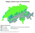
Switzerland Köppen.svg 990 × 945; 765 KB
-
Switzerland largest lakes.svg 1,349 × 865; 239 KB
-
Switzerland most common surname in each canton 2022.svg 1,123 × 794; 192 KB
-
Westalpen-Gebirgsgruppen nach Rochlitz & Bacher 2006.svg 1,190 × 842; 1.53 MB
-
Western Alps - Regions after Rochlitz & Bacher 2006 blank.svg 641 × 828; 1.27 MB
-
Übersichtskarte der Schweiz.svg 1,346 × 863; 132 KB
-
Übersichtskarte Jurakonflikt.svg 923 × 628; 1.99 MB


