Category:SVG maps of Greece
Jump to navigation
Jump to search
Subcategories
This category has the following 5 subcategories, out of 5 total.
Media in category "SVG maps of Greece"
The following 200 files are in this category, out of 373 total.
(previous page) (next page)-
2023 Greek Legislative Election Map (el).svg 850 × 684; 3.72 MB
-
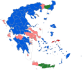
2023 Greek Legislative Election Map.svg 850 × 684; 3.72 MB
-
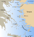
Aegean Sea map-de.svg 3,750 × 4,560; 2.28 MB
-
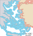
Aegean 10 nm.svg 432 × 467; 225 KB
-
Aegean 12 nm.svg 432 × 467; 186 KB
-
Aegean 6 nm.svg 432 × 467; 219 KB
-
Aegean basemap.svg 576 × 612; 185 KB
-
Aegean islands accession.svg 433 × 550; 165 KB
-
Aegean islands demilitarisation-es.svg 433 × 550; 198 KB
-
Aegean islands demilitarisation.svg 433 × 550; 166 KB
-
Aegean Sea map-es.svg 3,750 × 4,560; 2.14 MB
-
Aegean Sea map-fr.svg 3,750 × 4,560; 2.3 MB
-
Aegean with legend EL.svg 553 × 600; 148 KB
-
Aegean with legend EL2.svg 553 × 600; 148 KB
-
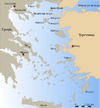
Aegean with legends MK.svg 432 × 467; 320 KB
-
Aegean with legends SV.svg 432 × 467; 177 KB
-
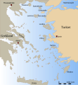
Aegean with legends tr.svg 432 × 467; 172 KB
-
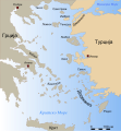
Aegean with legends uk.svg 432 × 467; 180 KB
-
Aegean with legends-es.svg 432 × 467; 256 KB
-
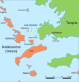
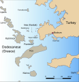
Aegean with legends.svg 432 × 467; 173 KB
-
Alfios River, Peloponnes, Greece - course - political map - DE Labels.svg 1,244 × 975; 1,002 KB
-
AncientGreekDialects (Woodard) ar.svg 660 × 555; 1.64 MB
-
AncientGreekDialects (Woodard) de.svg 660 × 555; 852 KB
-
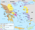
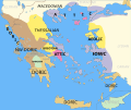
AncientGreekDialects (Woodard) en.svg 660 × 555; 950 KB
-
AncientGreekDialects (Woodard) es.svg 660 × 555; 1.15 MB
-
AncientGreekDialects (Woodard) fr.svg 660 × 555; 851 KB
-
AncientGreekDialects (Woodard) id.svg 660 × 555; 851 KB
-
AncientGreekDialects (Woodard) it.svg 660 × 555; 851 KB
-
AncientGreekDialects (Woodard) zh.svg 826 × 697; 354 KB
-
AncientGreekDialects Woodard relabelled per Risch.svg 660 × 555; 856 KB
-
Artemis Orthia location en.svg 991 × 784; 536 KB
-
Artemis Orthia location.svg 991 × 784; 96 KB
-
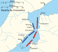
Battle-of-Cynossema-es.svg 512 × 455; 20 KB
-
Battle-of-Cynossema-pt.svg 512 × 455; 14 KB
-
Battle-of-Cynossema-ru.svg 512 × 455; 23 KB
-
Battles of Ancient Greece-ru.svg 512 × 409; 2.58 MB
-
Chalkidiki focussed svga.svg 1,206 × 733; 1.87 MB
-
Circonscription d'Arta.svg 1,266 × 1,074; 610 KB
-
Circonscription d'Athènes A.svg 1,266 × 1,074; 610 KB
-
Circonscription d'Athènes B.svg 1,266 × 1,074; 610 KB
-
Circonscription d'Héraklion.svg 1,266 × 1,074; 610 KB
-
Circonscription de Chios.svg 1,266 × 1,074; 610 KB
-
Circonscription de Corfou.svg 1,266 × 1,074; 610 KB
-
Circonscription de Céphalonie.svg 1,266 × 1,074; 610 KB
-
Circonscription de Dráma.svg 1,266 × 1,074; 610 KB
-
Circonscription de Flórina.svg 1,266 × 1,074; 610 KB
-
Circonscription de Grévéna.svg 1,266 × 1,074; 610 KB
-
Circonscription de Ioannina.svg 1,266 × 1,074; 610 KB
-
Circonscription de Kardítsa.svg 1,266 × 1,074; 610 KB
-
Circonscription de Kastoria.svg 1,266 × 1,074; 610 KB
-
Circonscription de Kavala.svg 1,266 × 1,074; 610 KB
-
Circonscription de Kilkís.svg 1,266 × 1,074; 610 KB
-
Circonscription de Kozani.svg 1,266 × 1,074; 610 KB
-
Circonscription de l'Achaïe.svg 1,266 × 1,074; 610 KB
-
Circonscription de l'Arcadie.svg 1,266 × 1,074; 610 KB
-
Circonscription de l'Argolide.svg 1,266 × 1,074; 610 KB
-
Circonscription de l'Attique.svg 1,266 × 1,074; 610 KB
-
Circonscription de l'Eubée.svg 1,266 × 1,074; 610 KB
-
Circonscription de l'Eurytanie.svg 1,266 × 1,074; 610 KB
-
Circonscription de l'Imathie.svg 1,266 × 1,074; 610 KB
-
Circonscription de l'Élide.svg 1,266 × 1,074; 610 KB
-
Circonscription de l'Étolie-Acarnanie.svg 1,266 × 1,074; 610 KB
-
Circonscription de l'Évros.svg 1,266 × 1,074; 610 KB
-
Circonscription de la Béotie.svg 1,266 × 1,074; 610 KB
-
Circonscription de la Canée.svg 1,266 × 1,074; 610 KB
-
Circonscription de la Chalcidique.svg 1,266 × 1,074; 610 KB
-
Circonscription de la Corinthie.svg 1,266 × 1,074; 610 KB
-
Circonscription de la Laconie.svg 1,266 × 1,074; 610 KB
-
Circonscription de la Magnésie.svg 1,266 × 1,074; 610 KB
-
Circonscription de la Messénie.svg 1,266 × 1,074; 610 KB
-
Circonscription de la Phocide.svg 1,266 × 1,074; 610 KB
-
Circonscription de la Phthiotide.svg 1,266 × 1,074; 610 KB
-
Circonscription de la Piérie.svg 1,266 × 1,074; 610 KB
-
Circonscription de la Thesprotie.svg 1,266 × 1,074; 610 KB
-
Circonscription de Larissa.svg 1,266 × 1,074; 610 KB
-
Circonscription de Lesbos.svg 1,266 × 1,074; 610 KB
-
Circonscription de Leucade.svg 1,266 × 1,074; 610 KB
-
Circonscription de Pella.svg 1,266 × 1,074; 610 KB
-
Circonscription de Préveza.svg 1,266 × 1,074; 610 KB
-
Circonscription de Rhodope.svg 1,266 × 1,074; 610 KB
-
Circonscription de Réthymnon.svg 1,266 × 1,074; 610 KB
-
Circonscription de Samos.svg 1,266 × 1,074; 610 KB
-
Circonscription de Serrès.svg 1,266 × 1,074; 610 KB
-
Circonscription de Thessalonique A.svg 1,266 × 1,074; 610 KB
-
Circonscription de Thessalonique B.svg 1,266 × 1,074; 610 KB
-
Circonscription de Tríkala.svg 1,266 × 1,074; 610 KB
-
Circonscription de Xánthi.svg 1,266 × 1,074; 610 KB
-
Circonscription de Zante.svg 1,266 × 1,074; 610 KB
-
Circonscription des Cyclades.svg 1,266 × 1,074; 610 KB
-
Circonscription du Dodécanèse.svg 1,266 × 1,074; 610 KB
-
Circonscription du Lassithi.svg 1,266 × 1,074; 610 KB
-
Circonscription du Pirée A.svg 1,266 × 1,074; 608 KB
-
Circonscription du Pirée B.svg 1,266 × 1,074; 610 KB
-
Corfu Channel topographic map-en.svg 595 × 755; 2.23 MB
-
Corfu Channel topographic map-fr.svg 595 × 755; 2.22 MB
-
Electoral constituencies of Greece (2018) by number of seats.svg 1,012 × 847; 1.24 MB
-
Electoral constituencies of Greece (2018).svg 1,012 × 847; 1.22 MB
-
Environs of Athens-be.svg 910 × 1,000; 553 KB
-
Environs of Athens-ru.svg 910 × 1,000; 553 KB
-
Epirus across Greece and Albania.svg 330 × 420; 159 KB
-
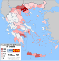
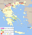
Ethnic Macedonians in Greece - census 2001.svg 4,168 × 4,298; 1.52 MB
-
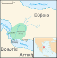
Euripus SWBD demo.svg 1,432 × 1,655; 1.78 MB
-
Gr-map-ES.svg 787 × 689; 5.26 MB
-
Grece 1832-es.svg 778 × 694; 281 KB
-
Grece 1832.svg 733 × 660; 77 KB
-
Grece remanie.svg 733 × 660; 76 KB
-
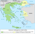
GreciaEnEntreguerras.svg 2,029 × 2,000; 420 KB
-
Greece Iraq Locator.svg 620 × 415; 1.72 MB
-
Greece linguistic minorities-es.svg 566 × 617; 495 KB
-
Greece linguistic minorities-hu.svg 566 × 617; 444 KB
-
Greece linguistic minorities.svg 566 × 617; 480 KB
-
Greece map blank.svg 750 × 700; 730 KB
-
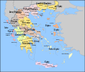
Greece subnat blank.svg 5,102 × 4,312; 1.82 MB
-
Greece subnat de.svg 5,102 × 4,312; 1.87 MB
-
Greece subnat el.svg 5,102 × 4,312; 1.87 MB
-
Greecemap-en.svg 983 × 751; 585 KB
-
Greecemap-it.svg 993 × 793; 3.2 MB
-
Greecemap.svg 983 × 751; 112 KB
-
Greek Islands regions map.svg 750 × 700; 4.93 MB
-
Greek legislative elections 2012 map.svg 3,909 × 3,312; 793 KB
-
Greek legislative elections 2015 map.svg 3,825 × 3,277; 803 KB
-
Greek legislative elections 2019 map.svg 1,012 × 847; 1.22 MB
-
Greek legislative elections June 2012 map.svg 3,825 × 3,277; 796 KB
-
Greek legislative elections Sept 2015 map.svg 1,012 × 847; 777 KB
-
Homeric Greece-en.svg 1,502 × 1,253; 1.21 MB
-
Homeric Greece-es.svg 1,502 × 1,253; 857 KB
-
Homeric Greece-fr.svg 1,502 × 1,253; 992 KB
-
Homeric Greece-zh-hans.svg 1,502 × 1,253; 990 KB
-
Imia delimitation 1932-it.svg 602 × 627; 98 KB
-
Imia delimitation 1932-tr.svg 602 × 627; 101 KB
-
Imia delimitation 1932.svg 602 × 627; 98 KB
-
Imia region.svg 1,454 × 1,370; 80 KB
-
Imia with legends el.svg 570 × 588; 86 KB
-
Imia with legends tr.svg 570 × 588; 112 KB
-
Imia with legends-es.svg 570 × 588; 87 KB
-
Imia with legends-fr.svg 570 × 588; 92 KB
-
Imia with legends.svg 570 × 588; 87 KB
-
Ionian Islands fr.svg 532 × 547; 284 KB
-
Ionian Islands-es.svg 1,003 × 825; 782 KB
-
Ionian Islands.svg 532 × 547; 281 KB
-
Isole della Grecia-es.svg 1,003 × 825; 1.48 MB
-
Karte Pelzstückenverarbeitung.svg 1,494 × 1,240; 505 KB
-
Katafygi Cave in Lefktron Municipality.svg 749 × 866; 71 KB
-
Kato Grammatiko Overview Map OSM.svg 800 × 755; 40 KB
-
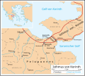
Korinth Isthmus de.svg 585 × 524; 105 KB
-
Korinth Isthmus es(1).svg 585 × 524; 317 KB
-
La Liga aquea en 188 aC.svg 1,848 × 1,252; 2.8 MB
-
La Liga aquea en 194 aC.svg 1,848 × 1,252; 2.78 MB
-
Lechaeum-la embed.svg 350 × 211; 77 KB
-
Lelantine War-el.svg 711 × 723; 345 KB
-
Lelantine War-en.svg 711 × 723; 231 KB
-
Lelantine War-es.svg 711 × 723; 279 KB
-
Lelantine War-fr.svg 711 × 723; 281 KB
-
Lelantine War-id.svg 711 × 723; 282 KB
-
Lelantine War-it.svg 711 × 723; 203 KB
-
Lelantine War-nl.svg 711 × 723; 282 KB
-
Lelantine War-tr.svg 711 × 723; 282 KB
-
Locator map of Achaea (constituency).svg 1,012 × 847; 1.22 MB
-
Locator map of Aetolia-Acarnania (constituency).svg 1,012 × 847; 1.22 MB
-
Locator map of Arcadia (constituency).svg 1,012 × 847; 1.22 MB
-
Locator map of Argolis (constituency).svg 1,012 × 847; 1.22 MB
-
Locator map of Arta (constituency).svg 1,012 × 847; 1.22 MB
-
Locator map of Athens A.svg 1,012 × 847; 892 KB
-
Locator map of Athens B1.svg 1,012 × 847; 1.22 MB
-
Locator map of Athens B2.svg 1,012 × 847; 1.22 MB
-
Locator map of Athens B3.svg 1,012 × 847; 1.22 MB
-
Locator map of Boetia (constituency).svg 1,012 × 847; 1.22 MB
-
Locator map of Cephalonia (constituency).svg 1,012 × 847; 1.22 MB
-
Locator map of Chalkidiki (constituency).svg 1,012 × 847; 1.22 MB
-
Locator map of Chania (constituency).svg 1,012 × 847; 1.22 MB
-
Locator map of Chios (constituency).svg 1,012 × 847; 1.22 MB
-
Locator map of Corfu (constituency).svg 1,012 × 847; 1.22 MB
-
Locator map of Corinthia (constituency).svg 1,012 × 847; 1.22 MB
-
Locator map of Drama (constituency).svg 1,012 × 847; 1.22 MB
-
Locator map of East Attica (constituency).svg 1,012 × 847; 1.22 MB
-
Locator map of Elis (constituency).svg 1,012 × 847; 1.22 MB
-
Locator map of Euboea (constituency).svg 1,012 × 847; 1.22 MB
-
Locator map of Evros (constituency).svg 1,012 × 847; 1.22 MB
-
Locator map of Evrytania (constituency).svg 1,012 × 847; 1.22 MB
-
Locator map of Florina (constituency).svg 1,012 × 847; 1.22 MB
-
Locator map of Greece.svg 680 × 520; 660 KB
-
Locator map of Grevena (constituency).svg 1,012 × 847; 1.22 MB
-
Locator map of Heraklion (constituency).svg 1,012 × 847; 1.22 MB
-
Locator map of Imathia (constituency).svg 1,012 × 847; 1.22 MB
-
Locator map of Ioannina (constituency).svg 1,012 × 847; 1.22 MB
-
Locator map of Karditsa (constituency).svg 1,012 × 847; 1.22 MB
-
Locator map of Kastoria (constituency).svg 1,012 × 847; 1.22 MB
-
Locator map of Kavala (constituency).svg 1,012 × 847; 1.22 MB
-
Locator map of Kilkis (constituency).svg 1,012 × 847; 1.22 MB
-
Locator map of Kozani (constituency).svg 1,012 × 847; 1.22 MB
-
Locator map of Laconia (constituency).svg 1,012 × 847; 1.22 MB
-
Locator map of Larissa (constituency).svg 1,012 × 847; 1.22 MB
-
Locator map of Lasithi (constituency).svg 1,012 × 847; 1.22 MB
-
Locator map of Lefkada (constituency).svg 1,012 × 847; 1.22 MB
-
Locator map of Lesbos (constituency).svg 1,012 × 847; 1.22 MB
-
Locator map of Magnesia (constituency).svg 1,012 × 847; 1.22 MB
-
Locator map of Messenia (constituency).svg 1,012 × 847; 1.22 MB
-
Locator map of Pella (constituency).svg 1,012 × 847; 1.22 MB
-
Locator map of Phocis (constituency).svg 1,012 × 847; 1.22 MB
-
Locator map of Phthiotis (constituency).svg 1,012 × 847; 1.22 MB


