Category:SVG locator maps of Greece
Jump to navigation
Jump to search
Subcategories
This category has only the following subcategory.
Media in category "SVG locator maps of Greece"
The following 17 files are in this category, out of 17 total.
-
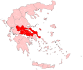
Central Greece periphery.svg 3,909 × 3,312; 720 KB
-
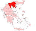
Central Macedonia periphery.svg 3,825 × 3,277; 718 KB
-
Europe greece.svg 680 × 520; 795 KB
-
Greece - Location Map (2013) - GRC - UNOCHA.svg 250 × 250; 1.61 MB
-
Greece - Location Map (2022) - GRC - UNOCHA.svg 512 × 564; 1.63 MB
-
Greece location map Lesbos-nomos.svg 1,003 × 825; 833 KB
-
Greece w1 locator.svg 1,000 × 1,000; 130 KB
-
Greece w2 locator.svg 1,000 × 1,000; 240 KB
-
Greece-regions.svg 940 × 477; 1.36 MB
-
Hellenic Republic (1935).svg 450 × 456; 476 KB
-
Kingdom of Greece (1862).svg 450 × 456; 784 KB
-
Kingdom of Greece (1890).svg 450 × 456; 437 KB
-
Kingdom of Greece (1914).svg 450 × 456; 456 KB
-
Kingdom of Greece (1973).svg 450 × 456; 465 KB
-
Kingdom of Greece 1920.svg 450 × 456; 500 KB
-
Location map of Macedonia (Greece).svg 8,460 × 7,315; 1.82 MB
-
LocationGreece.svg 1,000 × 500; 2.76 MB


