Category:SVG blank maps of Germany
Jump to navigation
Jump to search
Media in category "SVG blank maps of Germany"
The following 64 files are in this category, out of 64 total.
-
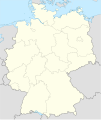
Germany location map July 1993 - December 2009.svg 1,075 × 1,273; 608 KB
-
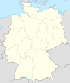
Germany location map October 1990 - March 1992.svg 1,075 × 1,273; 449 KB
-
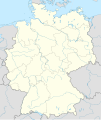
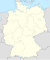
Germany location map.svg 1,073 × 1,272; 452 KB
-
Germany, Federal Republic of location map 23 May 1949 - 6 Oct 1949.svg 1,075 × 1,273; 1.12 MB
-
Germany, Federal Republic of location map April 1952 - August 1955.svg 1,073 × 1,272; 858 KB
-
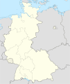
Germany, Federal Republic of location map December 1950 - April 1952.svg 1,075 × 1,273; 502 KB
-
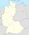
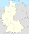
Germany, Federal Republic of location map January 1957 - October 1990.svg 1,075 × 1,273; 490 KB
-
Germany, Federal Republic of location map October 1949 - November 1950.svg 1,075 × 1,273; 501 KB
-
Germany, Federal Republic of location map September 1955 - December 1956.svg 1,075 × 1,273; 497 KB
-
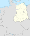
Germany, German Democratic Republic location map January 1957 - October 1990.svg 1,075 × 1,273; 478 KB
-
Germany, German Democratic Republic location map July 1952 - January 1957.svg 1,075 × 1,273; 480 KB
-
Germany, German Democratic Republic location map October 1949 - July 1952.svg 1,075 × 1,273; 453 KB
-
Germany, location map (SBZ perspective) 23 May 1949 - 6 Oct 1949.svg 1,075 × 1,273; 1.14 MB
-
Germany2 location map.svg 1,073 × 1,272; 638 KB
-
Germany location map 8 Jun 1947 - 22 Apr 1949.svg 1,075 × 1,273; 1.12 MB
-
Germany location map 23 April 1949 - 22 May 1949.svg 1,075 × 1,273; 1.13 MB
-
Germany location map April 1992 - July 1992.svg 1,075 × 1,273; 449 KB
-
Germany location map August 1992 - June 1993.svg 1,075 × 1,273; 450 KB
-
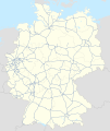
Deutschland Autobahnen.svg 1,073 × 1,272; 467 KB
-
Landers d'Allemagne sans noms.svg 600 × 810; 188 KB
-
Karte Bundesrepublik Deutschland.svg 592 × 801; 108 KB
-
DEU locator map.svg 592 × 801; 58 KB
-
Deutschland.svg 1,343 × 1,591; 735 KB
-
Deutschlandkarte (Bunt).svg 2,480 × 3,325; 55 KB
-
Deutschlandkarte leer.svg 512 × 724; 3.2 MB
-
East Germany location map.svg 618 × 789; 966 KB
-
Federal Republic of Germany (since 1990).png 1,728 × 2,048; 404 KB
-
German Democratic Republic - East Germany (1949-1990).png 1,728 × 2,048; 385 KB
-
Germany (+districts +municipalities) location map 2013.svg 1,779 × 2,095; 25.26 MB
-
Germany (+districts +municipalities) location map current.svg 1,779 × 2,095; 25.26 MB
-
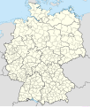
Germany (+districts) location map.svg 1,073 × 1,272; 2.21 MB
-
Germany adm location map.svg 1,073 × 1,272; 643 KB
-
Germany blank map.svg 2,480 × 3,325; 58 KB
-
Germany Coast adm location map.svg 891 × 401; 259 KB
-
Germany grey gradient theme.svg 602 × 816; 152 KB
-
Germany localisation map 2008.svg 525 × 630; 439 KB
-
Germany location map German color system.svg 1,001 × 1,198; 365 KB
-
Germany Southwest location map.svg 789 × 1,063; 212 KB
-
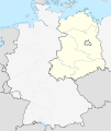
Germany, FRG and GDR location map October 1949 - November 1950.svg 1,075 × 1,273; 492 KB
-
Germany-Outline.svg 522 × 729; 50 KB
-
Grundlage für Karte zur Liste der Wappen mit hanauischen Sparren.svg 595 × 842; 436 KB
-
Karte Deutschland.svg 592 × 801; 208 KB
-
Karte gruenes deutschland.svg 450 × 600; 17 KB
-
Lands of GDR (1945-1952).svg 618 × 789; 72 KB
-
Lippstadt Wappen und Landkarte.jpg 2,565 × 1,500; 263 KB
-
Location Map German Democratic Republic Cottbus.svg 511 × 314; 137 KB
-
Location Map German Democratic Republic Dresden.svg 511 × 387; 142 KB
-
Location Map German Democratic Republic Erfurt.svg 511 × 429; 140 KB
-
Location Map German Democratic Republic Frankfurt.svg 511 × 737; 119 KB
-
Location Map German Democratic Republic Gera.svg 511 × 448; 101 KB
-
Location Map German Democratic Republic Halle.svg 511 × 403; 608 KB
-
Location Map German Democratic Republic Karl-Marx-Stadt.svg 511 × 480; 126 KB
-
Location Map German Democratic Republic Magdeburg.svg 511 × 578; 189 KB
-
Location Map German Democratic Republic Neubrandenburg.svg 587 × 497; 164 KB
-
Location Map German Democratic Republic Potsdam.svg 567 × 720; 199 KB
-
Location Map German Democratic Republic Rostock.svg 842 × 436; 370 KB
-
Location Map German Democratic Republic Suhl.svg 511 × 380; 103 KB
-
Map of Lands of Germany (Area States and City States).svg 592 × 801; 108 KB
-
Northwest Germany location map.svg 601 × 636; 871 KB
-
Relief Map of Germany.svg 1,073 × 1,272; 6.54 MB
-
Weimar Republic (1918-1933); Nazi Germany (1933-1938).png 2,560 × 2,035; 969 KB

