Category:Maps of the history of Vojvodina
Jump to navigation
Jump to search
Wikimedia category | |||||
| Upload media | |||||
| Instance of | |||||
|---|---|---|---|---|---|
| |||||
Subcategories
This category has the following 38 subcategories, out of 38 total.
- Maps of the history of Mačva (20 F)
*
A
B
- Maps of Banat of Temeswar (29 F)
C
D
H
I
M
- Maps of Danube Banovina (13 F)
- Maps of Eurasian Avars (71 F)
- Maps of Illyricum (65 F)
- Maps of the Pannonian Sea (13 F)
O
P
R
S
T
Y
Media in category "Maps of the history of Vojvodina"
The following 200 files are in this category, out of 280 total.
(previous page) (next page)-
1947. Nikola Mirkov FOTOKOPIJA IDEJNOG PLANA KANALA DTD.JPG 1,068 × 782; 155 KB
-
Ahtum sermon01.png 1,019 × 750; 75 KB
-
Ahtum sermon02-sr.png 1,019 × 750; 69 KB
-
Ahtum sermon02.gif 1,019 × 750; 38 KB
-
Ahtum sermon03 01-es.svg 5,529 × 3,380; 279 KB
-
Ahtum sermon03 01.png 1,019 × 750; 71 KB
-
Ahtum sermon04 01.png 1,019 × 750; 72 KB
-
Realms of Ahtum and Sermon in the 11th century-BG.png 1,556 × 1,202; 238 KB
-
Realms of Ahtum and Sermon in the 11th century.png 1,559 × 1,200; 260 KB
-
Ancient balkans 4thcentury-es.svg 2,039 × 1,823; 854 KB
-
Ancient balkans 4thcentury-sr.png 1,113 × 845; 88 KB
-
Ancient balkans 4thcentury-zh.svg 2,039 × 1,823; 318 KB
-
Ancient balkans 4thcentury.png 1,113 × 845; 88 KB
-
Archbishopric of Ohrid in 1020, map by Dimitar Rizov (1917).jpg 1,557 × 1,608; 868 KB
-
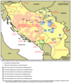
Fascist concentration camps in yugoslavia.png 1,076 × 1,326; 197 KB
-
Fascist concentration camps in yugoslavia-sr.png 1,076 × 1,275; 190 KB
-
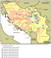
Fascist genocide in yugoslavia.png 1,076 × 1,260; 183 KB
-
Fascist genocide in yugoslavia-sr.png 1,076 × 1,209; 176 KB
-
Bacs-Bodrog county map.jpg 1,697 × 2,125; 889 KB
-
Balkans 6th century-hu.svg 1,400 × 755; 1.71 MB
-
Balkans 6th century-pt.svg 1,400 × 755; 1.06 MB
-
Balkans 6th century-zh.svg 1,400 × 755; 1.42 MB
-
Balkans 6th century.svg 1,400 × 755; 1.83 MB
-
Balkans05.png 1,128 × 1,040; 130 KB
-
Balkans925.png 472 × 605; 225 KB
-
Banat backa baranja 01 map sr.png 1,198 × 1,092; 111 KB
-
Banat backa baranja 01 map(RU).png 1,198 × 1,092; 103 KB
-
Banat backa baranja 01 map.png 1,198 × 1,092; 107 KB
-
Banat backa baranja 02 map sr.png 1,224 × 1,083; 126 KB
-
Banat backa baranja 02 map.png 1,224 × 1,083; 128 KB
-
Banat Republic bgiu.png 656 × 570; 138 KB
-
Banat Republic bgiu2.png 656 × 570; 145 KB
-
Banat republic hu.png 1,000 × 886; 119 KB
-
Banat republic-es.svg 5,275 × 3,689; 642 KB
-
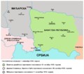
Banat republic-sr.png 1,000 × 886; 72 KB
-
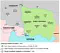
Banat republic.png 1,000 × 886; 80 KB
-
Banat2 en.png 1,147 × 1,249; 322 KB
-
Banat2 hu.png 1,927 × 2,098; 806 KB
-
Impartirea Banatului.png 1,147 × 1,249; 322 KB
-
RepartoDelBanatoEntreYugoslaviaYRumanía.svg 1,147 × 1,249; 344 KB
-
Banatia hu.svg 1,333 × 1,033; 67 KB
-
Banatia-sr.png 1,000 × 775; 62 KB
-
Banatia.png 1,000 × 775; 74 KB
-
Banatski ustanak-sr.png 918 × 784; 73 KB
-
Banatski ustanak.gif 1,209 × 691; 1.63 MB
-
Banatski ustanak.png 918 × 784; 71 KB
-
Basarabi culture.png 887 × 826; 270 KB
-
Belegis culture-sr.png 922 × 572; 35 KB
-
Belegis culture.png 922 × 572; 43 KB
-
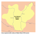
Bijelo Brdo Culture-it.svg 760 × 684; 92 KB
-
Bijelo brdo culture01.png 1,048 × 937; 47 KB
-
Bijelo brdo culture02.png 1,048 × 937; 47 KB
-
Bosut culture-sr.png 560 × 429; 23 KB
-
Bosut culture.png 560 × 429; 25 KB
-
Buta ul sr.png 1,052 × 868; 66 KB
-
Buta ul.png 1,052 × 868; 70 KB
-
Byzantine pannonia en.png 1,052 × 868; 54 KB
-
Byzantine pannonia sr.png 1,052 × 868; 54 KB
-
Central europe 1572 hu.svg 922 × 880; 117 KB
-
Central europe 1572.png 922 × 880; 120 KB
-
Central Erope 1572 es.svg 1,122 × 883; 248 KB
-
Central Erope 1572 HU.svg 1,122 × 883; 243 KB
-
A' budai pasaság 1650-ben Hadzsi Chalfa szerint.png 1,246 × 1,520; 1.62 MB
-
Croatia Serbia border Syrmia Vukovar-ru.svg 406 × 610; 120 KB
-
Croatia Serbia border Syrmia Vukovar.svg 406 × 610; 132 KB
-
Culture Vincha peoples.jpg 510 × 343; 80 KB
-
Danube-Kris-Mures-Tisa Euroregion map.png 824 × 970; 78 KB
-
Despotski posedi-sr.png 1,220 × 1,060; 88 KB
-
Despotski posedi.png 1,220 × 1,060; 116 KB
-
District of potisje en.png 578 × 1,127; 51 KB
-
District of potisje sr.png 578 × 1,127; 50 KB
-
District of velika kikinda en.png 627 × 1,044; 53 KB
-
District of velika kikinda sr.png 627 × 1,044; 53 KB
-
DKMTEuroregion.png 1,190 × 1,290; 317 KB
-
Dubovac zuto brdo culture-sr.png 520 × 558; 32 KB
-
Dubovac zuto brdo culture.png 520 × 558; 38 KB
-
Gepid kingdom 6th century - es.svg 1,102 × 1,154; 218 KB
-
Gepid kingdom 6th century - pt.svg 1,102 × 1,154; 223 KB
-
Gepid kingdom 6th century - ru.svg 1,033 × 1,082; 161 KB
-
Gepid kingdom 6th century - zh.svg 1,102 × 1,154; 82 KB
-
Gepid kingdom 6th century-hu.svg 1,102 × 1,154; 70 KB
-
Gepid kingdom 6th century-sr.png 858 × 894; 53 KB
-
Gepid kingdom 6th century.png 858 × 894; 55 KB
-
Great Moravia Puspoki's Theory.jpg 1,068 × 848; 960 KB
-
Great serb migration-es.svg 8,584 × 7,087; 300 KB
-
Great serb migration-pt.svg 8,584 × 7,087; 143 KB
-
Great serb migration-sr.png 1,601 × 1,534; 123 KB
-
Great serb migration.png 1,601 × 1,534; 150 KB
-
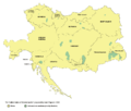
Greater austria.png 1,500 × 1,280; 45 KB
-
Vereinigte Staaten von Groß-Österreich.png 1,500 × 1,280; 192 KB
-
대 오스트리아.png 1,500 × 1,280; 64 KB
-
Greater austriaPL.png 1,500 × 1,280; 74 KB
-
Hungarian Occupied Yugoslavia 1941 44.png 1,032 × 659; 249 KB
-
Iazyges-en.png 574 × 661; 30 KB
-
Iazyges-es.svg 1,330 × 1,701; 186 KB
-
Iazyges-pt.svg 1,330 × 1,701; 92 KB
-
Iazyges-sr.png 574 × 661; 29 KB
-
Indo Europeans Vojvodina map-sr.png 983 × 923; 78 KB
-
Indo Europeans Vojvodina map.png 983 × 923; 84 KB
-
Josephinische Landaufnahme Banat.jpg 1,446 × 1,778; 346 KB
-
Josephinische Landaufnahme Slavonien.jpg 1,898 × 1,486; 213 KB
-
Josephinische Landaufnahme Slavonischen Distrikt.jpg 2,749 × 1,831; 370 KB
-
Jovan Nenad 1526.png 950 × 693; 716 KB
-
Kingdom of syrmia according to stanoje stanojevic-es.svg 1,279 × 1,016; 789 KB
-
Kingdom of syrmia according to stanoje stanojevic-sr.png 914 × 586; 58 KB
-
Kingdom of syrmia according to stanoje stanojevic.png 914 × 586; 73 KB
-
Koh administrative 1370 01.png 1,228 × 939; 128 KB
-
Koh administrative 1370 02.png 1,228 × 939; 122 KB
-
Kosovomap.gif 455 × 451; 50 KB
-
Kostolac culture-sr.png 520 × 542; 28 KB
-
Kostolac culture.png 520 × 542; 33 KB
-
KuK Nichtunierte.jpg 1,465 × 1,497; 1.29 MB
-
Kuver en.png 1,052 × 868; 60 KB
-
Kuver sr.png 1,052 × 868; 60 KB
-
Madjarska okupacija Backe i Baranje, 1941-1944.png 886 × 864; 67 KB
-
Ethnographic map of Backa and Baranja 1931.png 795 × 583; 30 KB
-
Magyar slavic.png 849 × 524; 32 KB
-
Map of Central Europe in 1791 by Reilly 006.jpg 650 × 508; 104 KB
-
Map of Central Europe in 1791 by Reilly 006b.jpg 1,200 × 906; 273 KB
-
MapaSrbijeiCrneGore.JPG 818 × 1,287; 82 KB
-
Medjuopstinske regionalne zajednice Socijalisticke Republike Srbije.png 740 × 1,059; 88 KB
-
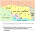
Militargrenze, Wojwodowena und Banat.jpg 900 × 312; 115 KB
-
Wojwodowena und Banat.jpg 400 × 295; 42 KB
-
Moriska kultura01.png 618 × 617; 28 KB
-
Moriska kultura02.png 618 × 617; 28 KB
-
Neolithic vinca culture en.png 888 × 930; 54 KB
-
Neolithic vinca culture sr.png 888 × 930; 56 KB
-
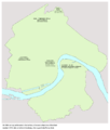
Novi sad razvoj naselja.png 1,800 × 2,512; 475 KB
-
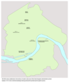
Novi sad stara naselja01a.png 1,800 × 2,112; 443 KB
-
Novi sad stara naselja01b.png 1,800 × 2,112; 441 KB
-
Novi sad stara naselja01c.png 1,800 × 2,112; 423 KB
-
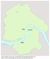
Novi sad stara naselja02.png 1,800 × 2,112; 423 KB
-
Novi sad stara naselja03.png 1,800 × 2,116; 405 KB
-
Novi sad stara naselja04.png 1,800 × 2,112; 353 KB
-
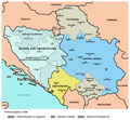
Occupation of vojvodina.png 1,548 × 1,653; 129 KB
-
RepartoDeVoivodinaEnLaSegundaGuerraMundial.svg 1,548 × 1,653; 470 KB
-
Ohrid archbishopric 1020 01.png 1,087 × 1,112; 101 KB
-
Ohrid archbishopric 1020 02.png 1,087 × 1,112; 103 KB
-
Pannonia secunda-es.svg 4,596 × 2,857; 720 KB
-
Pannonia secunda-sr.png 1,034 × 630; 49 KB
-
Pannonia secunda.png 1,034 × 630; 49 KB
-
Pannonian sea vojvodina-en.png 1,399 × 927; 92 KB
-
Pannonian sea vojvodina-sr.png 1,399 × 927; 92 KB
-
Pannonian sea02-sr.png 1,399 × 927; 84 KB
-
Pannonian sea02.png 1,399 × 927; 84 KB
-
Partizanski srem01.png 1,420 × 1,245; 110 KB
-
Partizanski srem02.png 1,420 × 1,200; 106 KB
-
Passarowitz 1718.JPG 1,200 × 1,681; 977 KB
-
Patriarchate of Peć in the 16th and 17th century.png 1,170 × 1,383; 129 KB
-
Pecka patrijarsija mapa sr.png 1,170 × 1,383; 123 KB
-
Prefecture of Illyricum map-sr.png 1,054 × 1,041; 92 KB
-
Prefecture of Illyricum map-zh.png 1,054 × 1,041; 101 KB
-
Prefecture of Illyricum map.png 1,054 × 1,041; 103 KB
-
PrefectureIllyricum.png 1,054 × 1,041; 96 KB
-
Racija1942 01.png 942 × 1,302; 99 KB
-
Racija1942 02.png 942 × 1,263; 84 KB
-
Radoslav celnik01.png 985 × 687; 66 KB
-
Radoslav celnik02 sr.png 985 × 687; 57 KB
-
Rascia in pannonia 16th 18th century-sr.png 1,356 × 716; 67 KB
-
Rascia in pannonia 16th 18th century.png 1,356 × 716; 70 KB
-
Rivolta pannonica 6 jpg.JPG 1,127 × 777; 241 KB
-
Rivolta pannonica 7.jpg 1,127 × 777; 242 KB
-
Rivolta pannonica 8.jpg 1,127 × 777; 239 KB
-
Rivolta pannonica 9.jpg 1,127 × 777; 244 KB
-
RizMap11.jpg 1,472 × 1,505; 1.89 MB
-
Roman cities Vojvodina-sr.png 1,770 × 1,185; 133 KB
-
Roman cities Vojvodina.png 1,770 × 1,185; 140 KB
-
Sabor u baji 1694 01.png 1,354 × 877; 74 KB
-
Sabor u baji 1694 02.png 1,354 × 877; 76 KB
-
Sabor u krusedolu 1708 01.png 1,354 × 877; 69 KB
-
Sabor u krusedolu 1708 02.png 1,354 × 877; 69 KB
-
Salan glad01-es.svg 5,460 × 3,432; 493 KB
-
Salan glad01.png 1,018 × 844; 75 KB
-
Salan glad02-sr.png 1,018 × 844; 73 KB
-
Salan glad02.gif 1,018 × 844; 40 KB
-
Salan-es.svg 5,475 × 3,422; 367 KB
-
Salan.png 1,018 × 713; 52 KB
-
Salan05 map.png 1,018 × 713; 52 KB
-
County of Salan-bg.png 1,567 × 1,140; 215 KB
-
SAP Vojvodina.png 941 × 824; 21 KB
-
Scg02 zh.png 818 × 1,287; 80 KB
-
Scg02-ar.png 818 × 1,287; 59 KB
-
Scg02.png 818 × 1,287; 71 KB
-
Serbia og Montenegro.png 500 × 669; 108 KB
-
Scordisci state-sr.png 813 × 565; 37 KB
-
Scordisci state.png 813 × 565; 38 KB
-
Serbia religion 1054 01.png 638 × 1,077; 57 KB
-
Serbia religion 1054 02.png 638 × 1,077; 58 KB
-
Serbia religion 14th 01.png 638 × 1,077; 50 KB
-
Serbia religion 14th 02.png 638 × 1,077; 50 KB
-
Serbia religion 16th 17th 01.png 638 × 1,077; 61 KB
-
Serbia religion 16th 17th 02.png 638 × 1,077; 62 KB
-
Serbia and Vojvodina 1848.png 717 × 924; 71 KB
-
Serbia1849 04.png 724 × 949; 71 KB
-
Serbia1849 sr latin.png 724 × 949; 72 KB
-
Serbia02.png 724 × 949; 73 KB
-
Serbia1849 01 01 04.png 724 × 760; 54 KB
-
Serbia1849 01 02 02.png 724 × 760; 51 KB
-
Serbia1849 01 03 03.png 724 × 760; 54 KB
-
Serbia02 (Voivodina).png 724 × 760; 53 KB


