Category:Maps of Illyricum
Jump to navigation
Jump to search
Wikimedia category | |||||
| Upload media | |||||
| Instance of | |||||
|---|---|---|---|---|---|
| Category combines topics | |||||
| Illyricum | |||||
Roman province from 27 BC to 69/79 AD | |||||
| Instance of | |||||
| Location |
| ||||
| Capital | |||||
| Replaces | |||||
| Replaced by | |||||
 | |||||
Media in category "Maps of Illyricum"
The following 65 files are in this category, out of 65 total.
-
1579 map of the Northern Balkan region of Illyricum by Johannes Matalius Metellus.jpg 1,665 × 1,200; 606 KB
-
1601 map by Abraham Ortelius ̠- Illyricum.tif 7,915 × 5,752; 260.53 MB
-
Map of the roman province of Moesia (250).jpg 2,352 × 1,559; 783 KB
-
321c AD reforms Constantine I in the prefecture of Illyricum.svg 687 × 981; 30 KB
-
Ancient balkans 4thcentury-es.svg 2,039 × 1,823; 854 KB
-
Ancient balkans 4thcentury-sr.png 1,113 × 845; 88 KB
-
Ancient balkans 4thcentury-zh.svg 2,039 × 1,823; 318 KB
-
Ancient balkans 4thcentury.png 1,113 × 845; 88 KB
-
AtlBalk0.jpg 318 × 327; 156 KB
-
AtlBalk200.jpg 318 × 327; 150 KB
-
AtlBalk400.jpg 318 × 327; 155 KB
-
Butler Vindellicia Illyricum.jpg 2,466 × 2,036; 1.45 MB
-
Daesitiataei in Illyricum 40BC.png 1,600 × 1,084; 2.05 MB
-
Dalmatia&Moesia Superior.JPG 5,061 × 6,589; 28.23 MB
-
Dardanija.jpg 1,600 × 1,067; 431 KB
-
Iapodes in Illyricum 40BC.png 1,600 × 1,084; 1.74 MB
-
Iliria.jpg 1,427 × 1,410; 153 KB
-
Illyria SPQR.png 1,600 × 1,096; 47 KB
-
Illyricum & Dacia - AD 400.png 971 × 673; 972 KB
-
Illyricum (Imperium Romanum).png 2,495 × 1,775; 46 KB
-
Illyricum Ortelius Sambucus Hirschvogel 1588.jpg 575 × 444; 144 KB
-
ILLYRICUM SPQR png.png 2,000 × 1,468; 404 KB
-
Illyricum SPQR.png 1,600 × 1,096; 56 KB
-
Ilyria Kingdom.png 500 × 337; 29 KB
-
Macedonia-Thracia-Illyria-Moesia-Dacia1849.jpg 2,038 × 1,677; 1.12 MB
-
Macedonia-Thracia-Illyria-Moesia-Dacia1849refurbished.jpg 2,038 × 1,677; 837 KB
-
Map of Illyricum by Abraham Ortelius.jpeg 1,581 × 1,178; 610 KB
-
Post Roman Balkans.jpg 2,038 × 1,677; 721 KB
-
Praetorian Prefectures of the Roman Empire 395 AD-ar.png 900 × 595; 161 KB
-
Praetorian Prefectures of the Roman Empire 395 AD.png 900 × 595; 144 KB
-
Praevalis or Praevalitana in Illyricum 306 cAD.svg 744 × 1,052; 22 KB
-
Praevalitana 4c AD 2.svg 1,024 × 768; 183 KB
-
Praevalitana or Praevalis in Ilyricum 306 c AD a2.svg 1,052 × 744; 127 KB
-
Prefecture of Illyricum map-sr.png 1,054 × 1,041; 92 KB
-
Prefecture of Illyricum map-zh.png 1,054 × 1,041; 101 KB
-
Prefecture of Illyricum map.png 1,054 × 1,041; 103 KB
-
PrefectureIllyricum.png 1,054 × 1,041; 96 KB
-
Province of Illyricum.png 300 × 220; 48 KB
-
Rascia01.jpg 655 × 640; 159 KB
-
REmpire Illyricum.PNG 400 × 296; 63 KB
-
REmpire-Dalmatia.png 400 × 296; 24 KB
-
Rivolta pannonica 6 jpg.JPG 1,127 × 777; 241 KB
-
Rivolta pannonica 7.jpg 1,127 × 777; 242 KB
-
Rivolta pannonica 8.jpg 1,127 × 777; 239 KB
-
Rivolta pannonica 9.jpg 1,127 × 777; 244 KB
-
Roman Dardania (detail), Droysens Historical Atlas, 1886.jpg 886 × 574; 628 KB
-
Roman Empire Map AlexanderFindlay1849.png 2,038 × 1,828; 2 MB
-
Roman Illyricum in 40 BC.png 2,724 × 2,204; 5.05 MB
-
Roman provinces in a 1867 school atlas.jpg 3,717 × 2,866; 969 KB
-
Roman provinces of Illyricum, Macedonia, Dacia, Moesia, Pannonia and Thracia.jpg 2,817 × 2,284; 1.41 MB
-
Roman war in Illyricum 33 BC.png 2,724 × 2,204; 5.01 MB
-
Roman war in Illyricum 34 BC.png 2,724 × 2,204; 5.05 MB
-
Roman war in Illyricum 35 BC.png 2,724 × 2,204; 5.08 MB
-
RomanDardaniaMoesiaSuperior1.png 886 × 574; 134 KB
-
Romanized and Hellenized Illyria & Dalmatia (English).svg 1,382 × 1,424; 6.05 MB
-
Romanized and Hellenized Illyria & Dalmatia (Portuguese).svg 1,382 × 1,424; 6.04 MB
-
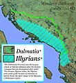
Romanized and Hellenized Illyria & Dalmatia.jpg 550 × 600; 223 KB
-
Sebastian Münster - Descriptio totius Illyridis.jpg 1,535 × 1,200; 2.2 MB
-
Segestani in Illyricum 40BC.png 1,600 × 1,084; 1.73 MB
-
Southeast Europe in the 450s AD.png 491 × 407; 340 KB
-
Südosteuropa BV043564311.jpg 3,631 × 4,879; 2.69 MB
-
Südosteuropa BV043564313.jpg 11,102 × 7,387; 12.66 MB
-
Südosteuropa BV043564314.jpg 6,661 × 5,805; 5.89 MB
-
The boundary of the Western and Eastern Roman Empire on the Adriatic Sea.svg 744 × 1,052; 270 KB
Categories:
- Illyricum
- Praetorian prefecture of Illyricum
- Maps of the history of the ancient Balkans
- Maps of the history of Albania in ancient times
- Maps of the history of Kosovo in ancient times
- Maps of the history of Greece
- Maps of the history of North Macedonia in ancient times
- Maps of the history of Bulgaria in ancient times
- Maps of the history of Serbia in ancient times
- Maps of the history of Vojvodina
- Maps of the history of Montenegro in ancient times
- Maps of the history of Bosnia and Herzegovina in ancient times
- Maps of the history of Croatia in ancient times
- Maps of the history of Slovenia in ancient times
- Maps of the history of Hungary
- Maps of Illyria
- Maps of Roman provinces


