Category:Maps of the Slavs
Jump to navigation
Jump to search
Wikimedia category | |||||
| Upload media | |||||
| Instance of | |||||
|---|---|---|---|---|---|
| Category combines topics | |||||
| |||||
Subcategories
This category has the following 15 subcategories, out of 15 total.
Media in category "Maps of the Slavs"
The following 75 files are in this category, out of 75 total.
-
.-Slavic europe.png 800 × 612; 108 KB
-
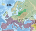
138 CE, Europe.svg 512 × 438; 1.74 MB
-
CHODZKO(1861) CARTE DES PAYS SLAVO-POLONAIS AUX VIII ET IX SIECLE.jpg 5,201 × 3,892; 5.45 MB
-
1861 р.. Ходзько Борейко Леонард Стан на 862 р.jpg 1,600 × 1,198; 553 KB
-
1916 planslavic map of Europe.jpg 1,203 × 1,271; 260 KB
-
476 CE, Europe.svg 512 × 438; 1.48 MB
-
626 CE, Europe.svg 512 × 438; 1.51 MB
-
651 CE, Europe.svg 512 × 438; 1.56 MB
-
737 CE, Europe.svg 512 × 438; 1.62 MB
-
771 CE, Europe.svg 512 × 438; 1.62 MB
-
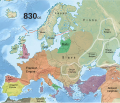
830 CE, Europe.svg 512 × 438; 1.6 MB
-
888 CE, Europe.svg 512 × 438; 1.74 MB
-
Antes01.png 1,243 × 966; 54 KB
-
Antes02.png 1,243 × 966; 54 KB
-
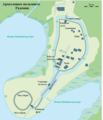
Arheološko nalazište Radomin.png 890 × 1,036; 687 KB
-
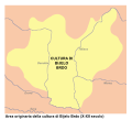
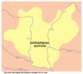
Bijelo Brdo Culture-it.svg 760 × 684; 92 KB
-
Bijelo brdo culture01.png 1,048 × 937; 47 KB
-
Bijelo brdo culture02.png 1,048 × 937; 47 KB
-
Brüske Seite 125.jpg 1,863 × 2,548; 494 KB
-
Catholic Slavs by percentage.png 2,076 × 1,264; 112 KB
-
Die slawische Besiedlung zwischen dem 5. und 7. Jh. n. Chr.jpg 902 × 648; 389 KB
-
Dispersal of Slavs as of 1900 (1910 map).jpg 1,200 × 1,031; 212 KB
-
Early Slavic settlement Prague-type CZ.png 1,477 × 873; 153 KB
-
East europe 3-4cc.png 3,935 × 3,033; 387 KB
-
East europe 5-6cc.png 3,935 × 3,033; 344 KB
-
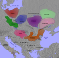
East Europe Archaeological Ancient-Slavs.jpg 1,536 × 998; 623 KB
-
Empires voies commerciales.jpg 663 × 500; 169 KB
-
Ethnographic map of Slavs, Lubor Niederle.JPG 1,017 × 847; 366 KB
-
Europa BV043417545.jpg 1,954 × 1,337; 311 KB
-
Europe around 650.jpg 3,891 × 2,392; 2.62 MB
-
Europe around 800.gif 1,737 × 1,361; 1.07 MB
-
Kingdom of Hungary - Ethnic Map - 1495.jpg 4,771 × 3,337; 11.96 MB
-
Kingdom of Hungary - Ethnic Map - 1784.jpg 4,771 × 3,337; 11.87 MB
-
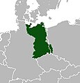
Lutizenbund-es.svg 1,134 × 997; 1.31 MB
-
Lutizenbund.PNG 713 × 616; 122 KB
-
Lutizenbund1.png 713 × 616; 156 KB
-
Macedonians noted on the map from Rusia, slavs in Europe outside Russia.jpg 941 × 1,024; 244 KB
-
Nová Evropa - stanovisko slovanské (1920) (14802241293).jpg 3,076 × 2,216; 1.47 MB
-
Nová Evropa - stanovisko slovanské (1920) (14802242943).jpg 3,260 × 2,156; 1.41 MB
-
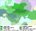
Origin slavs.svg 1,372 × 1,033; 7.77 MB
-
Ostmitteleuropa BV042518440.jpg 1,954 × 1,337; 292 KB
-
Ostmitteleuropa BV042518465.jpg 1,954 × 1,337; 286 KB
-
Ostmitteleuropa BV043417758.jpg 1,019 × 1,258; 188 KB
-
Polabie.jpg 225 × 235; 13 KB
-
Population of slavs.png 8,000 × 4,499; 6.79 MB
-
Połabszczyzna.png 543 × 649; 17 KB
-
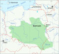
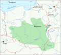
Przeworsk culture map bel.svg 900 × 816; 98 KB
-
Przeworsk culture map es.svg 900 × 816; 205 KB
-
Pueblos eslavos siglo VI mapa historico.jpg 767 × 952; 403 KB
-
PSM V63 D030 Areas of europe settled by slavs.png 1,239 × 1,162; 408 KB
-
Slav-7-8-obrez.png 3,051 × 3,359; 339 KB
-
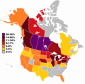
Slavic ancestry in the USA and Canada.png 1,749 × 1,740; 83 KB
-
Slavic archaeological cultures, beginning of 7th century.png 772 × 765; 716 KB
-
Slavic Europe mk.svg 680 × 520; 523 KB
-
Slavic expansion.gif 614 × 528; 82 KB
-
Slavic raids on Scandinavia, Nar.Muz.Mor., Gdańsk, Poland.jpg 1,826 × 1,749; 767 KB
-
Slavic World.png 2,000 × 1,027; 258 KB
-
SlavicEurope.png 1,137 × 948; 311 KB
-
Slavju Vikipedias ubt.png 350 × 310; 82 KB
-
Slavs 900AD.JPG 466 × 576; 72 KB
-
Slavs in Europe.svg 680 × 520; 530 KB
-
Slavs in the 6th century.jpg 1,193 × 836; 205 KB
-
Slovanskisvet.PNG 599 × 202; 7 KB
-
Slovanské staroitnosti (1902) (14592042668).jpg 4,096 × 2,790; 1.66 MB
-
Slovanské staroitnosti (1902) (14778743235).jpg 2,866 × 2,232; 1.52 MB
-
Zachodni Słowianie.png 876 × 723; 470 KB
-
Zachodni34567Słowianie.png 876 × 723; 469 KB
-
Carte des pays Slavo-Polonais aux VIII et IX siecles 1861 (68530044).jpg 10,533 × 7,738; 14.52 MB
-
Етноґрафічна карта славянщини.jpg 2,004 × 1,603; 992 KB
-
Территории славянского населения Европы.png 680 × 520; 33 KB
Categories:
- Slavs
- Maps of ethnic groups in Europe
- Historical Slavic lands
- Maps of the history of Europe by theme
- Maps of the history of the medieval Balkans
- Maps of the history of Central Europe
- Maps of the history of Russia
- Maps of the history of Ukraine in the Middle Ages
- Maps of the history of Poland
- Maps of the history of Czechia
- Maps of the history of Slovakia
- Maps of the history of Lusatia
- Maps of the history of Slovenia in the Middle Ages
- Maps of the history of Croatia in the Middle Ages
- Maps of the history of Bosnia and Herzegovina in the Middle Ages
- Maps of the history of Serbia in the Middle Ages
- Maps of the history of Vojvodina
- Maps of the history of Montenegro in the Middle Ages
- Maps of the history of North Macedonia in the Middle Ages
- Maps of the history of Bulgaria in the Middle Ages
- History of the Slavic peoples


