Category:Maps of Great Moravia
Jump to navigation
Jump to search
Wikimedia category | |||||
| Upload media | |||||
| Instance of | |||||
|---|---|---|---|---|---|
| Category combines topics | |||||
| Great Moravia | |||||
9th century Slavic state | |||||
| Instance of | |||||
| Capital |
| ||||
| Basic form of government |
| ||||
| Official language | |||||
| Inception |
| ||||
| Dissolved, abolished or demolished date |
| ||||
| Follows |
| ||||
 | |||||
Subcategories
This category has the following 2 subcategories, out of 2 total.
M
Pages in category "Maps of Great Moravia"
This category contains only the following page.
Media in category "Maps of Great Moravia"
The following 56 files are in this category, out of 56 total.
-
Balkan 9 vek.png 560 × 423; 212 KB
-
Balkans850-es.svg 1,521 × 1,424; 1.49 MB
-
Balkans850-it.svg 1,521 × 1,424; 1.67 MB
-
Balkans850.png 628 × 517; 287 KB
-
Central europe 9th century-it.svg 425 × 338; 44 KB
-
Central europe 9th century.png 700 × 528; 409 KB
-
Central Europe in the late ninth century.png 511 × 289; 195 KB
-
Core of Great Moravia.jpg 4,096 × 2,304; 4.07 MB
-
Core of moravia en.png 8,192 × 4,608; 39.66 MB
-
EvropaiSredizemnomorieto9.pdf 1,633 × 1,233; 1.78 MB
-
Fortified settlements in Slovakia, 8th-10th century.png 1,000 × 493; 545 KB
-
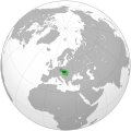
Great Moravia (orthographic projection).svg 512 × 512; 101 KB
-
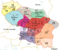
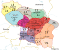
Great Moravia during Svatopluk (cs).svg 512 × 341; 169 KB
-
Great Moravia during Svatopluk (en).svg 512 × 341; 169 KB
-
Great Moravia during Svatopluk (it).svg 512 × 341; 466 KB
-
Great Moravia during Svatopluk (without labels).png 900 × 600; 164 KB
-
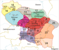
Great Moravia not cropped, deu labels.svg 2,550 × 3,300; 644 KB
-
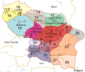
Great Moravia not cropped, eng labels.svg 2,550 × 3,300; 643 KB
-
Great Moravia not cropped, fra labels.svg 2,550 × 3,300; 644 KB
-
Great Moravia not cropped, no labels.svg 2,550 × 3,300; 633 KB
-
Great Moravia not cropped, pol labels.svg 2,550 × 3,300; 644 KB
-
Great Moravia not cropped, slk labels.svg 2,550 × 3,300; 645 KB
-
Great Moravia not cropped-es.svg 2,345 × 1,988; 2.67 MB
-
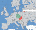
Great Moravia Puspoki's Theory.jpg 1,068 × 848; 960 KB
-
Great moravia svatopluk datailed.png 852 × 603; 190 KB
-
Great moravia svatopluk REAL.jpg 438 × 300; 85 KB
-
Great Moravia Svatopluk.jpg 1,214 × 878; 264 KB
-
Great moravia svatopluk.png 876 × 762; 223 KB
-
Great moravia svatopluk.svg 1,251 × 901; 2.19 MB
-
Great moravia vita.png 962 × 800; 439 KB
-
Great Moravia-deu.png 1,323 × 1,122; 533 KB
-
Great Moravia-eng.png 1,323 × 1,122; 529 KB
-
Great Moravia-fra.png 1,323 × 1,122; 528 KB
-
Great Moravia-no labels.png 1,323 × 1,122; 403 KB
-
Great Moravia-pol.png 1,323 × 1,122; 728 KB
-
Great Moravia-slk.png 1,323 × 1,122; 529 KB
-
Great Moravia.svg 600 × 439; 17 KB
-
Karte Mährerreich Mojmír I.png 1,126 × 994; 1.14 MB
-
Karte Mährerreich Rastislav.png 1,126 × 994; 1.14 MB
-
Karte Mährerreich Svatopluk I.png 1,126 × 994; 1.22 MB
-
Map of Great Moravia (869).png 1,862 × 1,800; 211 KB
-
Nitra a Morava.jpg 523 × 323; 190 KB
-
Nitra moravia 833 hu.svg 492 × 582; 18 KB
-
Nitra moravia 833 sl.svg 492 × 582; 81 KB
-
Nitra Moravia 833-es.svg 478 × 582; 184 KB
-
Nitra moravia 833-it.svg 491 × 636; 40 KB
-
Nitra Moravia 833-pt.svg 478 × 582; 22 KB
-
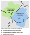
Nitra moravia 833.png 492 × 582; 27 KB
-
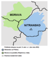
Nitra moravia 833-cs.png 492 × 582; 24 KB
-
Fürstentümer Nitra und Mähren.png 492 × 582; 18 KB
-
Nitriansko vo VM.jpg 1,024 × 838; 792 KB
-
Real great Moravian flag.jpg 4,000 × 2,250; 1.05 MB
-
Staroslovenská ríša002.jpg 879 × 619; 71 KB
-
Staroslovenská ríša004.jpg 873 × 615; 58 KB
-
Staroslovenská ríša006.jpg 927 × 653; 54 KB
-
Říše Velkomoravská v době Svatoplukově.jpg 594 × 553; 52 KB
Categories:
- Great Moravia
- Maps of the history of Czechia
- Maps of the history of Slovakia
- Maps of the prehistory of Hungary
- Maps of the history of Vojvodina
- Maps of the history of Lusatia
- Maps of the history of Europe by former country
- Maps of the history of Central Europe
- Maps showing 9th-century history
- Maps of the Slavs
- Maps showing history of the Early Middle Ages


