
Category:Maps of the Byzantine Empire
Wikimedia category | |||||
| Upload media | |||||
| Instance of | |||||
|---|---|---|---|---|---|
| Category combines topics | |||||
| Category contains | |||||
| Byzantine Empire | |||||
Roman Empire during Late Antiquity and the Middle Ages   | |||||
| Instance of |
| ||||
| Part of |
| ||||
| Named after | |||||
| Culture |
| ||||
| Capital |
| ||||
| Basic form of government |
| ||||
| Official language |
| ||||
| Currency | |||||
| Head of state | |||||
| Inception |
| ||||
| Dissolved, abolished or demolished date |
| ||||
| Population |
| ||||
| Religion or worldview | |||||
| Follows |
| ||||
| Followed by | |||||
| Replaces | |||||
| Replaced by |
| ||||
| Different from | |||||
| Said to be the same as | Q11497737 | ||||
| |||||
Subcategories
This category has the following 23 subcategories, out of 23 total.
Pages in category "Maps of the Byzantine Empire"
This category contains only the following page.
Media in category "Maps of the Byzantine Empire"
The following 136 files are in this category, out of 136 total.
-
 Seltsjoekentekst.png 1,236 × 689; 146 KB
-
 1823 map of the Eastern Part of the Roman Empire by Fielding Lucas, Jr.jpg 6,152 × 7,432; 6.17 MB
-
 Israel Byzantine 5c.jpg 707 × 839; 154 KB
-
 4KPARTITIO.png 3,840 × 2,160; 476 KB
-
 7. yüzyıl Hazarlar.jpg 1,905 × 1,376; 2.31 MB
-
 87EarlyBagratid884-962 (1).gif 700 × 457; 69 KB
-
 Aegean Sea After the Fourth Crusade (corrected).png 642 × 463; 68 KB
-
 Age of Caliphs-ar.png 677 × 343; 430 KB
-
 Age of Caliphs-tr.png 1,250 × 637; 1.63 MB
-
 Aksum.png 499 × 382; 18 KB
-
 Ancient Epirus & Modern Borders (Colored)-pt.svg 688 × 1,002; 168 KB
-
 Ancient Epirus & Modern Borders (Colored).svg 688 × 1,002; 175 KB
-
 Ancient Epirus & Modern Borders zh (Colored).svg 860 × 1,252; 252 KB
-
 Ancient Epirus & Modern Borders.svg 688 × 1,002; 200 KB
-

-
 Balkans between 1265 & 1355.jpg 736 × 1,657; 1.34 MB
-
 Battle of Yarmouk Day Two.svg 3,575 × 2,000; 1.88 MB
-
 Bgiusca Jirecek Line.jpg 614 × 561; 176 KB
-
 Biskupstvá.png 10,505 × 5,961; 2.28 MB
-
 BizEastBorder.svg 4,960 × 5,103; 227 KB
-

-
 Bulgaria of Kuber.gif 865 × 828; 237 KB
-
 Byzantine population transfers (c. 660-880).png 1,575 × 1,042; 893 KB
-
 Byzantium-Angeloi-ar.jpg 550 × 375; 208 KB
-
 Cartina dei domini di Philaretus Brachamius it.svg 704 × 674; 58 KB
-
 Caucasus, 884-962.gif 700 × 473; 67 KB
-
 Church organization of Byzantine Empire till 1204 year.jpg 3,499 × 2,661; 11.1 MB
-
 Conquête musulmane de la Sicile au IXe siècle.svg 1,052 × 744; 3.82 MB
-
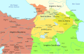
 Dardania and kosovo-sr.png 818 × 1,184; 80 KB
-
 Dardania and kosovo.png 818 × 1,184; 78 KB
-
 Deljan1040.jpg 595 × 780; 187 KB
-
 Deljan1040.svg 535 × 700; 259 KB
-
 Distribution of Greek dialects in late Byzantine Empire en.png 528 × 268; 112 KB
-
 Distribution of Greek dialects in late Byzantine Empire ru.png 528 × 268; 31 KB
-
 Distribution of Greek dialects in late Byzantine Empire tr.png 528 × 268; 117 KB
-
 Empire de Dušan es.svg 994 × 1,104; 453 KB
-
 Empire de Dušan pt.svg 994 × 1,104; 442 KB
-
 Empires voies commerciales.jpg 663 × 500; 169 KB
-
 Epirus & modern borders.jpg 410 × 600; 182 KB
-
 Europe 476.png 2,285 × 2,181; 124 KB
-
 Europe in 814AD.png 1,218 × 888; 115 KB
-
 Europe in 900 AD.png 2,830 × 2,480; 1.56 MB
-

-
 Exarchat von Karthago.jpg 1,324 × 852; 130 KB
-
 Folkevandringene.jpg 1,400 × 991; 286 KB
-
 Greek Asia Minor dialects.png 242 × 212; 59 KB
-
 Hesychasm in the Eastern Orthodox Church.jpg 3,515 × 2,679; 9.1 MB
-
 Image taken from page 531 of 'Histoire universelle' (11147289716).jpg 2,208 × 1,407; 706 KB
-
 Image taken from page 531 of 'Histoire universelle' (16589026591).jpg 834 × 987; 165 KB
-
 Interior Asia 6th century.png 1,056 × 714; 936 KB
-
 Invasioni dell'Impero Romano.png 1,962 × 1,374; 200 KB
-
 Invasions of the Roman Empire Arabic.png 2,943 × 2,061; 932 KB
-
 Invasions of the Roman Empire Dutch.svg 1,766 × 1,237; 676 KB
-
 Invasions of the Roman Empire el.svg 1,766 × 1,237; 162 KB
-
 Invasions of the Roman Empire Greek.png 1,766 × 1,239; 547 KB
-
 IslamicConquestsIroon-es.svg 1,578 × 1,614; 1.64 MB
-
 Italia Annonaria ca 400 AD.png 690 × 518; 573 KB
-
 Jemmeh byz.jpg 1,073 × 865; 114 KB
-
 John'sEmpire.jpg 801 × 370; 26 KB
-
 Kingdom of Aksum.png 499 × 382; 20 KB
-
 Language influence border between Latin and Hellenic.png 3,763 × 2,557; 4.49 MB
-
 Linguistic Map of Justinian I's Empire c. 560.png 1,486 × 1,101; 78 KB
-
 Map Dyrrhachion.svg 455 × 414; 293 KB
-
 Map of early medieval Balkans.png 491 × 407; 351 KB
-
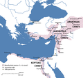
 Map of Persian Armenia and its surroundings.svg 512 × 327; 57 KB
-
 Map of the Balkans, circa the year 950.png 491 × 407; 356 KB
-
 Map of the Byzantine Empire (867-1081)-es.svg 787 × 467; 3.25 MB
-
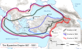 Map of the Byzantine Empire (867-1081).svg 787 × 467; 3.37 MB
-
 Map of the Christian world around the mediterranean in the 5th century AD.png 1,117 × 653; 206 KB
-
 Map Romanian Dawns.jpg 2,607 × 2,434; 2.77 MB
-
 Map States Philaretos Brakhamios-es.svg 704 × 674; 45 KB
-
 Map States Philaretos Brakhamios-fr.svg 704 × 674; 82 KB
-
 Map States Philaretos Brakhamios-ru.svg 704 × 674; 22 KB
-
 Mapa da Europa c.500 (sem legenda).png 1,985 × 1,686; 301 KB
-

-
 MapaWielkiejWedrowkiLudow.png 1,218 × 730; 232 KB
-
 Mauritanihia.png 714 × 386; 117 KB
-
 Mediterranean 476.png 2,285 × 988; 99 KB
-
 Moesia - AD 400.png 860 × 596; 756 KB
-
 Monasticizmus vývoj.jpg 4,120 × 3,740; 2.25 MB
-
 Monofyzitizmus.png 1,720 × 1,640; 166 KB
-
 Near East480ad.jpg 1,402 × 1,023; 226 KB
-
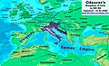 Odoacer 480ad.jpg 900 × 545; 701 KB
-
 Ongal battle.png 1,311 × 1,372; 610 KB
-
 Peloponnese in the Middle Ages.png 829 × 766; 146 KB
-
 Persian Armenia-es.svg 1,030 × 656; 1.27 MB
-
 Persian Armenia-fr.svg 512 × 327; 41 KB
-
 Persian Armenia-hu.svg 675 × 431; 83 KB
-
 Persian Armenia-pt.svg 512 × 327; 46 KB
-
 Pre Islamic Arabia-pt.svg 1,479 × 1,513; 1.49 MB
-
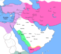 Pre Islamic Arabia.PNG 1,006 × 893; 217 KB
-
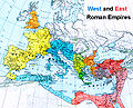
 Roman empire 395.jpg 2,316 × 1,861; 1.87 MB
-
 Roman-Empire 477ad-hu.svg 512 × 287; 37 KB
-
 Roman-Empire 477ad-pt.svg 512 × 287; 28 KB
-
 Roman-empire-mod.jpg 620 × 500; 141 KB
-
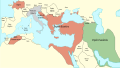
 RomanEmpireEast590-600.jpg 934 × 753; 220 KB
-
 Rome406.jpeg 750 × 469; 70 KB
-
 Rome476.jpeg 750 × 469; 78 KB
-
 Routes of the barbarian invaders, 5th century AD-zh-classical.png 624 × 575; 33 KB
-
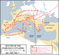 Routes of the barbarian invaders, 5th century AD.gif 624 × 575; 44 KB
-
 Sacred of Eastern Orthodox in Rus' the 9th-the 13rd Centuries.jpg 2,204 × 2,453; 8.25 MB
-
 Saint Archbishop Antonius Journey 1200 in Constantinople.jpg 2,567 × 1,593; 5.01 MB
-
 SELJUK history map 0001.jpg 2,400 × 1,745; 512 KB
-
 Seljukanddanishmends.PNG 801 × 370; 145 KB
-
 Slaves dans l'Empire romain (680).jpg 318 × 327; 153 KB
-
 South-eastern Europe 1354-1358-es.svg 2,086 × 1,483; 2.53 MB
-

-
 Spiritual culture of Byzantine Empire 7th century-1204.jpg 3,518 × 2,676; 6.86 MB
-
 State of Philaretus-ar.jpg 767 × 599; 442 KB
-
 State of Philaretus.jpg 767 × 599; 165 KB
-
 Syria toward end of Muslim conquest, c. 638-fr.svg 701 × 820; 10.07 MB
-
 Syria toward end of Muslim conquest, c. 638.png 943 × 1,142; 1.11 MB
-
 Territories of the major states in Europe in 814 year.png 1,503 × 929; 351 KB
-
 Territory at the end of the Byzantine Empire.png 795 × 600; 118 KB
-
 The Carolingian and Byzantine Empires and the Califate about 814.jpg 1,932 × 1,542; 674 KB
-
 Theme of sirmium en.png 1,243 × 1,036; 86 KB
-
 Theme of sirmium sr.png 1,243 × 1,036; 84 KB
-
 Thughur-Grenzmark in Südost-Anatolien.jpg 968 × 909; 327 KB
-
 Trade routes of the Medieval Roman Empire (improved).PNG 800 × 490; 97 KB
-
 Trade routes of the Medieval Roman Empire.PNG 800 × 490; 103 KB
-
 Vexilographic maps of Pontic littoral by end of 13th-17th century.svg 1,640 × 895; 2.58 MB
-
 VeľkáVýchodnáSchízma.png 9,709 × 7,695; 1.06 MB
-
 Via Egnatia-blank.jpg 1,100 × 900; 379 KB
-
 Via Egnatia-en.jpg 1,100 × 900; 420 KB
-
 Via Egnatia-fr.jpg 1,100 × 900; 422 KB
-
 Via Egnatia-HE.jpg 1,100 × 900; 416 KB
-
 Via Egnatia-pt.jpg 1,100 × 900; 417 KB
-
 Via Egnatia-zh.png 1,100 × 900; 1.27 MB
-
 Visigoth migrations.jpg 450 × 270; 69 KB
-
 World in 800.png 1,357 × 617; 37 KB
-
 Xəzər xaqanlığının xəritəsi (820-ci il).png 998 × 714; 85 KB
-
 Yedi-Kilise-Türkiye.svg 623 × 944; 11 KB
-
 Židia v Byzancii.jpg 1,081 × 826; 197 KB
-
 Византия1265.svg 1,708 × 816; 556 KB
-
 Похід на Хліат (1069).jpg 1,668 × 858; 502 KB
-
 对罗马帝国的入侵.png 1,962 × 1,374; 279 KB


.gif)
.png)


-pt.svg)
.svg)
.svg)


.jpg)
.jpg)


-es.svg)
.svg)


.png)
_al_Museu_Bizant%C3%AD_i_Cristi%C3%A0_d%27Atenes.jpg)


.jpg)


.PNG)


.png)


.jpg)

.png)
.png)
Categories:
- Byzantine Empire
- Maps of empires
- Maps of the Roman Empire
- Maps of the history of Europe by former country
- Maps of the history of Asia by former country
- Maps of the history of the medieval Balkans
- Maps of the history of Albania in the Middle Ages
- Maps of the history of Bosnia and Herzegovina in the Middle Ages
- Maps of the history of Croatia in the Middle Ages
- Maps of the history of Cyprus
- Maps of the history of Egypt
- Maps of the history of Georgia
- Maps of the history of Greece in the Middle Ages
- Maps of the history of Iraq
- Maps of the history of Italy
- Maps of the history of Libya
- Maps of the history of North Macedonia in the Middle Ages
- Maps of the history of Malta
- Maps of the history of Romania in the Middle Ages
- Maps of the history of Serbia in the Middle Ages by state
- Maps of the history of Vojvodina
- Maps of the history of Slovenia in the Middle Ages
- Maps of the history of Tunisia
- Maps of the history of Turkey