Category:Maps of the Habsburg Military Frontier
Jump to navigation
Jump to search
Subcategories
This category has only the following subcategory.
T
Media in category "Maps of the Habsburg Military Frontier"
The following 64 files are in this category, out of 64 total.
-
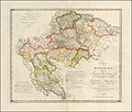
1803 map of Crotia by Karl Joseph Kipferling.jpg 15,846 × 13,464; 24.59 MB
-
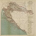
(1879) MAP OF CROATIA, SLAVONIA, DALMATIA & 'MILITÄRGRENZE' of AUSTRIAN EMPIRE.jpg 5,109 × 5,033; 10.02 MB
-
Backa ethnic map 1715.png 1,202 × 1,958; 269 KB
-
Backa ethnic map 1720.png 1,202 × 1,767; 239 KB
-
Croatian Military Frontier-1868.png 387 × 294; 20 KB
-
Eyalet of temesvar1699 hu.svg 1,347 × 1,312; 90 KB
-
Eyalet of temesvar1699-sr.png 1,010 × 984; 101 KB
-
Eyalet of temesvar1699.png 1,010 × 984; 113 KB
-
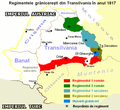
GraniţaMilitarăTransilvăneană.PNG 699 × 643; 87 KB
-
Josephinische Landaufnahme Banat.jpg 1,446 × 1,778; 346 KB
-
Josephinische Landaufnahme Slavonischen Distrikt.jpg 2,749 × 1,831; 370 KB
-
Karta Vretanije.jpg 2,287 × 1,692; 88 KB
-
Kingdom of Dalmatia-1868.png 542 × 502; 35 KB
-
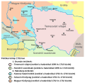
Magyarország a szatmári-béke korában.jpg 1,100 × 828; 311 KB
-
Map of the Kingdom of Croatia (1848).png 542 × 502; 39 KB
-
Map of the Kingdom of Croatia (1868).png 542 × 502; 40 KB
-
Militargrenze, Wojwodowena und Banat.jpg 900 × 312; 115 KB
-
Wojwodowena und Banat.jpg 400 × 295; 42 KB
-
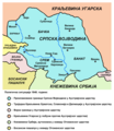
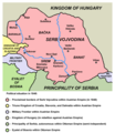
Serbia and Vojvodina 1848.png 717 × 924; 71 KB
-
Serbia1849 04.png 724 × 949; 71 KB
-
Serbia1849 sr latin.png 724 × 949; 72 KB
-
Serbia02.png 724 × 949; 73 KB
-
Serbia1849 01 01 04.png 724 × 760; 54 KB
-
Serbia1849 01 02 02.png 724 × 760; 51 KB
-
Serbia1849 01 03 03.png 724 × 760; 54 KB
-
Serbia02 (Voivodina).png 724 × 760; 53 KB
-
Voivodship and Serbia.png 724 × 949; 75 KB
-
Vojvodina-1849-1860-2C.png 724 × 760; 60 KB
-
Serbian Vojvodina and Tamis Banat ru.svg 793 × 423; 140 KB
-
Slavonia01.png 797 × 674; 80 KB
-
Slavonia02.png 797 × 674; 81 KB
-
Eslavonia02.png 797 × 674; 69 KB
-
Szerb Vajdaság és Temesi Bánság.svg 793 × 423; 140 KB
-
Tamis banat1718 1739 hu.png 1,178 × 1,514; 423 KB
-
Tamis banat1718 1739.png 1,008 × 1,298; 146 KB
-
Tamis banat1718 1739 sr.png 1,008 × 1,298; 134 KB
-
Banat03-sr.png 998 × 876; 85 KB
-
Banat03.png 998 × 876; 102 KB
-
Temeswarer Banat - Politische Situation 1739.png 998 × 876; 98 KB
-
Tamis banat06-sr.png 996 × 988; 100 KB
-
Tamis banat06.png 996 × 988; 111 KB
-
Tamis banat1751 1778-sr.png 996 × 962; 98 KB
-
Tamis banat1751 1778.png 996 × 962; 112 KB
-
Temeswarer Banat - Politische Situation 1751 -1778.png 996 × 962; 108 KB
-
Voivodeship of serbia ethnic map 1855.jpg 1,751 × 1,211; 1.15 MB
-
Vojvodina front lines 1848 1849-sr.png 934 × 1,156; 108 KB
-
Vojvodina front lines 1848 1849.png 934 × 1,227; 118 KB
-
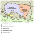
Map of Voivodeship of Serbia and Banat of Temeschwar (1849-1860).png 769 × 828; 95 KB
-
Vojvodina map sr.png 769 × 828; 83 KB
-
Vojvodina mapa.png 769 × 828; 79 KB
-
Vojvodina XIX ru.svg 793 × 423; 135 KB
-
Vojvodina03-sr.png 638 × 738; 67 KB
-
Vojvodina03.png 638 × 737; 66 KB
-
Vojvodina-1848-1.png 638 × 737; 69 KB
-
Srpska Vojvodina 1848. i današnji ZVO.png 621 × 504; 23 KB
-
Vojvodina18 19 cen-sr.png 2,000 × 1,563; 194 KB
-
Vojvodina18 19 cen.png 2,000 × 1,563; 220 KB
-
Vojvodstvo srbija okruzi 1849 01.png 769 × 746; 66 KB
-
Vojvodstvo srbija okruzi 1849 02.png 769 × 746; 64 KB
-
Vojvodstvo srbija okruzi 1850 01.png 769 × 828; 81 KB
-
Vojvodstvo srbija okruzi 1850 02.png 769 × 828; 74 KB
-
Аустро-турско разграничење на Кордуну 1795. године.jpg 690 × 480; 96 KB
Categories:
- Habsburg Military Frontier
- Maps of subdivisions of the Austrian Empire
- Maps of subdivisions of Austria-Hungary
- Maps of the history of Croatia
- Maps of the history of Slavonia
- Maps of the history of Serbia
- Maps of the history of Vojvodina
- Maps of the history of Banat
- Maps of the history of Bačka
- Maps of the history of Syrmia
- Maps of the history of Romania
- Maps of the history of Transylvania
