Category:Maps of Roman Pannonia
Jump to navigation
Jump to search
Media in category "Maps of Roman Pannonia"
The following 60 files are in this category, out of 60 total.
-
Ancient balkans 4thcentury-es.svg 2,039 × 1,823; 854 KB
-
Ancient balkans 4thcentury-sr.png 1,113 × 845; 88 KB
-
Ancient balkans 4thcentury-zh.svg 2,039 × 1,823; 318 KB
-
Ancient balkans 4thcentury.png 1,113 × 845; 88 KB
-
Ancient Bosnia.png 2,038 × 1,939; 520 KB
-
Dalmatia&Moesia Superior.JPG 5,061 × 6,589; 28.23 MB
-
Dardanija.jpg 1,600 × 1,067; 431 KB
-
Droysens Hist Handatlas S17 Germanien.jpg 2,741 × 2,213; 1.59 MB
-
Iasoru republic-es.svg 565 × 498; 415 KB
-
Iasoru republic.svg 512 × 532; 166 KB
-
Illyricum & Dacia - AD 400.png 971 × 673; 972 KB
-
Lage von Intercisa am Pannonischen Limes.png 2,633 × 2,447; 998 KB
-
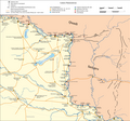
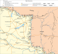
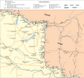
Limes4-en.png 2,633 × 2,447; 1 MB
-
Limes4-hu.png 2,633 × 2,447; 994 KB
-
Limes4-it.png 2,633 × 2,447; 1,023 KB
-
Limes4.png 2,633 × 2,447; 999 KB
-
Marcomannia e Sarmatia 170 dC V1.1 fr.png 1,280 × 886; 1.76 MB
-
Marcomannia e Sarmatia 170 dC V1.1.JPG 1,280 × 886; 280 KB
-
Marcomannia e Sarmatia 170 dC.jpg 1,280 × 886; 286 KB
-
Marcomannia e Sarmatia 171-175 dC.jpg 1,280 × 886; 279 KB
-
Marcomannia e Sarmatia 178-179 dC.jpg 1,280 × 886; 282 KB
-
Marcomannia e Sarmatia 180-182 dC.jpg 1,280 × 886; 908 KB
-
NW-Pannonia-in-the-1st-century.gif 684 × 1,000; 391 KB
-
Pannonia II secolo dC.jpg 1,435 × 1,356; 270 KB
-
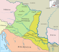
Pannonia Inferior (Imperium Romanum).png 2,495 × 1,775; 53 KB
-
Pannonia moesia dacia illyricum.jpg 1,600 × 1,085; 559 KB
-
Pannonia Paint 1st.JPG 724 × 358; 37 KB
-
Pannonia secunda-es.svg 4,596 × 2,857; 720 KB
-
Pannonia secunda-sr.png 1,034 × 630; 49 KB
-
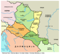
Pannonia secunda.png 1,034 × 630; 49 KB
-
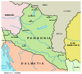
Pannonia SPQR.png 800 × 548; 28 KB
-
Pannonia Superior (Imperium Romanum).PNG 2,495 × 1,775; 55 KB
-
Pannonia térkép 2. század.jpg 3,091 × 2,348; 3.21 MB
-
Pannonia01 hu.svg 1,001 × 898; 62 KB
-
Pannonia01-sr.png 1,001 × 898; 70 KB
-
Pannonia01.png 1,001 × 898; 72 KB
-
Pannonia01b-sr.png 1,001 × 898; 70 KB
-
Pannonia01b.png 1,001 × 898; 71 KB
-
Pannonia02-es.svg 565 × 498; 632 KB
-
Pannonia02-sr.png 1,001 × 898; 75 KB
-
Pannonia02.png 1,001 × 898; 75 KB
-
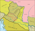
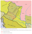
Pannonia03 en.png 1,001 × 898; 84 KB
-
Pannonia03-sr.png 1,001 × 898; 84 KB
-
Pannonia03.jpg 1,001 × 898; 92 KB
-
Iasoru republic.png 1,001 × 1,040; 93 KB
-
Pannonia.svg 702 × 751; 16 KB
-
Pannonien Grenzverschiebungen - 1-4 Jhr.svg 5,480 × 7,023; 471 KB
-
Provinciaromana-Panonia-pt.svg 2,235 × 1,627; 287 KB
-
Provinciaromana-PanoniaInferior-pt.svg 2,235 × 1,627; 287 KB
-
Provinciaromana-PanoniaSuperior-pt.svg 2,235 × 1,627; 287 KB
-
REmpire-Pannonia.png 400 × 296; 24 KB
-
Roman cities Vojvodina-sr.png 1,770 × 1,185; 133 KB
-
Roman cities Vojvodina.png 1,770 × 1,185; 140 KB
-
Roman Empire - Pannonia (125 AD).svg 2,186 × 1,817; 629 KB
-
Roman Empire Map AlexanderFindlay1849.png 2,038 × 1,828; 2 MB
-
Roman provinces in a 1867 school atlas.jpg 3,717 × 2,866; 969 KB
-
Roman provinces of Illyricum, Macedonia, Dacia, Moesia, Pannonia and Thracia.jpg 2,817 × 2,284; 1.41 MB
-
Route Ambre.jpg 1,186 × 1,216; 359 KB
-
Հռոմեական կայսրության Պանոնիա պրովինցիա.png 800 × 548; 67 KB
Categories:
- Maps of Roman provinces
- Maps of Pannonia
- Maps of the history of the ancient Balkans
- Maps of the history of Serbia in ancient times
- Maps of the history of Vojvodina
- Maps of the history of Syrmia
- Maps of the history of Croatia in ancient times
- Maps of the history of Slavonia
- Maps of the history of Bosnia and Herzegovina in ancient times
- Maps of the history of Slovenia in ancient times
- Maps of the prehistory of Hungary
- Maps of the history of Austria
- Maps of the history of Slovakia


