Category:Maps of the Gepids
Jump to navigation
Jump to search
Media in category "Maps of the Gepids"
The following 51 files are in this category, out of 51 total.
-
476 CE, Europe.svg 512 × 438; 1.48 MB
-
A view on 6th to 8th century ethnic distribution in Romania.png 1,003 × 912; 58 KB
-
AtHistEur560.jpg 1,912 × 2,200; 667 KB
-
AtlBalk400.jpg 318 × 327; 155 KB
-
AtlBalk500.jpg 318 × 327; 147 KB
-
AtlBalk550.jpg 318 × 327; 154 KB
-
Barbarian invasions from 3rd century.png 1,596 × 920; 791 KB
-
Carpathian Basin in 476 AD.png 800 × 424; 234 KB
-
Cesare prima Gallia 58 a.C.jpg 1,704 × 1,181; 633 KB
-
Costantino nord-limes png.PNG 2,660 × 1,532; 403 KB
-
Europe and the Near East at 476 AD.png 2,830 × 1,967; 1.58 MB
-
Europe at the fall of the Western Roman Empire in 476.jpg 5,491 × 3,506; 4.35 MB
-
Europe in 526.jpg 1,541 × 961; 1.43 MB
-
Europe-In-555AD.png 2,862 × 1,670; 2.85 MB
-
Gepid kingdom 6th century - es.svg 1,102 × 1,154; 218 KB
-
Gepid kingdom 6th century - pt.svg 1,102 × 1,154; 223 KB
-
Gepid kingdom 6th century - ru.svg 1,033 × 1,082; 161 KB
-
Gepid kingdom 6th century - zh.svg 1,102 × 1,154; 82 KB
-
Gepid kingdom 6th century-ang.svg 1,102 × 1,154; 71 KB
-
Gepid kingdom 6th century-hu.svg 1,102 × 1,154; 70 KB
-
Gepid kingdom 6th century-sr.png 858 × 894; 53 KB
-
Gepid kingdom 6th century.png 858 × 894; 55 KB
-
Germanic East Roman.jpg 840 × 658; 156 KB
-
Gutthiuda.jpg 800 × 547; 460 KB
-
Huns450.png 719 × 697; 185 KB
-
Huns450es.svg 3,202 × 2,535; 1.06 MB
-
Karte Ravennat.jpg 2,448 × 3,264; 3.9 MB
-
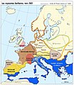
Kmene v Podunají.png 982 × 642; 688 KB
-
Limes Orientalis 337 AD png.PNG 1,637 × 1,532; 221 KB
-
Location of South Slavs in the 560 CE.png 1,431 × 1,097; 1.82 MB
-
Mapa da Europa c.500 (com legenda).png 1,985 × 1,686; 444 KB
-
Mapa da Europa c.500 (sem legenda).png 1,985 × 1,686; 301 KB
-
NE 500ad.jpg 1,424 × 1,049; 238 KB
-
NE 565ad.jpg 1,477 × 973; 226 KB
-
Roman Empire 125 general map-zh.png 2,732 × 2,271; 6.07 MB
-
Roman Empire 125 general map-zh.svg 2,732 × 2,271; 6.55 MB
-
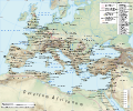
Roman Empire 125 general map.SVG 2,186 × 1,817; 1.77 MB
-
Roman Empire 125 political map-de.svg 2,186 × 1,817; 6.32 MB
-
Roman Empire 125 political map-zh.png 2,049 × 1,703; 2.99 MB
-
Roman Empire 125 political map-zh.svg 2,732 × 2,271; 2.02 MB
-
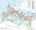
Roman Empire 125 political map.png 2,186 × 1,817; 3.21 MB
-
Roman Empire 125 political map.svg 2,186 × 1,817; 3.25 MB
-
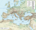
Roman Empire 125.png 2,186 × 1,817; 4.43 MB
-
Routes of Barbarian Invasions.jpg 2,411 × 1,871; 886 KB
-
Serbia ethnic 6 8 century-sr.png 638 × 1,146; 66 KB
-
Serbia ethnic 6 8 century.png 638 × 1,146; 68 KB
-
Slavs Vojvodina01 map sr.png 1,020 × 836; 67 KB
-
Slavs Vojvodina01 map.png 1,020 × 836; 69 KB
-
Southeast Europe in the 450s AD.png 491 × 407; 340 KB
Categories:
- Gepids
- Maps of the prehistory of Hungary
- Maps of the history of Romania in the Middle Ages
- Maps of the history of Vojvodina
- Maps of the history of Banat
- Maps of the history of Bačka
- Maps of the history of Syrmia
- Maps of the history of Transylvania
- Maps of the history of Central Europe
- Maps of Migration period
- Maps of ancient peoples


