
Category:Maps of the history of Australia
Subcategories
This category has the following 6 subcategories, out of 6 total.
D
E
T
Media in category "Maps of the history of Australia"
The following 56 files are in this category, out of 56 total.
-
 Australian states history 01.gif 300 × 279; 6 KB
-

-
 1846 Eastern Australia state boundaries.jpg 300 × 495; 28 KB
-
 Australian states history 06.gif 300 × 279; 9 KB
-

-
 Map of eureka stockade 1854.jpg 700 × 446; 35 KB
-
 Map of Gen MacArthur's escape from the Philippines, March 1942.tif 1,450 × 2,277; 12.6 MB
-

-
 Australia change 1947-11-01.png 1,000 × 967; 158 KB
-
 2009 Dust Storm - Australia and New Zealand Map.png 1,535 × 1,065; 542 KB
-
 Aboriginal Tasmania Map.png 442 × 437; 26 KB
-
 AC Gregory Map of Exploration.png 2,050 × 1,339; 393 KB
-
 ADF Deployments June 2007.PNG 1,425 × 625; 55 KB
-
 Australia 1942.jpg 1,989 × 1,387; 316 KB
-
 Australian Peacekeeping.PNG 1,425 × 625; 55 KB
-
 Australian states history 09.gif 300 × 279; 8 KB
-
 Australian states history 10.gif 300 × 279; 10 KB
-
 Australian states history 11.gif 300 × 279; 10 KB
-
 Australian states history 12.gif 300 × 279; 9 KB
-
 Australian states history 13.gif 300 × 279; 10 KB
-
 Australian states history 14.gif 300 × 279; 10 KB
-
 Australian states history 15.gif 300 × 279; 10 KB
-
 Australian states history.gif 300 × 279; 82 KB
-
 Autralian colonies before 1825 deutsch.svg 2,055 × 1,846; 267 KB
-
 Bass journeys.png 1,527 × 1,616; 258 KB
-
 Bita paka location 1914.jpg 350 × 384; 109 KB
-
 Ernest Giles expeditions.png 1,551 × 1,074; 293 KB
-
 Fake Japanese invasion map of Australia 1942.png 2,953 × 2,308; 3.5 MB
-
 Flinders Map v1P.png 754 × 438; 78 KB
-
 Flinders v10.svg 754 × 438; 118 KB
-
 Frank Hann travels.png 922 × 913; 1.22 MB
-
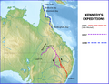 Kennedy map v2.png 782 × 600; 512 KB
-
 Map Capital Punishment Australia.png 2,190 × 1,577; 251 KB
-
 Map Of Capital Punishment in Australia.png 2,190 × 1,577; 213 KB
-

-
 Miklouho-Maclay's travels - ru.png 1,500 × 1,254; 3.08 MB
-
 Miklouho-Maclay's travels-ru.svg 1,500 × 1,254; 4.6 MB
-
 Mitchell (Thomas) exploration map.svg 776 × 1,065; 515 KB
-
 Mitchell explorations NSW.png 776 × 1,065; 211 KB
-
 New Holland incldg NSW.jpg 2,275 × 2,000; 540 KB
-
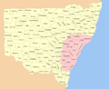 New South Wales cadastral divisions.png 1,400 × 1,144; 469 KB
-
 Northern Territory airfields 1943.jpg 1,920 × 1,452; 416 KB
-
 Northern Territory counties 1886.jpg 820 × 651; 135 KB
-
 Port Arthur and Hobart map (NationalMap) -- 1830s routes.png 1,544 × 1,368; 1.84 MB
-
 Port Phillip District location map 1839.svg 865 × 695; 169 KB
-
 Port Phillip District location map 1840.svg 865 × 695; 160 KB
-
 Sahul map.jpg 1,606 × 1,543; 150 KB
-
 South Australia cadastral divisions 1886.png 1,000 × 1,139; 117 KB
-
 South Australia cadastral divisions 1893.png 1,000 × 1,136; 127 KB
-
 Sydney - Bathurst Road Routes.jpg 1,510 × 660; 215 KB
-
 Tasmania cadastral divisions.png 504 × 527; 97 KB
-
 Tietkens exploration.png 897 × 598; 716 KB
-
 Tietkens Exploration.svg 895 × 597; 100 KB
-
 Vic SA NSW border 1883.jpg 1,200 × 1,200; 123 KB
-
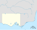
 Victoria cadastral divisions.png 1,000 × 697; 133 KB
-
 Western Australia cadastral divisions.png 800 × 1,012; 116 KB


.png)


_exploration_map.svg)


_--_1830s_routes.png)


