Category:Maps of the Dutch East Indies
Jump to navigation
Jump to search
Subcategories
This category has only the following subcategory.
A
Media in category "Maps of the Dutch East Indies"
The following 61 files are in this category, out of 61 total.
-
Bantam in 1602.jpg 1,443 × 1,184; 363 KB
-
Kaart van Eiland Java 1873.jpg 2,961 × 793; 471 KB
-
Kaart van Nederlandsch Indië, 1873.jpg 5,392 × 4,274; 3.16 MB
-
Plan van Batavia en omstreken.jpg 583 × 1,149; 165 KB
-
1925 Air Routes of the Dutch East Indies.jpg 960 × 592; 286 KB
-
1928 map of Bantam Residency from Schoolatlas van Nederlandsch Indië.jpg 1,985 × 1,224; 389 KB
-
1928 map of Blora Residency from Schoolatlas van Nederlandsch Indië.jpg 1,382 × 859; 202 KB
-
1928 map of Bodjonegoro Residency from Schoolatlas van Nederlandsch Indië.jpg 1,677 × 1,321; 595 KB
-
1928 map of Koedoes Residency from Schoolatlas van Nederlandsch Indië.jpg 1,807 × 1,339; 303 KB
-
1928 map of Krawang Residency from Schoolatlas van Nederlandsch Indië.jpg 1,736 × 1,338; 330 KB
-
1928 map of Madioen Residency from Schoolatlas van Nederlandsch Indië.jpg 1,279 × 796; 180 KB
-
1928 map of Midden-Priangan Residency from Schoolatlas van Nederlandsch Indië.jpg 1,823 × 1,224; 416 KB
-
1928 map of Oost-Priangan Residency from Schoolatlas van Nederlandsch Indië.jpg 1,823 × 1,224; 343 KB
-
1928 map of Rembang Residency from Schoolatlas van Nederlandsch Indië.jpg 1,382 × 782; 152 KB
-
East Indies - btv1b53209798t (1 of 2).jpg 12,039 × 9,166; 16.03 MB
-
Adonara 1911.jpg 768 × 543; 55 KB
-
Asia (late 19th century- early 20th century).jpg 1,857 × 1,387; 773 KB
-
Colonial Boundaries in Southeast Asia.jpg 1,229 × 898; 220 KB
-
DeliSpoorweg 1893.jpg 1,009 × 593; 613 KB
-
Dutch East Indies 1948–1949.svg 1,100 × 900; 2.13 MB
-
Dutch East Indies Expansion.gif 694 × 369; 373 KB
-
Dutch East Indies Expansion.png 923 × 447; 80 KB
-
Dutch map of Banda ca. 1602.jpg 1,367 × 1,100; 337 KB
-
Dutch ships of Wolfert Harmensz' fleet in Banda ca. 1602.jpg 1,111 × 655; 450 KB
-
Evolution of the Dutch East Indies (ru).png 443 × 187; 16 KB
-
Evolution of the Dutch East Indies.png 443 × 187; 13 KB
-
Havenplannen Batavia.jpg 2,030 × 1,031; 373 KB
-
Indonesia - Conquista neerlandesa après 1824.png 1,203 × 586; 239 KB
-
Indonesia - Implantacion de la VOC en 1790.png 4,125 × 2,144; 879 KB
-
IndonesianGreatEast.jpg 759 × 484; 99 KB
-
Jacatra in 1602.jpg 1,528 × 1,235; 363 KB
-
Japanese attack on Borneo 1941-1942.png 692 × 619; 459 KB
-
Japanseaanvallennederland.PNG 1,254 × 450; 42 KB
-
Java Great Post Road-su.svg 842 × 286; 149 KB
-
Java Great Post Road.svg 842 × 284; 140 KB
-
Java, Sumatra and the other islands of the Dutch East Indies (1914) (14577083058).jpg 1,984 × 2,264; 817 KB
-
JavaMapRail 1893.jpg 2,666 × 936; 2.2 MB
-
Lampung Residency 1916.jpg 3,071 × 2,376; 1.8 MB
-
Map of the Dutch East-Indies.jpg 5,000 × 3,101; 1.89 MB
-
MapEastIndian-PieterGoos.jpg 377 × 312; 46 KB
-
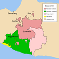
Mataram 1830-en.png 1,137 × 1,128; 58 KB
-
Mataram 1830-nl.png 1,137 × 1,128; 58 KB
-
Nederlando kaj Indonezio en area komparo.jpg 742 × 263; 91 KB
-
Nederlandsindie.PNG 1,254 × 450; 35 KB
-
Nederlandsindie.png 1,254 × 450; 27 KB
-
Neerland's twaalfde provincie; de Minahasa.JPG 540 × 800; 104 KB
-
Netherlands East Indies 1942.svg 824 × 647; 2.54 MB
-
Pacific War - Dutch East Indies 1941-42 - Map.jpg 1,261 × 971; 187 KB
-
Solor in 1602.jpg 2,268 × 950; 849 KB
-
Sumatra - De Grote Winkler Prins Encyclopedia 1910.jpg 1,841 × 1,441; 802 KB
-
Tarakan Island map marked with locations relevant to the 1945 Battle of Tarakan.png 1,181 × 1,454; 197 KB
-
Tarakan operations 1945.jpg 1,461 × 1,794; 524 KB
-
Ternate in 1602.jpg 1,486 × 1,220; 388 KB
-
Territorial Evolution of the Dutch East Indies.png 443 × 187; 20 KB
-
Timor strategic 1943.jpg 1,885 × 1,355; 281 KB
-
Van Mook.png 740 × 235; 47 KB
-
Westtimor 1911.png 2,296 × 1,796; 1.19 MB
-
Лиссабонский договор 1859 года.png 243 × 299; 16 KB


