Category:Topographic maps of the Isle of Man
Jump to navigation
Jump to search
Media in category "Topographic maps of the Isle of Man"
The following 12 files are in this category, out of 12 total.
-
Isle of Man railway map-de.svg 1,200 × 1,100; 274 KB
-
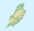
Isle of Man relief location map.svg 1,200 × 1,100; 340 KB
-
Isle of Man topographic map-de.svg 1,200 × 1,100; 334 KB
-
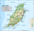
Isle of Man topographic map-en.svg 1,200 × 1,100; 642 KB
-
Isle of Man topographic map-fr.svg 1,200 × 1,100; 644 KB
-
Isle of Man topographic map-hu.svg 1,200 × 1,100; 645 KB
-
Isle of Man topographic map-it.svg 1,200 × 1,100; 745 KB
-
Isle of Man topographic map-mk.svg 1,200 × 1,100; 644 KB
-
Isle of Man topographic map-nb.svg 1,200 × 1,100; 643 KB
-
Isle of Man topographic map-ru.svg 1,200 × 1,100; 644 KB
-
The birds of the Isle of Man BHL48037974.jpg 2,695 × 3,501; 1.15 MB
-
Востраў Мэн.svg 1,200 × 1,100; 605 KB


