Category:Maps of groups of communes in Sarthe
Jump to navigation
Jump to search
Departments of Metropolitan France: Ain [01] · Aisne [02] · Allier [03] · Alpes-de-Haute-Provence [04] · Hautes-Alpes [05] · Alpes-Maritimes [06] · Ardèche [07] · Ardennes [08] · Ariège [09] · Aube [10] · Aude [11] · Aveyron [12] · Bouches-du-Rhône [13] · Calvados [14] · Cantal [15] · Charente [16] · Charente-Maritime [17] · Cher [18] · Corrèze [19] · Corse-du-Sud [2A]† · Haute-Corse [2B]† · Côte-d’Or [21] · Côtes-d'Armor [22] · Creuse [23] · Dordogne [24] · Doubs [25] · Drôme [26] · Eure [27] · Eure-et-Loir [28] · Finistère [29] · Gard [30] · Haute-Garonne [31] · Gers [32] · Gironde [33] · Hérault [34] · Ille-et-Vilaine [35] · Indre [36] · Indre-et-Loire [37] · Isère [38] · Jura [39] · Landes [40] · Loir-et-Cher [41] · Loire [42] · Haute-Loire [43] · Loire-Atlantique [44] · Loiret [45] · Lot [46] · Lot-et-Garonne [47] · Lozère [48] · Maine-et-Loire [49] · Manche [50] · Marne [51] · Haute-Marne [52] · Mayenne [53] · Meurthe-et-Moselle [54] · Meuse [55] · Morbihan [56] · Moselle [57] · Nièvre [58] · Nord [59] · Oise [60] · Orne [61] · Pas-de-Calais [62] · Puy-de-Dôme [63] · Pyrénées-Atlantiques [64] · Hautes-Pyrénées [65] · Pyrénées-Orientales [66] · Bas-Rhin [67] · Haut-Rhin [68] · departmental district of the Rhône [69] · Rhône [69D]‡ · Haute-Saône [70] · Saône-et-Loire [71] · Sarthe [72] · Savoie [73] · Haute-Savoie [74] · Seine-Maritime [76] · Seine-et-Marne [77] · Yvelines [78] · Deux-Sèvres [79] · Somme [80] · Tarn [81] · Tarn-et-Garonne [82] · Var [83] · Vaucluse [84] · Vendée [85] · Vienne [86] · Haute-Vienne [87] · Vosges [88] · Yonne [89] · Territoire de Belfort [90] · Essonne [91] · Hauts-de-Seine [92] · Seine-Saint-Denis [93] · Val-de-Marne [94] · Val-d'Oise [95]
Overseas departments and regions: Guadeloupe [971] · Martinique [972] · French Guiana [973] · Réunion [974] · Mayotte [976]
Sui generis territories: New Caledonia [988]
Overseas departments and regions: Guadeloupe [971] · Martinique [972] · French Guiana [973] · Réunion [974] · Mayotte [976]
Sui generis territories: New Caledonia [988]
| NO WIKIDATA ID FOUND! Search for Maps of groups of communes in Sarthe on Wikidata | |
| Upload media |
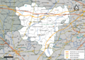
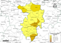
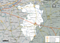
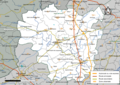
Français : Cartes des établissements publics de coopération intercommunale (communautés de communes, d’agglomération ou urbaines, métropoles, syndicats intercommunaux) et syndicats mixtes (dont les pôles métropolitains) du département français de la Sarthe.

Subcategories
This category has the following 4 subcategories, out of 4 total.
Media in category "Maps of groups of communes in Sarthe"
The following 53 files are in this category, out of 53 total.
-
 Gemeindeverbände im Département Sarthe 2023.png 3,500 × 3,362; 2.08 MB
-
 72-Intercos2019-200040475-Densités.png 3,519 × 2,480; 1.89 MB
-
 72-Intercos2019-200040475.png 3,519 × 2,480; 3.16 MB
-
 72-Intercos2019-200068963-Densités.png 3,519 × 2,480; 1.4 MB
-
 72-Intercos2019-200068963.png 3,519 × 2,480; 2.53 MB
-
 72-Intercos2019-200070373-Densités.png 3,519 × 2,480; 1.82 MB
-
 72-Intercos2019-200070373.png 3,519 × 2,480; 3.11 MB
-
 72-Intercos2019-200072676-Densités.png 3,519 × 2,480; 2.51 MB
-
 72-Intercos2019-200072676.png 3,519 × 2,480; 3.97 MB
-
 72-Intercos2019-200072684-Densités.png 3,519 × 2,480; 1.82 MB
-
 72-Intercos2019-200072684.png 3,519 × 2,480; 3.53 MB
-
 72-Intercos2019-200072692-Densités.png 3,519 × 2,480; 1.83 MB
-
 72-Intercos2019-200072692.png 3,519 × 2,480; 3.04 MB
-
 72-Intercos2019-200072700-Densités.png 3,519 × 2,480; 1.72 MB
-
 72-Intercos2019-200072700.png 3,519 × 2,480; 2.78 MB
-
 72-Intercos2019-200072718-Densités.png 3,519 × 2,480; 1.76 MB
-
 72-Intercos2019-200072718.png 3,519 × 2,480; 2.97 MB
-
 72-Intercos2019-200073112-Densités.png 3,519 × 2,480; 1.63 MB
-
 72-Intercos2019-200073112.png 3,519 × 2,480; 3.11 MB
-
 72-Intercos2019-247200090-Densités.png 3,519 × 2,480; 1.45 MB
-
 72-Intercos2019-247200090.png 3,519 × 2,480; 2.58 MB
-
 72-Intercos2019-247200132-Densités.png 3,519 × 2,480; 1.46 MB
-
 72-Intercos2019-247200132.png 3,519 × 2,480; 3.09 MB
-
 72-Intercos2019-247200348-Densités.png 3,519 × 2,480; 1.19 MB
-
 72-Intercos2019-247200348.png 3,519 × 2,480; 2.22 MB
-
 72-Intercos2019-247200421-Densités.png 3,519 × 2,480; 1.04 MB
-
 72-Intercos2019-247200421.png 3,519 × 2,480; 2.19 MB
-
 72-Intercos2019-247200447-Densités.png 3,519 × 2,480; 1.02 MB
-
 72-Intercos2019-247200447.png 3,519 × 2,480; 1.92 MB
-
 72-Intercos2019-247200629-Densités.png 3,519 × 2,480; 1.47 MB
-
 72-Intercos2019-247200629.png 3,519 × 2,480; 2.84 MB
-
 72-Intercos2019-247200686-Densités.png 3,519 × 2,480; 1.62 MB
-
 72-Intercos2019-247200686.png 3,519 × 2,480; 2.94 MB
-
 72-Sarthe-intercos-2019.png 3,507 × 2,480; 2.21 MB
-
 Gemeindeverband Alençon - Pays de la Loire 2019.png 3,500 × 3,362; 2.05 MB
-
 Gemeindeverband Champagne Conlinoise et Pays de Sillé 2019.png 3,500 × 3,362; 2.05 MB
-
 Gemeindeverband Gesnois Bilurien 2023.png 3,500 × 3,362; 2.07 MB
-
 Gemeindeverband Haute Sarthe Alpes Mancelles 2019.png 3,500 × 3,362; 2.05 MB
-
 Intercommunalités Maine.png 3,206 × 1,870; 1.63 MB
-
 Gemeindeverband LBN Communauté 2023.png 3,500 × 3,362; 2.07 MB
-
 Gemeindeverband Le Mans Métropole 2023.png 3,500 × 3,362; 2.07 MB
-
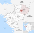
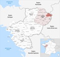
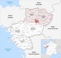
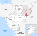
 Localisation CC du Val de Sarthe dans la Sarthe, France.svg 684 × 677; 299 KB
-
 Gemeindeverband Loir-Lucé-Bercé 2019.png 3,500 × 3,362; 2.05 MB
-
 Gemeindeverband Maine Cœur de Sarthe 2019.png 3,500 × 3,362; 2.05 MB
-
 Gemeindeverband Maine Saosnois - Pays de la Loire 2019.png 3,500 × 3,362; 2.05 MB
-
 Gemeindeverband Orée de Bercé - Belinois 2023.png 3,500 × 3,362; 2.07 MB
-
 Gemeindeverband Pays de l’Huisne Sarthoise 2019.png 3,500 × 3,362; 2.05 MB
-
 Gemeindeverband Pays Fléchois 2019.png 3,500 × 3,362; 2.05 MB
-
 Gemeindeverband Pays Sabolien 2023.png 3,500 × 3,362; 2.07 MB
-
 Gemeindeverband Sud Est Manceau 2023.png 3,500 × 3,362; 2.07 MB
-
 Gemeindeverband Sud Sarthe 2019.png 3,500 × 3,362; 2.05 MB
-
 Gemeindeverband Val de Sarthe 2019.png 3,500 × 3,362; 2.05 MB
-
 Gemeindeverband Vallées de la Braye et de l’Anille 2019.png 3,500 × 3,362; 2.05 MB


