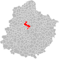
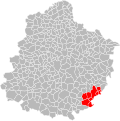
Category:Maps of groups of communes in Sarthe to 2015
Jump to navigation
Jump to search
Media in category "Maps of groups of communes in Sarthe to 2015"
The following 32 files are in this category, out of 32 total.
-
Localisation EPCI Aune et Loir dans la Sarthe, France.svg 1,000 × 1,003; 164 KB
-
Localisation EPCI de la Champagne conlinoise dans la Sarthe, France.svg 1,000 × 1,003; 164 KB
-
Localisation EPCI de Lucé dans la Sarthe, France.svg 1,000 × 1,003; 164 KB
-
Localisation EPCI de Sablé-sur-Sarthe dans la Sarthe, France.svg 1,000 × 1,003; 165 KB
-
Localisation EPCI de Vègre et Champagne dans la Sarthe, France.svg 1,000 × 1,003; 164 KB
-
Localisation EPCI des Alpes mancelles dans la Sarthe, France.svg 1,000 × 1,003; 164 KB
-
Localisation EPCI des pays de Loué dans la Sarthe, France.svg 1,000 × 1,003; 164 KB
-
Localisation EPCI des portes du Maine dans la Sarthe, France.svg 1,000 × 1,003; 164 KB
-
Localisation EPCI des portes du Maine normand dans la Sarthe, France.svg 1,000 × 1,003; 164 KB
-
Localisation EPCI des rives de Sarthe dans la Sarthe, France.svg 1,000 × 1,003; 164 KB
-
Localisation EPCI du bassin ludois dans la Sarthe, France.svg 1,000 × 1,003; 164 KB
-
Localisation EPCI du bocage cénoman dans la Sarthe, France.svg 1,000 × 1,003; 164 KB
-
Localisation EPCI du canton de Pontvallain dans la Sarthe, France.svg 1,000 × 1,003; 164 KB
-
Localisation EPCI du massif de Perseigne dans la Sarthe, France.svg 1,000 × 1,003; 164 KB
-
Localisation EPCI du pays belmontais dans la Sarthe, France.svg 1,000 × 1,003; 164 KB
-
Localisation EPCI du pays bilurien dans la Sarthe, France.svg 1,000 × 1,003; 164 KB
-
Localisation EPCI du pays calaisien dans la Sarthe, France.svg 1,000 × 1,003; 164 KB
-
Localisation EPCI du pays de l'Huisne sarthoise dans la Sarthe, France.svg 1,000 × 1,003; 164 KB
-
Localisation EPCI du pays de Sillé dans la Sarthe, France.svg 1,000 × 1,003; 164 KB
-
Localisation EPCI du pays des Brières et du Gesnois dans la Sarthe, France.svg 1,000 × 1,003; 164 KB
-
Localisation EPCI du pays fléchois dans la Sarthe, France.svg 1,000 × 1,003; 164 KB
-
Localisation EPCI du pays malicornais dans la Sarthe, France.svg 1,000 × 1,003; 164 KB
-
Localisation EPCI du pays marollais dans la Sarthe, France.svg 1,000 × 1,003; 164 KB
-
Localisation EPCI du Saosnois dans la Sarthe, France.svg 1,000 × 1,003; 166 KB
-
Localisation EPCI du sud est du pays manceau dans la Sarthe, France.svg 1,000 × 1,003; 164 KB
-
Localisation EPCI du val de Braye dans la Sarthe, France.svg 1,000 × 1,003; 164 KB
-
Localisation EPCI du val de Sarthe dans la Sarthe, France.svg 1,000 × 1,003; 164 KB
-
Localisation EPCI du val du Loir dans la Sarthe, France.svg 1,000 × 1,003; 164 KB
-
Localisation EPCI Le Mans Métropole dans la Sarthe, France.svg 1,000 × 1,003; 164 KB
-
Localisation EPCI Loir et Bercé dans la Sarthe, France.svg 1,000 × 1,003; 164 KB
-
Localisation EPCI Maine 301 dans la Sarthe, France.svg 1,000 × 1,003; 164 KB
-
Localisation EPCI Orée de Bercé bélinois dans la Sarthe, France.svg 1,000 × 1,003; 164 KB

