Category:Maps of groups of communes in Meurthe-et-Moselle
Jump to navigation
Jump to search
Departments of Metropolitan France: Ain [01] · Aisne [02] · Allier [03] · Alpes-de-Haute-Provence [04] · Hautes-Alpes [05] · Alpes-Maritimes [06] · Ardèche [07] · Ardennes [08] · Ariège [09] · Aube [10] · Aude [11] · Aveyron [12] · Bouches-du-Rhône [13] · Calvados [14] · Cantal [15] · Charente [16] · Charente-Maritime [17] · Cher [18] · Corrèze [19] · Corse-du-Sud [2A]† · Haute-Corse [2B]† · Côte-d’Or [21] · Côtes-d'Armor [22] · Creuse [23] · Dordogne [24] · Doubs [25] · Drôme [26] · Eure [27] · Eure-et-Loir [28] · Finistère [29] · Gard [30] · Haute-Garonne [31] · Gers [32] · Gironde [33] · Hérault [34] · Ille-et-Vilaine [35] · Indre [36] · Indre-et-Loire [37] · Isère [38] · Jura [39] · Landes [40] · Loir-et-Cher [41] · Loire [42] · Haute-Loire [43] · Loire-Atlantique [44] · Loiret [45] · Lot [46] · Lot-et-Garonne [47] · Lozère [48] · Maine-et-Loire [49] · Manche [50] · Marne [51] · Haute-Marne [52] · Mayenne [53] · Meurthe-et-Moselle [54] · Meuse [55] · Morbihan [56] · Moselle [57] · Nièvre [58] · Nord [59] · Oise [60] · Orne [61] · Pas-de-Calais [62] · Puy-de-Dôme [63] · Pyrénées-Atlantiques [64] · Hautes-Pyrénées [65] · Pyrénées-Orientales [66] · Bas-Rhin [67] · Haut-Rhin [68] · departmental district of the Rhône [69] · Rhône [69D]‡ · Haute-Saône [70] · Saône-et-Loire [71] · Sarthe [72] · Savoie [73] · Haute-Savoie [74] · Seine-Maritime [76] · Seine-et-Marne [77] · Yvelines [78] · Deux-Sèvres [79] · Somme [80] · Tarn [81] · Tarn-et-Garonne [82] · Var [83] · Vaucluse [84] · Vendée [85] · Vienne [86] · Haute-Vienne [87] · Vosges [88] · Yonne [89] · Territoire de Belfort [90] · Essonne [91] · Hauts-de-Seine [92] · Seine-Saint-Denis [93] · Val-de-Marne [94] · Val-d'Oise [95]
Overseas departments and regions: Guadeloupe [971] · Martinique [972] · French Guiana [973] · Réunion [974] · Mayotte [976]
Sui generis territories: New Caledonia [988]
Overseas departments and regions: Guadeloupe [971] · Martinique [972] · French Guiana [973] · Réunion [974] · Mayotte [976]
Sui generis territories: New Caledonia [988]
| NO WIKIDATA ID FOUND! Search for Maps of groups of communes in Meurthe-et-Moselle on Wikidata | |
| Upload media |
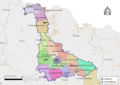
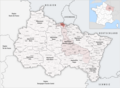
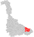
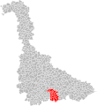
Français : Cartes des établissements publics de coopération intercommunale (communautés de communes, d’agglomération ou urbaines, métropoles, syndicats intercommunaux) et syndicats mixtes (dont les pôles métropolitains) du département français de Meurthe-et-Moselle.

Subcategories
This category has the following 3 subcategories, out of 3 total.
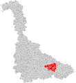
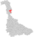
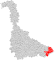
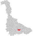
Media in category "Maps of groups of communes in Meurthe-et-Moselle"
The following 65 files are in this category, out of 65 total.
-
 Gemeindeverbände im Département Meurthe-et-Moselle 2023.png 3,499 × 2,580; 2.99 MB
-
 54-Meurthe-et-Moselle-intercos-2019.png 3,507 × 2,480; 2.52 MB
-
 Gemeindeverband Bassin de Pompey 2019.png 3,499 × 2,580; 2.74 MB
-
 Gemeindeverband Bassin de Pont-à-Mousson 2019.png 3,499 × 2,580; 2.74 MB
-
 CARTECCBP.png 800 × 679; 65 KB
-
 CC de la Valée de la Plaine.png 906 × 546; 41 KB
-
 Gemeindeverband Cœur du Pays-Haut 2023.png 3,499 × 2,580; 2.95 MB
-
 Gemeindeverband Grand Longwy Agglomération 2023.png 3,499 × 2,580; 2.92 MB
-
 Gemeindeverband Grand Nancy 2019.png 3,499 × 2,580; 2.74 MB
-
 Intercommunalités de Meurthe-et-Moselle.svg 1,015 × 1,108; 655 KB
-
 Localisation EPCI de Hazelle en Haye en Meurthe-et-Moselle, France.svg 1,000 × 1,088; 211 KB
-
 Localisation EPCI de l'agglomération de Longwy en Meurthe-et-Moselle, France.svg 1,000 × 1,088; 211 KB
-
 Localisation EPCI de la Mortagne en Meurthe-et-Moselle, France.svg 1,000 × 1,088; 211 KB
-
 Localisation EPCI de la Vezouze en Meurthe-et-Moselle, France.svg 1,000 × 1,088; 212 KB
-
 Localisation EPCI de Seille et Mauchère en Meurthe-et-Moselle, France.svg 1,000 × 1,088; 211 KB
-
 Localisation EPCI de Vezouze en Piémont en Meurthe-et-Moselle, France.svg 1,000 × 1,088; 227 KB
-
 Localisation EPCI des côtes en Haye en Meurthe-et-Moselle, France.svg 1,000 × 1,088; 211 KB
-
 Localisation EPCI des deux rivières en Meurthe-et-Moselle, France.svg 1,000 × 1,088; 211 KB
-
 Localisation EPCI des pays du sel et du Vermois en Meurthe-et-Moselle, France.svg 1,000 × 1,088; 211 KB
-
 Localisation EPCI des vallées du cristal en Meurthe-et-Moselle, France.svg 1,000 × 1,088; 211 KB
-
 Localisation EPCI des vals de Moselle et de l'Esch en Meurthe-et-Moselle, France.svg 1,000 × 1,088; 211 KB
-
 Localisation EPCI du Badonvillois en Meurthe-et-Moselle, France.svg 1,000 × 1,088; 211 KB
-
 Localisation EPCI du bassin de Landres en Meurthe-et-Moselle, France.svg 1,000 × 1,088; 212 KB
-
 Localisation EPCI du bassin de Pompey en Meurthe-et-Moselle, France.svg 1,000 × 1,088; 211 KB
-
 Localisation EPCI du bassin de Pont-à-Mousson en Meurthe-et-Moselle, France.svg 1,000 × 1,088; 212 KB
-
 Localisation EPCI du Bayonnais en Meurthe-et-Moselle, France.svg 1,000 × 1,088; 211 KB
-
 Localisation EPCI du chardon lorrain en Meurthe-et-Moselle, France.svg 1,000 × 1,088; 212 KB
-
 Localisation EPCI du Froidmont en Meurthe-et-Moselle, France.svg 1,000 × 1,088; 211 KB
-
 Localisation EPCI du grand Nancy en Meurthe-et-Moselle, France.svg 1,000 × 1,088; 211 KB
-
 Localisation EPCI du grand Valmont en Meurthe-et-Moselle, France.svg 1,000 × 1,088; 211 KB
-
 Localisation EPCI du Jarnisy en Meurthe-et-Moselle, France.svg 1,000 × 1,088; 211 KB
-
 Localisation EPCI du Lunévillois en Meurthe-et-Moselle, France.svg 1,000 × 1,088; 211 KB
-
 Localisation EPCI du pays audunois en Meurthe-et-Moselle, France.svg 1,000 × 1,088; 211 KB
-
 Localisation EPCI du pays de Briey en Meurthe-et-Moselle, France.svg 1,000 × 1,088; 211 KB
-

-
 Localisation EPCI du pays de l'Orne en Meurthe-et-Moselle, France.svg 1,000 × 1,088; 211 KB
-
 Localisation EPCI du pays de la haute Vezouze en Meurthe-et-Moselle, France.svg 1,000 × 1,088; 211 KB
-
 Localisation EPCI du pays de Longuyon en Meurthe-et-Moselle, France.svg 1,000 × 1,088; 211 KB
-

-
 Localisation EPCI du pays de Pont-à-Mousson en Meurthe-et-Moselle, France.svg 1,000 × 1,088; 211 KB
-
 Localisation EPCI du pays de Saintois en Meurthe-et-Moselle, France.svg 1,000 × 1,088; 212 KB
-
 Localisation EPCI du pays du Sânon en Meurthe-et-Moselle, France.svg 1,000 × 1,088; 212 KB
-
 Localisation EPCI du Piémont vosgien en Meurthe-et-Moselle, France.svg 1,000 × 1,088; 211 KB
-
 Localisation EPCI du Saintois au Vermois en Meurthe-et-Moselle, France.svg 1,000 × 1,088; 211 KB
-
 Localisation EPCI du Toulois en Meurthe-et-Moselle, France.svg 1,000 × 1,088; 211 KB
-
 Localisation EPCI du val de Meurthe en Meurthe-et-Moselle, France.svg 1,000 × 1,088; 211 KB
-
 Localisation EPCI Grand couronné en Meurthe-et-Moselle, France.svg 1,000 × 1,088; 211 KB
-
 Localisation EPCI Meurthe, Mortagne, Moselle en Meurthe-et-Moselle, France.svg 1,000 × 1,088; 220 KB
-
 Localisation EPCI Moselle et Madon en Meurthe-et-Moselle, France.svg 1,000 × 1,088; 211 KB
-
 Localisation EPCI Terres Touloises en Meurthe-et-Moselle, France.svg 1,000 × 1,088; 222 KB
-
 Gemeindeverband Mad et Moselle 2023.png 3,499 × 2,580; 2.96 MB
-
 Gemeindeverband Meurthe Mortagne Moselle 2019.png 3,499 × 2,580; 2.74 MB
-
 Gemeindeverband Moselle et Madon 2019.png 3,499 × 2,580; 2.74 MB
-
 Gemeindeverband Orne Lorraine Confluences 2019.png 3,499 × 2,580; 2.74 MB
-
 Gemeindeverband Pays de Colombey et du Sud Toulois 2019.png 3,499 × 2,580; 2.78 MB
-
 Gemeindeverband Pays du Saintois 2019.png 3,499 × 2,580; 2.74 MB
-
 Gemeindeverband Pays du Sel et du Vermois 2019.png 3,499 × 2,580; 2.74 MB
-
 Gemeindeverband Pays du Sânon 2019.png 3,499 × 2,580; 2.74 MB
-
 Gemeindeverband Pays Haut Val d’Alzette 2019.png 3,499 × 2,580; 2.8 MB
-
 Gemeindeverband Saint-Dié-des-Vosges 2019.png 3,499 × 2,580; 2.79 MB
-
 Gemeindeverband Seille et Grand Couronné 2019.png 3,499 × 2,580; 2.74 MB
-
 Gemeindeverband Terre Lorraine du Longuyonnais 2019.png 3,499 × 2,580; 2.74 MB
-
 Gemeindeverband Terres Touloises 2019.png 3,499 × 2,580; 2.74 MB
-
 Gemeindeverband Territoire de Lunéville à Baccarat 2019.png 3,499 × 2,580; 2.74 MB
-
 Gemeindeverband Vezouze en Piémont 2019.png 3,499 × 2,580; 2.74 MB


