Category:Maps of groups of communes in Gironde
Jump to navigation
Jump to search
Departments of Metropolitan France: Ain [01] · Aisne [02] · Allier [03] · Alpes-de-Haute-Provence [04] · Hautes-Alpes [05] · Alpes-Maritimes [06] · Ardèche [07] · Ardennes [08] · Ariège [09] · Aube [10] · Aude [11] · Aveyron [12] · Bouches-du-Rhône [13] · Calvados [14] · Cantal [15] · Charente [16] · Charente-Maritime [17] · Cher [18] · Corrèze [19] · Corse-du-Sud [2A]† · Haute-Corse [2B]† · Côte-d’Or [21] · Côtes-d'Armor [22] · Creuse [23] · Dordogne [24] · Doubs [25] · Drôme [26] · Eure [27] · Eure-et-Loir [28] · Finistère [29] · Gard [30] · Haute-Garonne [31] · Gers [32] · Gironde [33] · Hérault [34] · Ille-et-Vilaine [35] · Indre [36] · Indre-et-Loire [37] · Isère [38] · Jura [39] · Landes [40] · Loir-et-Cher [41] · Loire [42] · Haute-Loire [43] · Loire-Atlantique [44] · Loiret [45] · Lot [46] · Lot-et-Garonne [47] · Lozère [48] · Maine-et-Loire [49] · Manche [50] · Marne [51] · Haute-Marne [52] · Mayenne [53] · Meurthe-et-Moselle [54] · Meuse [55] · Morbihan [56] · Moselle [57] · Nièvre [58] · Nord [59] · Oise [60] · Orne [61] · Pas-de-Calais [62] · Puy-de-Dôme [63] · Pyrénées-Atlantiques [64] · Hautes-Pyrénées [65] · Pyrénées-Orientales [66] · Bas-Rhin [67] · Haut-Rhin [68] · departmental district of the Rhône [69] · Rhône [69D]‡ · Haute-Saône [70] · Saône-et-Loire [71] · Sarthe [72] · Savoie [73] · Haute-Savoie [74] · Seine-Maritime [76] · Seine-et-Marne [77] · Yvelines [78] · Deux-Sèvres [79] · Somme [80] · Tarn [81] · Tarn-et-Garonne [82] · Var [83] · Vaucluse [84] · Vendée [85] · Vienne [86] · Haute-Vienne [87] · Vosges [88] · Yonne [89] · Territoire de Belfort [90] · Essonne [91] · Hauts-de-Seine [92] · Seine-Saint-Denis [93] · Val-de-Marne [94] · Val-d'Oise [95]
Overseas departments and regions: Guadeloupe [971] · Martinique [972] · French Guiana [973] · Réunion [974] · Mayotte [976]
Sui generis territories: New Caledonia [988]
Overseas departments and regions: Guadeloupe [971] · Martinique [972] · French Guiana [973] · Réunion [974] · Mayotte [976]
Sui generis territories: New Caledonia [988]
| NO WIKIDATA ID FOUND! Search for Maps of groups of communes in Gironde on Wikidata | |
| Upload media |
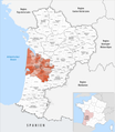
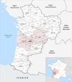
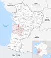
Français : Cartes des établissements publics de coopération intercommunale (communautés de communes, d'agglomération ou urbaines, métropoles, syndicats intercommunaux) et syndicats mixtes (dont les pôles métropolitains) du département français de la Gironde.

Subcategories
This category has the following 5 subcategories, out of 5 total.
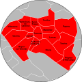
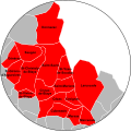
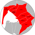
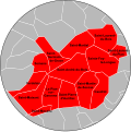
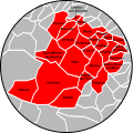
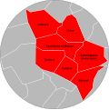
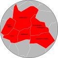
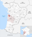
Media in category "Maps of groups of communes in Gironde"
The following 179 files are in this category, out of 179 total.
-
 Gemeindeverbände im Département Gironde 2023.png 3,500 × 4,020; 3.14 MB
-
 2014 EPCI Gironde type intercom.jpg 2,500 × 3,096; 1.17 MB
-
 33-Gironde-intercos-2019.png 3,507 × 2,480; 2.05 MB
-
 33-Intercos2019-200023794-Densités.png 3,519 × 2,480; 1.49 MB
-
 33-Intercos2019-200023794.png 3,519 × 2,480; 2.59 MB
-
 33-Intercos2019-200035533-Densités.png 3,519 × 2,480; 1.64 MB
-
 33-Intercos2019-200035533.png 3,519 × 2,480; 2.65 MB
-
 33-Intercos2019-200043974-Densités.png 3,519 × 2,480; 1.99 MB
-
 33-Intercos2019-200043974.png 3,519 × 2,480; 3.75 MB
-
 33-Intercos2019-200043982-Densités.png 3,519 × 2,480; 1.54 MB
-
 33-Intercos2019-200043982.png 3,519 × 2,480; 2.74 MB
-
 33-Intercos2019-200044394-Densités.png 3,519 × 2,480; 1.97 MB
-
 33-Intercos2019-200044394.png 3,519 × 2,480; 3.17 MB
-
 33-Intercos2019-200069581-Densités.png 3,519 × 2,480; 1.28 MB
-
 33-Intercos2019-200069581.png 3,519 × 2,480; 2.47 MB
-
 33-Intercos2019-200069599-Densités.png 3,519 × 2,480; 2.34 MB
-
 33-Intercos2019-200069599.png 3,519 × 2,480; 3.41 MB
-
 33-Intercos2019-200069995-Densités.png 3,519 × 2,480; 1.4 MB
-
 33-Intercos2019-200069995.png 3,519 × 2,480; 2.51 MB
-
 33-Intercos2019-200070092-Densités.png 3,519 × 2,480; 2.73 MB
-
 33-Intercos2019-200070092.png 3,519 × 2,480; 4.66 MB
-
 33-Intercos2019-200070720-Densités.png 3,519 × 2,480; 1.94 MB
-
 33-Intercos2019-200070720.png 3,519 × 2,480; 3.3 MB
-
 33-Intercos2019-243300316-Densités.png 3,519 × 2,480; 1.54 MB
-
 33-Intercos2019-243300316.png 3,519 × 2,480; 3.79 MB
-
 33-Intercos2019-243300563-Densités.png 3,519 × 2,480; 728 KB
-
 33-Intercos2019-243300563.png 3,519 × 2,480; 1.7 MB
-
 33-Intercos2019-243300811-Densités.png 3,519 × 2,480; 1.33 MB
-
 33-Intercos2019-243300811.png 3,519 × 2,480; 2.3 MB
-
 33-Intercos2019-243301165-Densités.png 3,519 × 2,480; 721 KB
-
 33-Intercos2019-243301165.png 3,519 × 2,480; 2.05 MB
-
 33-Intercos2019-243301181-Densités.png 3,519 × 2,480; 1.58 MB
-
 33-Intercos2019-243301181.png 3,519 × 2,480; 3.05 MB
-
 33-Intercos2019-243301215-Densités.png 3,519 × 2,480; 1.48 MB
-
 33-Intercos2019-243301215.png 3,519 × 2,480; 2.47 MB
-
 33-Intercos2019-243301223-Densités.png 3,519 × 2,480; 1.41 MB
-
 33-Intercos2019-243301223.png 3,519 × 2,480; 2.59 MB
-
 33-Intercos2019-243301249-Densités.png 3,519 × 2,480; 867 KB
-
 33-Intercos2019-243301249.png 3,519 × 2,480; 2.03 MB
-
 33-Intercos2019-243301264-Densités.png 3,519 × 2,480; 1.06 MB
-
 33-Intercos2019-243301264.png 3,519 × 2,480; 2.39 MB
-
 33-Intercos2019-243301355-Densités.png 3,519 × 2,480; 820 KB
-
 33-Intercos2019-243301355.png 3,519 × 2,480; 1.54 MB
-
 33-Intercos2019-243301371-Densités.png 3,519 × 2,480; 1.77 MB
-
 33-Intercos2019-243301371.png 3,519 × 2,480; 2.51 MB
-
 33-Intercos2019-243301389.png 3,519 × 2,480; 1.9 MB
-
 33-Intercos2019-243301397-Densités.png 3,519 × 2,480; 1.33 MB
-
 33-Intercos2019-243301397.png 3,519 × 2,480; 2.69 MB
-
 33-Intercos2019-243301405-Densités.png 3,519 × 2,480; 931 KB
-
 33-Intercos2019-243301405.png 3,519 × 2,480; 2.32 MB
-
 33-Intercos2019-243301439.png 3,519 × 2,480; 2.22 MB
-
 33-Intercos2019-243301447-Densités.png 3,519 × 2,480; 1.37 MB
-
 33-Intercos2019-243301447.png 3,519 × 2,480; 2.73 MB
-
 33-Intercos2019-243301454-Densités.png 3,519 × 2,480; 1.66 MB
-
 33-Intercos2019-243301454.png 3,519 × 2,480; 2.5 MB
-
 33-Intercos2019-243301504-Densités.png 3,519 × 2,480; 965 KB
-
 33-Intercos2019-243301504.png 3,519 × 2,480; 2.33 MB
-
 Gemeindeverband Bassin d’Arcachon Sud 2023.png 3,500 × 4,020; 3.12 MB
-
 Gemeindeverband Bassin d’Arcachon Sud-Pôle Atlantique 2019.png 3,500 × 4,020; 3.11 MB
-
 Gemeindeverband Bazadais 2019.png 3,500 × 4,020; 3.12 MB
-
 Gemeindeverband Blaye 2020.png 3,500 × 4,020; 3.11 MB
-
 Gemeindeverband Bordeaux Métropole 2019.png 3,500 × 4,020; 3.12 MB
-
 Carte des communes Bordeaux Métropole.svg 1,000 × 1,000; 291 KB
-
 Gemeindeverband Castillon Pujols 2023.png 3,500 × 4,020; 3.16 MB
-
 Communauté de communes des Coteaux Bordelais.svg 626 × 460; 44 KB
-
 Gemeindeverband Convergence Garonne 2019.png 3,500 × 4,020; 3.12 MB
-
 Gemeindeverband Créonnais 2019.png 3,500 × 4,020; 3.11 MB
-
 Gemeindeverband Estuaire - Canton de Saint-Ciers-sur-Gironde 2019.png 3,500 × 4,020; 3.11 MB
-
 Gemeindeverband Fronsadais 2019.png 3,500 × 4,020; 3.11 MB
-
 Gemeindeverband Grand Cubzaguais 2019.png 3,500 × 4,020; 3.11 MB
-
 Gemeindeverband Grand Saint-Émilionnais 2019.png 3,500 × 4,020; 3.12 MB
-
 Gemeindeverband Jalle-Eau-Bourde 2019.png 3,500 × 4,020; 3.11 MB
-
 Gemeindeverband Latitude Nord Gironde 2020.png 3,500 × 4,020; 3.11 MB
-
 Gemeindeverband Les Coteaux Bordelais 2023.png 3,500 × 4,020; 3.12 MB
-
 Gemeindeverband Les Rives de la Laurence 2023.png 3,500 × 4,020; 3.12 MB
-
 Gemeindeverband Libournais 2019.png 3,500 × 4,020; 3.12 MB
-
 Localisation EPCI Blaye dans la Gironde, France.svg 1,092 × 1,306; 147 KB
-
 Localisation EPCI Bourg dans la Gironde, France.svg 1,092 × 1,306; 147 KB
-
 Localisation EPCI Brannais dans la Gironde, France.svg 1,075 × 1,306; 147 KB
-
 Localisation EPCI Castillon Pujols dans la Gironde, France.svg 1,000 × 1,234; 207 KB
-
 Localisation EPCI CC de l'Estuaire - Saint-Ciers 2019.png 1,000 × 1,234; 199 KB
-
 Localisation EPCI CC Médoc Coeur de Presqu'île 2019.png 1,000 × 1,234; 199 KB
-
 Localisation EPCI COBAN dans la Gironde, France.svg 1,075 × 1,306; 147 KB
-
 Localisation EPCI Coteaux Bordelais dans la Gironde, France.svg 1,048 × 1,306; 147 KB
-
 Localisation EPCI Créonnais dans la Gironde, France.svg 1,000 × 1,234; 206 KB
-
 Localisation EPCI Cœur du Médoc dans la Gironde, France.svg 1,000 × 1,234; 206 KB
-
 Localisation EPCI de Bordeaux dans la Gironde, France.svg 1,038 × 1,306; 147 KB
-
-
 Localisation EPCI de la pointe du Médoc dans la Gironde, France.svg 1,000 × 1,234; 206 KB
-
 Localisation EPCI de Montesquieu dans la Gironde, France.svg 1,000 × 1,234; 206 KB
-
 Localisation EPCI des coteaux bordelais dans la Gironde, France.svg 1,000 × 1,234; 206 KB
-
 Localisation EPCI des coteaux de Garonne dans la Gironde, France.svg 1,000 × 1,234; 206 KB
-
 Localisation EPCI des coteaux macariens dans la Gironde, France.svg 1,000 × 1,234; 206 KB
-
 Localisation EPCI des lacs médocains dans la Gironde, France.svg 1,000 × 1,234; 206 KB
-
 Localisation EPCI des portes de l'entre deux mers dans la Gironde, France.svg 1,000 × 1,234; 206 KB
-
 Localisation EPCI du bassin d'Arcachon nord Atlantique dans la Gironde, France.svg 1,000 × 1,234; 206 KB
-
 Localisation EPCI du bassin d'Arcachon sud - Pôle Atlantique dans la Gironde, France.svg 1,000 × 1,234; 206 KB
-
 Localisation EPCI du Bazadais 2014 dans la Gironde, France.svg 1,000 × 1,234; 207 KB
-
 Localisation EPCI du Brannais dans la Gironde, France.svg 1,000 × 1,234; 206 KB
-
 Localisation EPCI du canton de Blaye dans la Gironde, France.svg 1,000 × 1,234; 206 KB
-
 Localisation EPCI du canton de Bourg sur Gironde dans la Gironde, France.svg 1,000 × 1,234; 206 KB
-
 Localisation EPCI du canton de Fronsac dans la Gironde, France.svg 1,000 × 1,234; 206 KB
-
 Localisation EPCI du canton de Podensac dans la Gironde, France.svg 1,000 × 1,234; 206 KB
-
 Localisation EPCI du canton de Saint-Savin dans la Gironde, France.svg 1,000 × 1,234; 206 KB
-
 Localisation EPCI du centre Médoc dans la Gironde, France.svg 1,000 × 1,234; 206 KB
-
 Localisation EPCI du Cubzaguais dans la Gironde, France.svg 1,000 × 1,234; 206 KB
-
 Localisation EPCI du grand Saint-Émilionnais dans la Gironde, France.svg 1,000 × 1,234; 207 KB
-
 Localisation EPCI du Monségurais dans la Gironde, France.svg 1,000 × 1,234; 206 KB
-
 Localisation EPCI du nord Libournais dans la Gironde, France.svg 1,000 × 1,234; 207 KB
-
 Localisation EPCI du pays foyen 2014 dans la Gironde, France.svg 1,000 × 1,234; 254 KB
-
 Localisation EPCI du Réolais en Sud Gironde 2014, France.svg 1,000 × 1,234; 207 KB
-
 Localisation EPCI du Sauveterrois 2014 dans la Gironde, France.svg 1,000 × 1,234; 189 KB
-
 Localisation EPCI du secteur de Saint-Loubès dans la Gironde, France.svg 1,000 × 1,234; 206 KB
-
 Localisation EPCI du Sud Gironde 2014, France.svg 1,000 × 1,234; 207 KB
-
 Localisation EPCI du sud Libournais dans la Gironde, France.svg 1,000 × 1,234; 206 KB
-
 Localisation EPCI du Targonnais dans la Gironde, France.svg 1,000 × 1,234; 207 KB
-
 Localisation EPCI du val de l'Eyre dans la Gironde, France.svg 1,000 × 1,234; 206 KB
-
 Localisation EPCI du vallon de l'Artolie dans la Gironde, France.svg 1,000 × 1,234; 206 KB
-
 Localisation EPCI Entre-Deux-Mers dans la Gironde, France.svg 1,000 × 1,234; 201 KB
-
 Localisation EPCI Jalle eau bourde dans la Gironde, France.svg 1,000 × 1,234; 206 KB
-
 Localisation EPCI Médoc Atlantique dans la Gironde, France.svg 1,000 × 1,234; 208 KB
-
 Localisation EPCI Médoc estuaire dans la Gironde, France.svg 1,000 × 1,234; 206 KB
-
 Localisation EPCI médullienne dans la Gironde, France.svg 1,000 × 1,234; 206 KB
-
-
 Localisation EPCI Portes Entre Deux Mers dans la Gironde, France.svg 1,000 × 1,234; 206 KB
-
 Localisation EPCI Saint Loubès dans la Gironde, France - Copie.svg 1,038 × 1,306; 147 KB
-
 Localisation EPCI Sud-Libournais dans la Gironde, France.svg 1,038 × 1,306; 147 KB
-
 Localisation EPCI Val Eyre dans la Gironde, France - Copie.svg 1,038 × 1,306; 147 KB
-
 Localisation Pays Barval en Gironde 2014, France.svg 1,000 × 1,234; 207 KB
-
 Localisation Pays du Libournais en Gironde 2014, France.svg 1,000 × 1,234; 218 KB
-
 Loupe EPCI Bazadais 2014, France.svg 1,000 × 1,000; 293 KB
-
 Loupe EPCI Brannais 2014, France.svg 1,000 × 1,000; 155 KB
-
 Loupe EPCI canton de Blaye 2014, France.svg 1,000 × 1,000; 149 KB
-
 Loupe EPCI canton de Bourg 2014, France.svg 1,000 × 1,000; 165 KB
-
 Loupe EPCI canton de Fronsac 2014, France.svg 1,000 × 1,000; 219 KB
-
 Loupe EPCI Canton de Podensac 2014, France.svg 1,000 × 1,000; 127 KB
-
 Loupe EPCI canton de Saint-Savin 2014, France.svg 1,000 × 1,000; 189 KB
-
 Loupe EPCI canton de Targon 2014, France.svg 1,000 × 1,000; 185 KB
-
 Loupe EPCI Castillon-Pujols 2014, France.svg 1,000 × 1,000; 307 KB
-
 Loupe EPCI Centre Médoc 2014, France.svg 1,000 × 1,000; 118 KB
-
 Loupe EPCI Coban Atlantique 2014, France.svg 1,000 × 1,000; 78 KB
-
 Loupe EPCI Cobas 2014, France.svg 1,000 × 1,000; 45 KB
-
 Loupe EPCI Coteaux Bordelais 2014, France.svg 1,000 × 1,000; 92 KB
-
 Loupe EPCI Coteaux de Garonne 2014, France.svg 1,000 × 1,000; 83 KB
-
 Loupe EPCI Coteaux Macariens 2014, France.svg 1,000 × 1,002; 208 KB
-
 Loupe EPCI Créonnais 2014, France.svg 1,000 × 1,000; 124 KB
-
 Loupe EPCI Cubzaguais 2014, France.svg 1,000 × 1,000; 135 KB
-
 Loupe EPCI Cœur Médoc 2014, France.svg 1,000 × 1,000; 150 KB
-
 Loupe EPCI du Sud Gironde 2014, France.svg 1,000 × 1,000; 350 KB
-
 Loupe EPCI Estuaire canton de Saint-Ciers-sur-Gironde 2014, France.svg 1,000 × 1,000; 128 KB
-
 Loupe EPCI Grand Saint-Émilionais 2014, France.svg 1,000 × 1,000; 301 KB
-
 Loupe EPCI Jalle-Eau Bourde 2014, France.svg 1,000 × 1,000; 41 KB
-
 Loupe EPCI Lacs Médocains 2014, France.svg 1,000 × 1,000; 31 KB
-
 Loupe EPCI Libournais CALI 2014, France.svg 1,000 × 1,000; 432 KB
-
 Loupe EPCI Montesquieu 2014, France.svg 1,000 × 1,000; 173 KB
-
 Loupe EPCI Médillienne 2014, France.svg 1,000 × 1,000; 110 KB
-
 Loupe EPCI Médoc-Estuaire 2014, France.svg 1,000 × 1,000; 115 KB
-
 Loupe EPCI Pays foyen 2014, France.svg 1,000 × 1,000; 199 KB
-
-
 Loupe EPCI Pointe du Médoc 2014, France.svg 1,000 × 1,000; 131 KB
-
 Loupe EPCI Portes de l'Entre-deux-Mers 2014, France.svg 1,000 × 1,000; 90 KB
-
 Loupe EPCI Réolais en Sud Gironde 2014, France.svg 1,000 × 1,000; 381 KB
-
 Loupe EPCI Saint-Loubès 2014, France.svg 1,000 × 1,000; 16 KB
-
 Loupe EPCI Sauveterrois 2014, France.svg 1,000 × 1,000; 388 KB
-
 Loupe EPCI Sud-Libournais 2014, France.svg 1,000 × 1,000; 55 KB
-
 Loupe EPCI Val de l'Eyre 2014, France.svg 1,000 × 1,000; 49 KB
-
 Loupe EPCI Vallon de l'Artolie 2014, France.svg 1,000 × 1,000; 91 KB
-
 Gemeindeverband Montesquieu 2019.png 3,500 × 4,020; 3.12 MB
-
 Gemeindeverband Médoc Atlantique 2019.png 3,500 × 4,020; 3.12 MB
-
 Gemeindeverband Médoc Cœur de Presqu’île 2019.png 3,500 × 4,020; 3.12 MB
-
 Gemeindeverband Médoc Estuaire 2019.png 3,500 × 4,020; 3.11 MB
-
 Gemeindeverband Médullienne 2019.png 3,500 × 4,020; 3.12 MB
-
 Gemeindeverband Pays Foyen 2018.png 3,500 × 4,020; 3.16 MB
-
 Gemeindeverband Pays Foyen 2019.png 3,500 × 4,020; 3.15 MB
-
 Gemeindeverband Portes de l’Entre-Deux-Mers 2019.png 3,500 × 4,020; 3.11 MB
-
 Gemeindeverband Rurales de l’Entre-Deux-Mers 2019.png 3,500 × 4,020; 3.12 MB
-
 Gemeindeverband Réolais en Sud Gironde 2019.png 3,500 × 4,020; 3.12 MB
-
 Gemeindeverband Sud Gironde 2019.png 3,500 × 4,020; 3.12 MB
-
 Gemeindeverband Val de l’Eyre 2019.png 3,500 × 4,020; 3.11 MB


