Category:Maps of groups of communes in Aveyron
Jump to navigation
Jump to search
Departments of Metropolitan France: Ain [01] · Aisne [02] · Allier [03] · Alpes-de-Haute-Provence [04] · Hautes-Alpes [05] · Alpes-Maritimes [06] · Ardèche [07] · Ardennes [08] · Ariège [09] · Aube [10] · Aude [11] · Aveyron [12] · Bouches-du-Rhône [13] · Calvados [14] · Cantal [15] · Charente [16] · Charente-Maritime [17] · Cher [18] · Corrèze [19] · Corse-du-Sud [2A]† · Haute-Corse [2B]† · Côte-d’Or [21] · Côtes-d'Armor [22] · Creuse [23] · Dordogne [24] · Doubs [25] · Drôme [26] · Eure [27] · Eure-et-Loir [28] · Finistère [29] · Gard [30] · Haute-Garonne [31] · Gers [32] · Gironde [33] · Hérault [34] · Ille-et-Vilaine [35] · Indre [36] · Indre-et-Loire [37] · Isère [38] · Jura [39] · Landes [40] · Loir-et-Cher [41] · Loire [42] · Haute-Loire [43] · Loire-Atlantique [44] · Loiret [45] · Lot [46] · Lot-et-Garonne [47] · Lozère [48] · Maine-et-Loire [49] · Manche [50] · Marne [51] · Haute-Marne [52] · Mayenne [53] · Meurthe-et-Moselle [54] · Meuse [55] · Morbihan [56] · Moselle [57] · Nièvre [58] · Nord [59] · Oise [60] · Orne [61] · Pas-de-Calais [62] · Puy-de-Dôme [63] · Pyrénées-Atlantiques [64] · Hautes-Pyrénées [65] · Pyrénées-Orientales [66] · Bas-Rhin [67] · Haut-Rhin [68] · departmental district of the Rhône [69] · Rhône [69D]‡ · Haute-Saône [70] · Saône-et-Loire [71] · Sarthe [72] · Savoie [73] · Haute-Savoie [74] · Seine-Maritime [76] · Seine-et-Marne [77] · Yvelines [78] · Deux-Sèvres [79] · Somme [80] · Tarn [81] · Tarn-et-Garonne [82] · Var [83] · Vaucluse [84] · Vendée [85] · Vienne [86] · Haute-Vienne [87] · Vosges [88] · Yonne [89] · Territoire de Belfort [90] · Essonne [91] · Hauts-de-Seine [92] · Seine-Saint-Denis [93] · Val-de-Marne [94] · Val-d'Oise [95]
Overseas departments and regions: Guadeloupe [971] · Martinique [972] · French Guiana [973] · Réunion [974] · Mayotte [976]
Sui generis territories: New Caledonia [988]
Overseas departments and regions: Guadeloupe [971] · Martinique [972] · French Guiana [973] · Réunion [974] · Mayotte [976]
Sui generis territories: New Caledonia [988]
| NO WIKIDATA ID FOUND! Search for Maps of groups of communes in Aveyron on Wikidata | |
| Upload media |
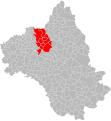
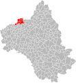
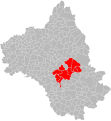
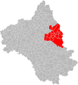
Français : Cartes des établissements publics de coopération intercommunale (communautés de communes, d’agglomération ou urbaines, métropoles, syndicats intercommunaux) et syndicats mixtes (dont les pôles métropolitains) du département français de l’Aveyron.
Subcategories
This category has the following 3 subcategories, out of 3 total.
Media in category "Maps of groups of communes in Aveyron"
The following 67 files are in this category, out of 67 total.
-
Gemeindeverbände im Département Aveyron 2023.png 3,500 × 2,853; 2.7 MB
-
12-Intercos-2019.png 3,507 × 2,480; 1.72 MB
-
Gemeindeverband Aubrac, Carladez et Viadène 2019.png 3,500 × 2,853; 2.66 MB
-
Gemeindeverband Aveyron Bas Ségala Viaur 2019.png 3,500 × 2,853; 2.66 MB
-
Gemeindeverband Causses à l’Aubrac 2019.png 3,500 × 2,853; 2.66 MB
-
Gemeindeverband Comtal Lot et Truyère 2019.png 3,500 × 2,853; 2.66 MB
-
Gemeindeverband Conques-Marcillac 2019.png 3,500 × 2,853; 2.66 MB
-
Gemeindeverband Decazeville Communauté 2019.png 3,500 × 2,853; 2.66 MB
-
Gemeindeverband Grand-Figeac 2019.png 3,500 × 2,853; 2.68 MB
-
Gemeindeverband Larzac et Vallées 2019.png 3,500 × 2,853; 2.66 MB
-
Localisation EPCI Aubrac - Laguiole dans l'Aveyron, France.svg 1,000 × 1,083; 172 KB
-
Localisation EPCI Aubrac et Carladez dans l'Aveyron, France.svg 1,000 × 1,083; 423 KB
-
Localisation EPCI Aveyron Bas Ségala Viaur dans l'Aveyron, France.svg 1,000 × 1,083; 409 KB
-
Localisation EPCI Comtal Lot et Truyère dans l'Aveyron, France.svg 1,000 × 1,083; 420 KB
-
Localisation EPCI Conques - Marcillac dans l'Aveyron, France.svg 1,000 × 1,083; 413 KB
-
Localisation EPCI d'Entraygues-sur-Truyère dans l'Aveyron, France.svg 1,000 × 1,083; 172 KB
-
Localisation EPCI d'Estaing dans l'Aveyron, France.svg 1,000 × 1,083; 172 KB
-
Localisation EPCI de Bozouls Comtal dans l'Aveyron, France.svg 1,000 × 1,083; 172 KB
-
Localisation EPCI de l'Argence dans l'Aveyron, France.svg 1,000 × 1,083; 172 KB
-
Localisation EPCI de la Muse et des raspes du Tarn dans l'Aveyron, France.svg 1,000 × 1,083; 414 KB
-
Localisation EPCI de la vallée du Lot dans l'Aveyron, France.svg 1,000 × 1,083; 172 KB
-
Localisation EPCI de la Viadène dans l'Aveyron, France.svg 1,000 × 1,083; 172 KB
-
Localisation EPCI de Lévézou Pareloup dans l'Aveyron, France.svg 1,000 × 1,083; 415 KB
-
Localisation EPCI de Millau Grands Causses dans l'Aveyron, France.svg 1,000 × 1,083; 414 KB
-
Localisation EPCI de Sévérac-le-Château dans l'Aveyron, France.svg 1,000 × 1,083; 172 KB
-
Localisation EPCI Decazeville Communauté dans l'Aveyron, France.svg 1,000 × 1,083; 411 KB
-
Localisation EPCI des Causses à l'Aubrac dans l'Aveyron, France.svg 1,000 × 1,083; 418 KB
-
Localisation EPCI des pays d'Olt et d'Aubrac dans l'Aveyron, France.svg 1,000 × 1,083; 172 KB
-
Localisation EPCI des sept vallons dans l'Aveyron, France.svg 1,000 × 1,083; 172 KB
-
Localisation EPCI du Bas Ségala dans l'Aveyron, France.svg 1,000 × 1,083; 171 KB
-
Localisation EPCI du bassin de Decazeville Aubin dans l'Aveyron, France.svg 1,000 × 1,083; 172 KB
-
Localisation EPCI du canton de Laissac dans l'Aveyron, France.svg 1,000 × 1,083; 172 KB
-
Localisation EPCI du canton de Najac dans l'Aveyron, France.svg 1,000 × 1,083; 172 KB
-
Localisation EPCI du Carladez dans l'Aveyron, France.svg 1,000 × 1,083; 172 KB
-
Localisation EPCI du Grand Villefranchois dans l'Aveyron, France.svg 1,000 × 1,083; 428 KB
-
Localisation EPCI du Lot et de la Serre dans l'Aveyron, France.svg 1,000 × 1,083; 172 KB
-
Localisation EPCI du Naucellois dans l'Aveyron, France.svg 1,000 × 1,083; 172 KB
-
Localisation EPCI du pays baraquevillois dans l'Aveyron, France.svg 1,000 × 1,083; 172 KB
-
Localisation EPCI du pays belmontais dans l'Aveyron, France.svg 1,000 × 1,083; 172 KB
-
Localisation EPCI du pays de Salars dans l'Aveyron, France.svg 1,000 × 1,083; 414 KB
-
Localisation EPCI du pays rignacois dans l'Aveyron, France.svg 1,000 × 1,083; 410 KB
-
Localisation EPCI du pays saint-serninois dans l'Aveyron, France.svg 1,000 × 1,083; 172 KB
-
Localisation EPCI du plateau de Montbazens dans l'Aveyron, France.svg 1,000 × 1,083; 411 KB
-
Localisation EPCI du rougier de Camarès dans l'Aveyron, France.svg 1,000 × 1,083; 172 KB
-
Localisation EPCI du Réquistanais dans l'Aveyron, France.svg 1,000 × 1,083; 413 KB
-
Localisation EPCI du Saint-Affricain dans l'Aveyron, France.svg 1,000 × 1,083; 172 KB
-
Localisation EPCI du Tarn et de la Muse dans l'Aveyron, France.svg 1,000 × 1,083; 172 KB
-
Localisation EPCI du Villefranchois dans l'Aveyron, France.svg 1,029 × 1,084; 148 KB
-
Localisation EPCI Larzac et Vallées dans l'Aveyron, France.svg 1,000 × 1,083; 417 KB
-
Localisation EPCI Monts, Rance et Rougier dans l'Aveyron, France.svg 1,000 × 1,083; 421 KB
-
Localisation EPCI Pays Ségali dans l'Aveyron, France.svg 1,000 × 1,083; 425 KB
-
Localisation EPCI Rodez Agglomération dans l'Aveyron, France.svg 1,000 × 1,083; 410 KB
-
Localisation EPCI Saint Affricain, Roquefort, Sept Vallons dans l'Aveyron, France.svg 1,000 × 1,083; 416 KB
-
Localisation EPCI Viaur Céor Lagast dans l'Aveyron, France.svg 1,000 × 1,083; 172 KB
-
Localisation EPCI Villeneuvois, Diège et Lot dans l'Aveyron, France.svg 1,000 × 1,083; 172 KB
-
Gemeindeverband Lévézou Pareloup 2019.png 3,500 × 2,853; 2.66 MB
-
Gemeindeverband Millau Grands Causses 2019.png 3,500 × 2,853; 2.68 MB
-
Gemeindeverband Monts, Rance et Rougier 2019.png 3,500 × 2,853; 2.66 MB
-
Gemeindeverband Muse et Raspes du Tarn 2019.png 3,500 × 2,853; 2.66 MB
-
Gemeindeverband Ouest Aveyron Communauté 2023.png 3,500 × 2,853; 2.69 MB
-
Gemeindeverband Pays de Salars 2019.png 3,500 × 2,853; 2.66 MB
-
Gemeindeverband Pays Rignacois 2019.png 3,500 × 2,853; 2.66 MB
-
Gemeindeverband Pays Ségali Communauté 2023.png 3,500 × 2,853; 2.68 MB
-
Gemeindeverband Plateau de Montbazens 2019.png 3,500 × 2,853; 2.66 MB
-
Gemeindeverband Rodez Agglomération 2019.png 3,500 × 2,853; 2.66 MB
-
Gemeindeverband Réquistanais 2019.png 3,500 × 2,853; 2.66 MB
-
Gemeindeverband Saint Affricain, Roquefort, Sept Vallons 2019.png 3,500 × 2,853; 2.66 MB


