Category:Maps of groups of communes in Ain
Jump to navigation
Jump to search
Departments of Metropolitan France: Ain [01] · Aisne [02] · Allier [03] · Alpes-de-Haute-Provence [04] · Hautes-Alpes [05] · Alpes-Maritimes [06] · Ardèche [07] · Ardennes [08] · Ariège [09] · Aube [10] · Aude [11] · Aveyron [12] · Bouches-du-Rhône [13] · Calvados [14] · Cantal [15] · Charente [16] · Charente-Maritime [17] · Cher [18] · Corrèze [19] · Corse-du-Sud [2A]† · Haute-Corse [2B]† · Côte-d’Or [21] · Côtes-d'Armor [22] · Creuse [23] · Dordogne [24] · Doubs [25] · Drôme [26] · Eure [27] · Eure-et-Loir [28] · Finistère [29] · Gard [30] · Haute-Garonne [31] · Gers [32] · Gironde [33] · Hérault [34] · Ille-et-Vilaine [35] · Indre [36] · Indre-et-Loire [37] · Isère [38] · Jura [39] · Landes [40] · Loir-et-Cher [41] · Loire [42] · Haute-Loire [43] · Loire-Atlantique [44] · Loiret [45] · Lot [46] · Lot-et-Garonne [47] · Lozère [48] · Maine-et-Loire [49] · Manche [50] · Marne [51] · Haute-Marne [52] · Mayenne [53] · Meurthe-et-Moselle [54] · Meuse [55] · Morbihan [56] · Moselle [57] · Nièvre [58] · Nord [59] · Oise [60] · Orne [61] · Pas-de-Calais [62] · Puy-de-Dôme [63] · Pyrénées-Atlantiques [64] · Hautes-Pyrénées [65] · Pyrénées-Orientales [66] · Bas-Rhin [67] · Haut-Rhin [68] · departmental district of the Rhône [69] · Rhône [69D]‡ · Haute-Saône [70] · Saône-et-Loire [71] · Sarthe [72] · Savoie [73] · Haute-Savoie [74] · Seine-Maritime [76] · Seine-et-Marne [77] · Yvelines [78] · Deux-Sèvres [79] · Somme [80] · Tarn [81] · Tarn-et-Garonne [82] · Var [83] · Vaucluse [84] · Vendée [85] · Vienne [86] · Haute-Vienne [87] · Vosges [88] · Yonne [89] · Territoire de Belfort [90] · Essonne [91] · Hauts-de-Seine [92] · Seine-Saint-Denis [93] · Val-de-Marne [94] · Val-d'Oise [95]
Overseas departments and regions: Guadeloupe [971] · Martinique [972] · French Guiana [973] · Réunion [974] · Mayotte [976]
Sui generis territories: New Caledonia [988]
Overseas departments and regions: Guadeloupe [971] · Martinique [972] · French Guiana [973] · Réunion [974] · Mayotte [976]
Sui generis territories: New Caledonia [988]
| NO WIKIDATA ID FOUND! Search for Maps of groups of communes in Ain on Wikidata | |
| Upload media |
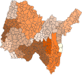
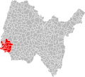
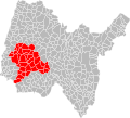
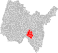
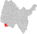
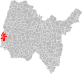
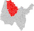
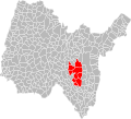
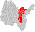
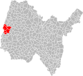
Français : Cartes des établissements publics de coopération intercommunale (communautés de communes, d’agglomération ou urbaines, métropoles, syndicats intercommunaux) et syndicats mixtes (dont les pôles métropolitains) du département français de l’Ain.
Subcategories
This category has the following 4 subcategories, out of 4 total.
Media in category "Maps of groups of communes in Ain"
The following 69 files are in this category, out of 69 total.
-
Gemeindeverbände im Département Ain 2023.png 3,500 × 2,793; 2.6 MB
-
01-Ain-intercos-2019.png 3,519 × 2,480; 2.84 MB
-
Gemeindeverband Bassin de Bourg-en-Bresse 2019.png 3,500 × 2,793; 2.64 MB
-
Gemeindeverband Bresse et Saône 2019.png 3,500 × 2,793; 2.64 MB
-
Gemeindeverband Bugey Sud 2023.png 2,500 × 1,995; 1.7 MB
-
CC Veyle.svg 1,430 × 1,046; 661 KB
-
Communauté d'agglomération de Villefranche-sur-Saône en 2019.svg 310 × 243; 215 KB
-
Gemeindeverband Côtière à Montluel 2019.png 3,500 × 2,793; 2.64 MB
-
Gemeindeverband Dombes 2019.png 3,500 × 2,793; 2.64 MB
-
Gemeindeverband Dombes Saône Vallée 2019.png 3,500 × 2,793; 2.64 MB
-
Gemeindeverband Haut - Bugey Agglomération 2023.png 3,500 × 2,793; 2.56 MB
-
Intercommunalités Communes Ain 2017.svg 802 × 729; 3.14 MB
-
Localisation CC Dombes-Saône Vallée dans l'Ain, France.svg 1,000 × 908; 201 KB
-
Localisation EPCI Bugey - Arène - Furans dans l'Ain, France.svg 1,000 × 908; 161 KB
-
Localisation EPCI Bugey Sud dans l'Ain, France, 2017.svg 1,000 × 908; 192 KB
-
Localisation EPCI Bugey Sud dans l'Ain, France.svg 1,000 × 908; 162 KB
-
Localisation EPCI Centre Dombes dans l'Ain, France.svg 1,000 × 908; 161 KB
-
Localisation EPCI Chalaronne Centre dans l'Ain, France.svg 1,000 × 908; 161 KB
-
Localisation EPCI d'Oyonnax dans l'Ain, France.svg 1,000 × 908; 161 KB
-
Localisation EPCI de Belley - Bas Bugey dans l'Ain, France.svg 1,000 × 908; 161 KB
-
Localisation EPCI de Bourg-en-Bresse dans l'Ain, France.svg 1,000 × 908; 161 KB
-
Localisation EPCI de la Combe du Val dans l'Ain, France.svg 1,000 × 908; 161 KB
-
Localisation EPCI de la Dombes dans l'Ain, France.svg 1,000 × 908; 192 KB
-
Localisation EPCI de la plaine de l'Ain dans l'Ain, France, 2017.svg 1,000 × 908; 192 KB
-
Localisation EPCI de la plaine de l'Ain dans l'Ain, France.svg 1,000 × 908; 162 KB
-
Localisation EPCI de la Vallière dans l'Ain, France.svg 1,000 × 908; 161 KB
-
Localisation EPCI de la vallée de l'Albarine dans l'Ain, France.svg 1,000 × 908; 161 KB
-
Localisation EPCI de la Veyle dans l'Ain, France.svg 1,000 × 908; 192 KB
-
Localisation EPCI de Miribel et du plateau dans l'Ain, France.svg 1,000 × 908; 161 KB
-
Localisation EPCI de Montmerle trois rivières dans l'Ain, France.svg 1,000 × 908; 161 KB
-
Localisation EPCI de Montrevel-en-Bresse dans l'Ain, France.svg 1,000 × 908; 161 KB
-
Localisation EPCI de Treffort en Revermont dans l'Ain, France.svg 1,000 × 908; 161 KB
-
Localisation EPCI des bords de Veyle dans l'Ain, France.svg 1,000 × 908; 161 KB
-
Localisation EPCI des monts Berthiand dans l'Ain, France.svg 1,000 × 908; 161 KB
-
Localisation EPCI du Bassin de Bourg-en-Bresse dans l'Ain, France.svg 1,000 × 908; 192 KB
-
Localisation EPCI du canton de Chalamont dans l'Ain, France.svg 1,000 × 908; 161 KB
-
Localisation EPCI du canton de Coligny dans l'Ain, France.svg 1,000 × 908; 161 KB
-
Localisation EPCI du canton de Montluel dans l'Ain, France.svg 1,000 × 908; 161 KB
-
Localisation EPCI du canton de Pont-de-Vaux dans l'Ain, France.svg 1,000 × 908; 161 KB
-
Localisation EPCI du canton de Pont-de-Veyle dans l'Ain, France.svg 1,000 × 908; 161 KB
-
Localisation EPCI du canton de Saint-Trivier-de-Courtes dans l'Ain, France.svg 1,000 × 908; 161 KB
-
Localisation EPCI du Colombier dans l'Ain, France.svg 1,000 × 908; 161 KB
-
Localisation EPCI du pays bellegardien dans l'Ain, France.svg 1,000 × 908; 161 KB
-
Localisation EPCI du Pays Bâgé et de Pont-de-Vaux dans l'Ain, France.svg 1,000 × 908; 192 KB
-
Localisation EPCI du pays de Bâgé dans l'Ain, France.svg 1,000 × 908; 161 KB
-
Localisation EPCI du pays de Gex dans l'Ain, France.svg 1,000 × 908; 161 KB
-
Localisation EPCI du plateau d'Hauteville dans l'Ain, France, 2017.svg 1,000 × 908; 192 KB
-
Localisation EPCI du plateau d'Hauteville dans l'Ain, France.svg 1,000 × 908; 161 KB
-
Localisation EPCI du Valromey dans l'Ain, France.svg 1,000 × 908; 161 KB
-
Localisation EPCI Haut Bugey Agglomération dans l'Ain, 2019, France.svg 1,000 × 908; 181 KB
-
Localisation EPCI Haut Bugey dans l'Ain, France.svg 1,000 × 908; 162 KB
-
Localisation EPCI Lac de Nantua dans l'Ain, France.svg 1,000 × 908; 161 KB
-
Localisation EPCI Porte ouest de la Dombes dans l'Ain, France.svg 1,000 × 908; 161 KB
-
Localisation EPCI Rhône - Chartreuse de Portes dans l'Ain, France.svg 1,000 × 908; 201 KB
-
Localisation EPCI Rives de l'Ain - Pays de Cerdon dans l'Ain, France.svg 1,000 × 908; 201 KB
-
Localisation EPCI Saône - Vallée dans l'Ain, France.svg 1,000 × 908; 161 KB
-
Localisation EPCI Terre d'eaux dans l'Ain, France.svg 1,000 × 908; 161 KB
-
Localisation EPCI Val de Saône - Chalaronne dans l'Ain, France.svg 1,000 × 908; 161 KB
-
Gemeindeverband Miribel et du Plateau 2019.png 3,500 × 2,793; 2.64 MB
-
Gemeindeverband Mâconnais Beaujolais Agglomération - Auvergne-Rhône-Alpes 2019.png 3,500 × 2,793; 2.64 MB
-
Gemeindeverband Pays Bellegardien 2019.png 3,500 × 2,793; 2.64 MB
-
Gemeindeverband Pays de Gex 2019.png 3,500 × 2,793; 2.64 MB
-
Gemeindeverband Pays de Gex Agglo 2019.png 3,500 × 2,793; 2.64 MB
-
Gemeindeverband Plaine de l’Ain 2019.png 3,500 × 2,793; 2.64 MB
-
Gemeindeverband Rives de l’Ain - Pays du Cerdon 2023.png 3,500 × 2,793; 2.55 MB
-
Gemeindeverband Usses et Rhône 2019.png 3,500 × 2,793; 2.66 MB
-
Gemeindeverband Val de Saône Centre 2019.png 3,500 × 2,793; 2.64 MB
-
Gemeindeverband Veyle 2019.png 3,500 × 2,793; 2.64 MB
-
Gemeindeverband Villefranche Beaujolais Saône 2019.png 3,500 × 2,793; 2.67 MB


