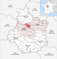
Category:Maps of groups of communes in Loiret
Jump to navigation
Jump to search
Departments of Metropolitan France: Ain [01] · Aisne [02] · Allier [03] · Alpes-de-Haute-Provence [04] · Hautes-Alpes [05] · Alpes-Maritimes [06] · Ardèche [07] · Ardennes [08] · Ariège [09] · Aube [10] · Aude [11] · Aveyron [12] · Bouches-du-Rhône [13] · Calvados [14] · Cantal [15] · Charente [16] · Charente-Maritime [17] · Cher [18] · Corrèze [19] · Corse-du-Sud [2A]† · Haute-Corse [2B]† · Côte-d’Or [21] · Côtes-d'Armor [22] · Creuse [23] · Dordogne [24] · Doubs [25] · Drôme [26] · Eure [27] · Eure-et-Loir [28] · Finistère [29] · Gard [30] · Haute-Garonne [31] · Gers [32] · Gironde [33] · Hérault [34] · Ille-et-Vilaine [35] · Indre [36] · Indre-et-Loire [37] · Isère [38] · Jura [39] · Landes [40] · Loir-et-Cher [41] · Loire [42] · Haute-Loire [43] · Loire-Atlantique [44] · Loiret [45] · Lot [46] · Lot-et-Garonne [47] · Lozère [48] · Maine-et-Loire [49] · Manche [50] · Marne [51] · Haute-Marne [52] · Mayenne [53] · Meurthe-et-Moselle [54] · Meuse [55] · Morbihan [56] · Moselle [57] · Nièvre [58] · Nord [59] · Oise [60] · Orne [61] · Pas-de-Calais [62] · Puy-de-Dôme [63] · Pyrénées-Atlantiques [64] · Hautes-Pyrénées [65] · Pyrénées-Orientales [66] · Bas-Rhin [67] · Haut-Rhin [68] · departmental district of the Rhône [69] · Rhône [69D]‡ · Haute-Saône [70] · Saône-et-Loire [71] · Sarthe [72] · Savoie [73] · Haute-Savoie [74] · Seine-Maritime [76] · Seine-et-Marne [77] · Yvelines [78] · Deux-Sèvres [79] · Somme [80] · Tarn [81] · Tarn-et-Garonne [82] · Var [83] · Vaucluse [84] · Vendée [85] · Vienne [86] · Haute-Vienne [87] · Vosges [88] · Yonne [89] · Territoire de Belfort [90] · Essonne [91] · Hauts-de-Seine [92] · Seine-Saint-Denis [93] · Val-de-Marne [94] · Val-d'Oise [95]
Overseas departments and regions: Guadeloupe [971] · Martinique [972] · French Guiana [973] · Réunion [974] · Mayotte [976]
Sui generis territories: New Caledonia [988]
Overseas departments and regions: Guadeloupe [971] · Martinique [972] · French Guiana [973] · Réunion [974] · Mayotte [976]
Sui generis territories: New Caledonia [988]
| NO WIKIDATA ID FOUND! Search for Maps of groups of communes in Loiret on Wikidata | |
| Upload media |
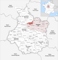
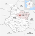
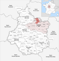
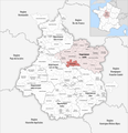
Français : Cartes des établissements publics de coopération intercommunale (communautés de communes, d’agglomération ou urbaines, métropoles, syndicats intercommunaux) et syndicats mixtes (dont les pôles métropolitains) du département français du Loiret.
Subcategories
This category has the following 3 subcategories, out of 3 total.
Media in category "Maps of groups of communes in Loiret"
The following 96 files are in this category, out of 96 total.
-
Gemeindeverbände im Département Loiret 2023.png 3,500 × 3,619; 2.57 MB
-
45-CC Clery Betz Ouanne.png 3,507 × 2,480; 1.07 MB
-
45-CC-Foret.svg 1,681 × 1,194; 1.81 MB
-
45-CC-Loges.svg 1,681 × 1,194; 1.81 MB
-
45-CC4V.svg 1,681 × 1,194; 1.81 MB
-
45-CCBL.svg 1,681 × 1,194; 1.81 MB
-
45-CCBLP.svg 1,681 × 1,194; 1.81 MB
-
45-CCCBO.svg 1,681 × 1,194; 1.81 MB
-
45-CCCFG.svg 1,681 × 1,194; 1.81 MB
-
45-CCG.svg 1,681 × 1,194; 1.81 MB
-
45-CCP.svg 1,681 × 1,194; 1.81 MB
-
45-CCPG.svg 1,681 × 1,194; 1.81 MB
-
45-CCPNL.svg 1,681 × 1,194; 1.81 MB
-
45-CCPS.svg 1,681 × 1,194; 1.81 MB
-
45-CCTVL.svg 1,681 × 1,194; 1.81 MB
-
45-CCVS.svg 1,681 × 1,194; 1.81 MB
-
45-Intercos-2019.png 3,507 × 2,480; 2.26 MB
-
45-Intercos2019-200005932.png 3,519 × 2,480; 1.09 MB
-
45-Intercos2019-200066280-Densités.png 3,519 × 2,480; 2.29 MB
-
45-Intercos2019-200067668-Densités.png 3,519 × 2,480; 1.75 MB
-
45-Intercos2019-200067676-Densités.png 3,519 × 2,480; 1.94 MB
-
45-Intercos2019-200068278-Densités.png 3,519 × 2,480; 1.54 MB
-
45-Intercos2019-200070100-Densités.png 3,519 × 2,480; 1.25 MB
-
45-Intercos2019-200070100.png 3,519 × 2,480; 1.24 MB
-
45-Intercos2019-200070183-Densités.png 3,519 × 2,480; 1.83 MB
-
45-Intercos2019-200071850-Densités.png 3,519 × 2,480; 2.47 MB
-
45-Intercos2019-244500203-Densités.png 3,519 × 2,480; 1.25 MB
-
45-Intercos2019-244500211-Densités.png 3,519 × 2,480; 1.31 MB
-
45-Intercos2019-244500419-Densités.png 3,519 × 2,480; 1.63 MB
-
45-Intercos2019-244500427-Densités.png 3,519 × 2,480; 1.61 MB
-
45-Intercos2019-244500468-Densités.png 3,519 × 2,480; 1.44 MB
-
45-Intercos2019-244500484-Densités.png 3,519 × 2,480; 1.31 MB
-
45-Intercos2019-244500542-Densités.png 3,519 × 2,480; 1.39 MB
-
45-Loiret-intercos-2019.png 3,507 × 2,480; 2.54 MB
-
45-Orleans-metropole.svg 1,681 × 1,194; 1.81 MB
-
Gemeindeverband Beauce Loirétaine 2019.png 3,500 × 3,619; 2.57 MB
-
Gemeindeverband Berry Loire Puisaye 2019.png 3,500 × 3,619; 2.57 MB
-
Gemeindeverband Canaux et Forêts en Gâtinais 2019.png 3,500 × 3,619; 2.57 MB
-
Gemeindeverband Cléry, du Betz et de l’Ouanne - Centre-Val de Loire 2019.png 3,500 × 3,619; 2.57 MB
-
Gemeindeverband Forêt 2019.png 3,500 × 3,619; 2.57 MB
-
Gemeindeverband Giennoises 2019.png 3,500 × 3,619; 2.57 MB
-
Intercos2019-200005932.png 3,519 × 2,480; 2.64 MB
-
Intercos2019-200035764.png 3,519 × 2,480; 2.42 MB
-
Intercos2019-200066280.png 3,519 × 2,480; 3.52 MB
-
Intercos2019-200067668.png 3,519 × 2,480; 3.36 MB
-
Intercos2019-200067676.png 3,519 × 2,480; 3.76 MB
-
Intercos2019-200068278.png 3,519 × 2,480; 3.23 MB
-
Intercos2019-200070100.png 3,519 × 2,480; 2.9 MB
-
Intercos2019-200070183.png 3,519 × 2,480; 3.57 MB
-
Intercos2019-200071850.png 3,519 × 2,480; 4.02 MB
-
Intercos2019-244500203.png 3,519 × 2,480; 2.55 MB
-
Intercos2019-244500211.png 3,519 × 2,480; 3.08 MB
-
Intercos2019-244500419.png 3,519 × 2,480; 3.1 MB
-
Intercos2019-244500427.png 3,519 × 2,480; 3.65 MB
-
Intercos2019-244500468.png 3,519 × 2,480; 3.41 MB
-
Intercos2019-244500484.png 3,519 × 2,480; 2.47 MB
-
Intercos2019-244500542.png 3,519 × 2,480; 2.27 MB
-
Localisation EPCI de Beauce et du Gâtinais dans le Loiret, France.svg 1,000 × 796; 141 KB
-
Localisation EPCI de Château-Renard dans le Loiret, France.svg 1,000 × 796; 141 KB
-
Localisation EPCI de Châtillon-Coligny dans le Loiret, France.svg 1,000 × 796; 141 KB
-
Localisation EPCI de la Beauce loirétaine dans le Loiret, France.svg 1,000 × 796; 141 KB
-
Localisation EPCI de la forêt dans le Loiret, France.svg 1,000 × 796; 141 KB
-
Localisation EPCI de la plaine du nord Loiret dans le Loiret, France.svg 1,000 × 796; 141 KB
-
Localisation EPCI des Loges dans le Loiret, France.svg 1,000 × 796; 141 KB
-
Localisation EPCI des quatre vallées dans le Loiret, France.svg 1,000 × 796; 141 KB
-
Localisation EPCI des terres puiseautines dans le Loiret, France.svg 1,000 × 796; 141 KB
-
Localisation EPCI du Beaunois dans le Loiret, France.svg 1,000 × 796; 141 KB
-
Localisation EPCI du Bellegardois dans le Loiret, France.svg 1,000 × 796; 141 KB
-
Localisation EPCI du Betz et de la Cléry dans le Loiret, France.svg 1,000 × 796; 141 KB
-
Localisation EPCI du canton de Beaugency dans le Loiret, France.svg 1,000 × 796; 141 KB
-
Localisation EPCI du canton de Briare dans le Loiret, France.svg 1,000 × 796; 141 KB
-
Localisation EPCI du canton de Châtillon-sur-Loire dans le Loiret, France.svg 1,000 × 796; 141 KB
-
Localisation EPCI du canton de La Ferté-Saint-Aubin dans le Loiret, France.svg 1,000 × 796; 141 KB
-
Localisation EPCI du canton de Lorris dans le Loiret, France.svg 1,000 × 796; 141 KB
-
Localisation EPCI du Malesherbois dans le Loiret, France.svg 1,000 × 796; 141 KB
-
Localisation EPCI du plateau beauceron dans le Loiret, France.svg 1,000 × 796; 141 KB
-
Localisation EPCI du Sullias dans le Loiret, France.svg 1,000 × 796; 141 KB
-
Localisation EPCI du val d'Ardoux dans le Loiret, France.svg 1,000 × 796; 141 KB
-
Localisation EPCI du val des Mauves dans le Loiret, France.svg 1,000 × 796; 141 KB
-
Localisation EPCI giennoises dans le Loiret, France.svg 1,000 × 796; 141 KB
-
Localisation EPCI Le cœur du Pithiverais dans le Loiret, France.svg 1,000 × 796; 141 KB
-
Localisation EPCI montargoise et rives du Loing dans le Loiret, France.svg 1,000 × 796; 141 KB
-
Localisation EPCI Orléans val de Loire dans le Loiret, France.svg 1,000 × 796; 141 KB
-
Localisation EPCI Val d'or et forêt dans le Loiret, France.svg 1,000 × 796; 141 KB
-
Localisation EPCI Valsol dans le Loiret, France.svg 1,000 × 796; 141 KB
-
Gemeindeverband Loges 2019.png 3,500 × 3,619; 2.57 MB
-
Gemeindeverband Montargoise et Rives du Loing 2019.png 3,500 × 3,619; 2.57 MB
-
Gemeindeverband Orléans Métropole 2019.png 3,500 × 3,619; 2.57 MB
-
Gemeindeverband Pithiverais 2019.png 3,500 × 3,619; 2.57 MB
-
Gemeindeverband Pithiverais-Gâtinais 2019.png 3,500 × 3,619; 2.57 MB
-
Gemeindeverband Plaine du Nord Loiret 2019.png 3,500 × 3,619; 2.57 MB
-
Gemeindeverband Portes de Sologne 2019.png 3,500 × 3,619; 2.57 MB
-
Pressigny-les-Pins-Interco.png 3,507 × 2,480; 1.4 MB
-
Gemeindeverband Quatre Vallées 2019.png 3,500 × 3,619; 2.57 MB
-
Gemeindeverband Terres du Val de Loire 2019.png 3,500 × 3,619; 2.6 MB
-
Gemeindeverband Val de Sully 2019.png 3,500 × 3,619; 2.57 MB


