Category:Maps of Yellowstone National Park
Jump to navigation
Jump to search
United States national parks: Acadia · American Samoa · Arches · Badlands · Big Bend · Biscayne · Black Canyon of the Gunnison · Bryce Canyon · Canyonlands · Capitol Reef · Carlsbad Caverns · Channel Islands · Congaree · Crater Lake · Cuyahoga Valley · Death Valley · Denali · Dry Tortugas · Everglades · Gateway Arch · Gates of the Arctic · Glacier · Glacier Bay · Grand Canyon · Grand Teton · Great Basin · Great Smoky Mountains · Guadalupe Mountains · Haleakalā · Hawaii Volcanoes · Hot Springs · Indiana Dunes · Isle Royale · Joshua Tree · Kenai Fjords · Kings Canyon · Kobuk Valley · Lake Clark · Lassen Volcanic · Mammoth Cave · Mesa Verde · Mount Rainier · North Cascades · Olympic · Petrified Forest · Pinnacles · Redwood · Rocky Mountain · Saguaro · Sequoia · Shenandoah · Theodore Roosevelt · Virgin Islands · Voyageurs · White Sands · Wind Cave · Wrangell-St. Elias · Yellowstone · Yosemite · Zion
Wikimedia category | |||||
| Upload media | |||||
| Instance of | |||||
|---|---|---|---|---|---|
| Category combines topics | |||||
| Yellowstone National Park | |||||
first national park in the world, located in Wyoming, Montana, and Idaho in the United States | |||||
| Instance of | |||||
| Part of |
| ||||
| Named after | |||||
| Location | |||||
| Visitor center | |||||
| Operator | |||||
| Has part(s) | |||||
| Heritage designation |
| ||||
| IUCN protected areas category | |||||
| Inception |
| ||||
| Significant event |
| ||||
| Part of the series | |||||
| Highest point | |||||
| Area |
| ||||
| Visitors per year |
| ||||
| official website | |||||
 | |||||
Subcategories
This category has the following 15 subcategories, out of 15 total.
Media in category "Maps of Yellowstone National Park"
The following 92 files are in this category, out of 92 total.
-
Map Yellowstone National Park.jpg 1,371 × 1,666; 307 KB
-
2020 Yellowstone Road Construction Map (48980485441).jpg 11,787 × 12,098; 13.26 MB
-
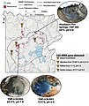
41467 2019 8499 Fig1.webp 1,314 × 1,451; 121 KB
-
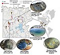
41598 2018 32593 Fig1 map.jpg 776 × 811; 153 KB
-
41598 2018 32593 Fig1.webp 1,650 × 1,300; 276 KB
-
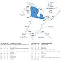
43705 2022 175 Fig2 HTML.webp 2,096 × 1,459; 459 KB
-
43705 2022 175 Fig2l HTML.jpg 1,572 × 1,458; 611 KB
-
43705 2022 175 Fig2ll HTML.jpg 1,230 × 1,458; 500 KB
-
43705 2023 225 Fig1 LCB.jpg 1,780 × 454; 380 KB
-
43705 2023 225 Fig1.webp 2,025 × 1,385; 363 KB
-
Greater Yellowstone ecosystem map.jpg 640 × 952; 135 KB
-
Grizzly bear range expansion in Greater Yellowstone Ecosystem 1990–2018 – animated map.gif 1,440 × 1,080; 1.35 MB
-
Heinrich Berann NPS Panorama of Yellowstone with labels.jpg 12,132 × 9,021; 89.26 MB
-
Heinrich Berann NPS Panorama of Yellowstone without labels.jpg 12,358 × 8,445; 97.47 MB
-
Heinrich Berann NPS Yellowstone.jpg 5,284 × 3,587; 8.19 MB
-
Lewis Lake, Wyoming - OSM.png 1,169 × 826; 378 KB
-
Yellowstone National Park location map.svg 576 × 576; 773 KB
-
Yellowstone National Park relief location map.png 1,920 × 1,920; 2.56 MB
-
LocMap of WH Yellowstone.png 280 × 210; 29 KB
-
LowerGeyserBasinBelcher1872.jpg 10,528 × 6,736; 10.83 MB
-
Map Wyoming NPS sites USA.gif 500 × 429; 15 KB
-
Map-of-YNP-showing-hydrothermal-areas.jpg 980 × 1,070; 227 KB
-
Midway Geyser Basin map.jpg 1,600 × 1,677; 647 KB
-
NPS craters-of-the-moon-regional-map.jpg 865 × 918; 154 KB
-
NPS craters-of-the-moon-regional-map.pdf 370 × 393; 752 KB
-
NPS yellowstone-backcountry-map.jpg 4,370 × 3,195; 2.35 MB
-
NPS yellowstone-canyon-backcountry-map.jpg 2,066 × 732; 151 KB
-
NPS yellowstone-canyon-map.jpg 595 × 736; 91 KB
-
NPS yellowstone-canyon-village-printable-map.gif 626 × 829; 63 KB
-
NPS yellowstone-canyon-winter-map.gif 1,038 × 1,645; 198 KB
-
NPS yellowstone-fishing-bridge-lake-bridge-bay-map.jpg 814 × 730; 95 KB
-
NPS yellowstone-fountain-paint-pot-trail-map.gif 516 × 769; 50 KB
-
NPS yellowstone-grand-canyon-trail-map.gif 580 × 737; 48 KB
-
NPS yellowstone-heart-lake-backcountry-map.jpg 1,552 × 1,528; 220 KB
-
NPS yellowstone-lake-backcountry-map.jpg 2,090 × 2,536; 819 KB
-
NPS yellowstone-lake-depth-map.jpg 1,552 × 2,190; 777 KB
-
NPS yellowstone-lake-geologic-map.jpg 4,508 × 4,460; 2.93 MB
-
NPS yellowstone-lake-printable-map.gif 899 × 827; 72 KB
-
NPS yellowstone-lodging-map.gif 630 × 616; 28 KB
-
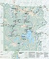
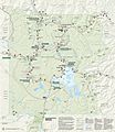
NPS yellowstone-map-2020.jpg 3,000 × 3,558; 2.5 MB
-
NPS yellowstone-map.jpg 3,025 × 3,487; 1.85 MB
-
NPS yellowstone-map.pdf 2,520 × 3,360; 11.18 MB
-
NPS yellowstone-northeast-winter-map.gif 1,038 × 1,645; 290 KB
-
NPS yellowstone-old-faithful-area-trail-map.gif 593 × 751; 36 KB
-
NPS yellowstone-old-faithful-map.jpg 589 × 734; 85 KB
-
NPS yellowstone-old-faithful-printable-map.gif 623 × 826; 66 KB
-
NPS yellowstone-old-faithful-trail-map.gif 582 × 646; 39 KB
-
NPS yellowstone-old-faithful-winter-map.gif 1,038 × 1,645; 350 KB
-
NPS yellowstone-printable-map.gif 2,580 × 3,100; 564 KB
-
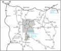
NPS yellowstone-regional-map.jpg 1,430 × 982; 199 KB
-
NPS yellowstone-regional-road-map.gif 1,163 × 980; 113 KB
-
NPS yellowstone-river-backcountry-map.jpg 2,070 × 1,366; 460 KB
-
NPS yellowstone-shoshone-lake-backcountry-map.jpg 1,058 × 2,030; 263 KB
-
NPS yellowstone-simple-map.gif 630 × 616; 27 KB
-
NPS yellowstone-topo-map-north.jpg 5,685 × 3,597; 5.96 MB
-
NPS yellowstone-topo-map-south.jpg 5,818 × 3,659; 5.96 MB
-
NPS yellowstone-tower-winter-map.gif 1,645 × 1,048; 395 KB
-
NPS yellowstone-west-thumb-geyser-basin-trail-map.gif 725 × 724; 41 KB
-
NPS yellowstone-west-thumb-grant-printable-map.gif 625 × 826; 53 KB
-
NPS yellowstone-west-thumb-grant-village-map.jpg 596 × 736; 72 KB
-
NPS yellowstone-west-yellowstone-winter-trails.gif 963 × 1,645; 261 KB
-
NPS yellowstone-winter-map.gif 1,656 × 2,096; 294 KB
-
OldFaithfulHistoricDistrictApplication Map.jpg 4,380 × 3,385; 1.14 MB
-
Park map exhibit at Canyon Visitor Education Center (48637380658).jpg 8,374 × 5,583; 31.53 MB
-
TopoReliefMapYellowstoneNationalPark.jpg 1,056 × 1,344; 184 KB
-
Tower Falls Parking Area Plan - DPLA - a88b0be2760e139aad3de6a784a20a2e.JPG 12,444 × 10,720; 14.92 MB
-
Upper Falls Viewpoints (b82a8cc7-04c3-41d3-8856-f0ed30b10266).png 1,400 × 1,600; 469 KB
-
Where to See Volcanic Flows (b9c667f4-155d-451f-67f8-856f078bb5e2).png 2,287 × 2,347; 466 KB
-
YELL145676.00001 (19302965281).jpg 8,339 × 7,342; 68.22 MB
-
YELL145676.00002 (19292943972).jpg 2,936 × 4,012; 15.59 MB
-
Yellowstone Hamilton Stores Map.png 3,000 × 3,558; 12.19 MB
-
Yellowstone Major Calderas Map Simplified.jpg 1,275 × 1,020; 288 KB
-
Yellowstone Major Calderas Map.jpg 1,275 × 1,020; 310 KB
-
Yellowstone Map.jpg 800 × 1,031; 746 KB
-
Yellowstone mapdirectory.JPG 4,320 × 3,240; 3.69 MB
-
Yellowstone National Park Map.png 2,857 × 3,797; 2.46 MB
-
Yellowstone National Park.svg 1,000 × 1,000; 23 KB
-
Yellowstone relief map.jpg 800 × 500; 171 KB
-
Yellowstone route Nez Perce.png 748 × 486; 674 KB
-
Yellowstone Zone of Death.png 2,751 × 3,013; 1.78 MB
-
Yellowstone-area-map.png 2,261 × 2,416; 805 KB
-
Yellowstone-area-map.svg 2,386 × 2,609; 4.87 MB
-
Yellowstone-map.png 845 × 926; 258 KB
-
Yellowstone-TF.jpg 7,680 × 4,320; 8.3 MB
-
Yellowstone.png 750 × 750; 242 KB
-
YellowstoneMap.jpg 394 × 410; 25 KB
-
YellowstoneNationalPark1880.jpg 2,867 × 2,035; 1.1 MB
-
YellowstoneNationalParkMap.png 551 × 577; 38 KB
-
YellowstonePanorama1910.jpg 2,528 × 2,680; 1.41 MB
-
YellowstonePlateaus.jpg 3,300 × 3,655; 7.44 MB
-
YellowstoneTopoWithRanges.jpg 1,056 × 1,344; 281 KB


