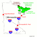
Category:Maps of Voyageurs National Park
Jump to navigation
Jump to search
United States national parks: Acadia · American Samoa · Arches · Badlands · Big Bend · Biscayne · Black Canyon of the Gunnison · Bryce Canyon · Canyonlands · Capitol Reef · Carlsbad Caverns · Channel Islands · Congaree · Crater Lake · Cuyahoga Valley · Death Valley · Denali · Dry Tortugas · Everglades · Gateway Arch · Gates of the Arctic · Glacier · Glacier Bay · Grand Canyon · Grand Teton · Great Basin · Great Smoky Mountains · Guadalupe Mountains · Haleakalā · Hawaii Volcanoes · Hot Springs · Indiana Dunes · Isle Royale · Joshua Tree · Kenai Fjords · Kings Canyon · Kobuk Valley · Lake Clark · Lassen Volcanic · Mammoth Cave · Mesa Verde · Mount Rainier · North Cascades · Olympic · Petrified Forest · Pinnacles · Redwood · Rocky Mountain · Saguaro · Sequoia · Shenandoah · Theodore Roosevelt · Virgin Islands · Voyageurs · White Sands · Wind Cave · Wrangell-St. Elias · Yellowstone · Yosemite · Zion
English: Maps of Voyageurs National Park
Wikimedia category | |||||
| Upload media | |||||
| Instance of | |||||
|---|---|---|---|---|---|
| Category combines topics | |||||
| Voyageurs National Park | |||||
United States National Park near International Falls, Minnesota | |||||
| Instance of | |||||
| Named after |
| ||||
| Location |
| ||||
| Visitor center | |||||
| Operator | |||||
| Heritage designation |
| ||||
| IUCN protected areas category | |||||
| Inception |
| ||||
| Area |
| ||||
| Visitors per year |
| ||||
| official website | |||||
 | |||||
Subcategories
This category has only the following subcategory.
Media in category "Maps of Voyageurs National Park"
The following 29 files are in this category, out of 29 total.
-
Bwca map.png 1,000 × 781; 311 KB
-
La Vérendrye Map.jpg 1,024 × 364; 70 KB
-
LocMap Voyageurs np.png 280 × 183; 40 KB
-
Northern Minnesota Parks map.gif 806 × 823; 42 KB
-
Northern Parks overview Map.jpg 1,140 × 890; 169 KB
-
NPS Voyageurs National Park map.png 916 × 691; 783 KB
-
NPS voyageurs-ash-river-blind-ash-bay-trail-map.jpg 1,111 × 759; 92 KB
-
NPS voyageurs-ash-river-trails-map.jpg 1,111 × 855; 92 KB
-
NPS voyageurs-black-bay-ski-hiking-trail-map.jpg 1,320 × 902; 145 KB
-
NPS voyageurs-camping-houseboating-backside-map.jpg 2,100 × 2,880; 1.6 MB
-
NPS voyageurs-camping-houseboating-backside-map.pdf 2,625 × 3,600; 474 KB
-
NPS voyageurs-camping-houseboating-map.jpg 2,880 × 2,100; 1.54 MB
-
NPS voyageurs-camping-houseboating-map.pdf 3,600 × 2,625; 669 KB
-
NPS voyageurs-cruiser-lake-trail.gif 994 × 1,287; 116 KB
-
NPS voyageurs-day-use-site-map.jpg 1,320 × 1,020; 251 KB
-
NPS voyageurs-echo-bay-map.gif 892 × 1,155; 49 KB
-
NPS voyageurs-ellseworth-rock-gardens-map.jpg 1,360 × 776; 253 KB
-
NPS voyageurs-kab-ash-trail-map.gif 1,100 × 850; 109 KB
-
NPS voyageurs-map.jpg 3,101 × 2,207; 767 KB
-
NPS voyageurs-map.pdf 3,550 × 2,527; 8.52 MB
-
NPS voyageurs-oberholtzer-trail-map.jpg 1,320 × 1,020; 97 KB
-
NPS voyageurs-regional-map.jpg 918 × 810; 108 KB
-
NPS voyageurs-regional-map.pdf 593 × 522; 884 KB
-
NPS voyageurs-snowmobile-trails-map.jpg 2,800 × 1,800; 1.5 MB
-
NPS voyageurs-snowmobile-trails-map.pdf 2,100 × 1,350; 3.23 MB
-
NPS voyageurs-vegetation-map.jpg 3,949 × 2,420; 2.12 MB
-
Voyageurs National Park map 2005.04.png 3,370 × 2,256; 399 KB
-
Voyageurs National Park.svg 1,000 × 1,000; 220 KB
-
Voyageurs NP Map.jpg 3,551 × 2,527; 1.14 MB


