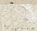
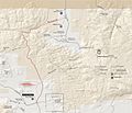
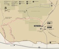
Category:Maps of Joshua Tree National Park
Jump to navigation
Jump to search
United States national parks: Acadia · American Samoa · Arches · Badlands · Big Bend · Biscayne · Black Canyon of the Gunnison · Bryce Canyon · Canyonlands · Capitol Reef · Carlsbad Caverns · Channel Islands · Congaree · Crater Lake · Cuyahoga Valley · Death Valley · Denali · Dry Tortugas · Everglades · Gateway Arch · Gates of the Arctic · Glacier · Glacier Bay · Grand Canyon · Grand Teton · Great Basin · Great Smoky Mountains · Guadalupe Mountains · Haleakalā · Hawaii Volcanoes · Hot Springs · Indiana Dunes · Isle Royale · Joshua Tree · Kenai Fjords · Kings Canyon · Kobuk Valley · Lake Clark · Lassen Volcanic · Mammoth Cave · Mesa Verde · Mount Rainier · North Cascades · Olympic · Petrified Forest · Pinnacles · Redwood · Rocky Mountain · Saguaro · Sequoia · Shenandoah · Theodore Roosevelt · Virgin Islands · Voyageurs · White Sands · Wind Cave · Wrangell-St. Elias · Yellowstone · Yosemite · Zion
English: Maps of Joshua Tree National Park — in the Mojave Desert and Colorado Desert, Southern California.
Wikimedia category | |||||
| Upload media | |||||
| Instance of | |||||
|---|---|---|---|---|---|
| Category combines topics | |||||
| Joshua Tree National Park | |||||
national park of the United States | |||||
| Instance of | |||||
| Part of | |||||
| Named after | |||||
| Location |
| ||||
| Visitor center | |||||
| Operator | |||||
| Heritage designation |
| ||||
| IUCN protected areas category | |||||
| Inception |
| ||||
| Highest point | |||||
| Area |
| ||||
| Visitors per year |
| ||||
| official website | |||||
 | |||||
Subcategories
This category has the following 2 subcategories, out of 2 total.
Media in category "Maps of Joshua Tree National Park"
The following 54 files are in this category, out of 54 total.
-
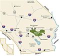
Joshua Tree National Park - area map.jpg 1,164 × 1,091; 112 KB
-
LocMap Joshua Tree National Park.png 280 × 183; 31 KB
-
Indian Cove.jpg 3,089 × 2,293; 781 KB
-
Joshua Tree National Park.svg 1,000 × 1,000; 11 KB
-
Joshua tree national-park map crop.jpg 1,327 × 1,086; 195 KB
-
Joshua tree national-park map.jpg 6,774 × 3,267; 1.64 MB
-
Joshua-Tree-NP-TF.jpg 4,800 × 2,700; 3.39 MB
-
NPS joshua-tree-49-palms-oasis-trail-map.gif 900 × 1,131; 39 KB
-
NPS joshua-tree-area-map.gif 859 × 804; 61 KB
-
NPS joshua-tree-area-map.pdf 858 × 804; 120 KB
-
NPS joshua-tree-barker-dam-nature-trail-map.gif 996 × 697; 57 KB
-
NPS joshua-tree-belle-whitetank-rock-climbing-map.gif 357 × 1,287; 58 KB
-
NPS joshua-tree-belle-whitetank-rock-climbing-map.pdf 397 × 1,287; 78 KB
-
NPS joshua-tree-berdoo-canyon-road-map.gif 1,351 × 1,266; 98 KB
-
NPS joshua-tree-berdoo-canyon-road-map.pdf 2,025 × 1,900; 78 KB
-
NPS joshua-tree-blackrock-canyon-board-map.jpg 1,947 × 1,673; 506 KB
-
NPS joshua-tree-cottonwood-spring-board-map.jpg 1,921 × 1,010; 306 KB
-
NPS joshua-tree-covington-board-map.jpg 2,562 × 877; 431 KB
-
NPS joshua-tree-geology-tour-road-map.pdf 1,881 × 3,081; 57 KB
-
NPS joshua-tree-geology-tour-rock-climbing-map.pdf 1,750 × 1,093; 301 KB
-
NPS joshua-tree-hidden-valley-rock-climbing-map.gif 2,634 × 2,197; 930 KB
-
NPS joshua-tree-hidden-valley-rock-climbing-map.pdf 2,256 × 1,883; 1.13 MB
-
NPS joshua-tree-hidden-valley-trail-map.gif 849 × 894; 47 KB
-
NPS joshua-tree-indian-cove-board-map.jpg 2,068 × 1,784; 449 KB
-
NPS joshua-tree-indian-cove-rock-climbing-map.gif 1,171 × 845; 272 KB
-
NPS joshua-tree-indian-cove-rock-climbing-map.pdf 966 × 666; 326 KB
-
NPS joshua-tree-juniper-flats-board-map.jpg 1,911 × 1,203; 364 KB
-
NPS joshua-tree-keys-west-board-map.jpg 2,070 × 1,780; 436 KB
-
NPS joshua-tree-lost-horse-loop-trail-map.gif 993 × 692; 49 KB
-
NPS joshua-tree-lost-palms-oasis-mastadon-peak-trail-map.gif 992 × 707; 56 KB
-
NPS joshua-tree-map.jpg 4,031 × 1,927; 1.18 MB
-
NPS joshua-tree-map.pdf 3,454 × 1,652; 6.56 MB
-
NPS joshua-tree-north-entrance-board-map.jpg 816 × 1,936; 279 KB
-
NPS joshua-tree-old-dale-black-eagle-mine-road-map.gif 1,131 × 1,652; 116 KB
-
NPS joshua-tree-old-dale-black-eagle-mine-road-map.pdf 2,118 × 3,097; 84 KB
-
NPS joshua-tree-pine-city-board-map.jpg 1,735 × 1,400; 333 KB
-
NPS joshua-tree-pinkham-canyon-road-map.gif 1,176 × 990; 85 KB
-
NPS joshua-tree-pinkham-canyon-road-map.pdf 2,204 × 1,856; 73 KB
-
NPS joshua-tree-pleasant-valley-board-map.jpg 1,560 × 1,050; 238 KB
-
NPS joshua-tree-porcupine-wash-board-map.jpg 1,473 × 1,242; 226 KB
-
NPS joshua-tree-queen-valley-rock-climbing-map.gif 931 × 1,036; 238 KB
-
NPS joshua-tree-queen-valley-rock-climbing-map.pdf 777 × 816; 307 KB
-
NPS joshua-tree-ryan-mountain-trail-map.gif 991 × 692; 58 KB
-
NPS joshua-tree-sheep-pass-rock-climbing-map.gif 1,263 × 754; 164 KB
-
NPS joshua-tree-sheep-pass-rock-climbing-map.pdf 1,160 × 664; 212 KB
-
NPS joshua-tree-simple-map.jpg 3,927 × 1,909; 1.08 MB
-
NPS joshua-tree-simple-map.pdf 4,950 × 2,406; 636 KB
-
NPS joshua-tree-split-rock-rock-climbing-map.gif 1,413 × 1,410; 366 KB
-
NPS joshua-tree-split-rock-rock-climbing-map.pdf 1,454 × 1,408; 503 KB
-
NPS joshua-tree-turkey-flats-board-map.jpg 1,906 × 1,655; 252 KB
-
NPS joshua-tree-twin-tanks-board-map.jpg 1,262 × 1,635; 348 KB
-
NPS joshua-tree-vegetation-map.gif 4,883 × 2,636; 1.15 MB
-
NPS joshua-tree-willow-hole-trail-map.gif 824 × 1,022; 214 KB
-
Wpdms shdrlfi020l colorado desert.jpg 300 × 267; 49 KB


