Category:Maps of Crater Lake National Park
Jump to navigation
Jump to search
United States national parks: Acadia · American Samoa · Arches · Badlands · Big Bend · Biscayne · Black Canyon of the Gunnison · Bryce Canyon · Canyonlands · Capitol Reef · Carlsbad Caverns · Channel Islands · Congaree · Crater Lake · Cuyahoga Valley · Death Valley · Denali · Dry Tortugas · Everglades · Gateway Arch · Gates of the Arctic · Glacier · Glacier Bay · Grand Canyon · Grand Teton · Great Basin · Great Smoky Mountains · Guadalupe Mountains · Haleakalā · Hawaii Volcanoes · Hot Springs · Indiana Dunes · Isle Royale · Joshua Tree · Kenai Fjords · Kings Canyon · Kobuk Valley · Lake Clark · Lassen Volcanic · Mammoth Cave · Mesa Verde · Mount Rainier · North Cascades · Olympic · Petrified Forest · Pinnacles · Redwood · Rocky Mountain · Saguaro · Sequoia · Shenandoah · Theodore Roosevelt · Virgin Islands · Voyageurs · White Sands · Wind Cave · Wrangell-St. Elias · Yellowstone · Yosemite · Zion
English: Maps of Crater Lake National Park
Wikimedia category | |||||
| Upload media | |||||
| Instance of | |||||
|---|---|---|---|---|---|
| Category combines topics | |||||
| Crater Lake National Park | |||||
national park in Klamath, Douglas, and Jackson counites in Oregon, United States 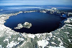 El Llac del Cràter, vista aèria de l'oest i a l'hivern. | |||||
| Instance of | |||||
| Named after | |||||
| Location |
| ||||
| Visitor center | |||||
| Operator | |||||
| IUCN protected areas category | |||||
| Inception |
| ||||
| Mountain range |
| ||||
| Highest point | |||||
| Area |
| ||||
| Visitors per year |
| ||||
| official website | |||||
 | |||||
Subcategories
This category has the following 4 subcategories, out of 4 total.
G
M
Media in category "Maps of Crater Lake National Park"
The following 29 files are in this category, out of 29 total.
-
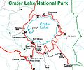
CraterLakeMap.jpg 428 × 358; 42 KB
-
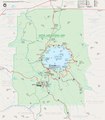
Crater Lake National Park map.jpg 2,519 × 2,873; 1.37 MB
-
Crater Lake National Park map.svg 1,511 × 1,724; 1.46 MB
-
Crater Lake National Park SW corner map.jpg 1,129 × 779; 318 KB
-
Crater Lake National Park, OR 2006 (6539577583).jpg 451 × 600; 129 KB
-
Crater Lake National Park, Oregon LOC 97684223.jpg 4,141 × 5,796; 2.96 MB
-
Crater Lake National Park, Oregon LOC 97684223.tif 4,141 × 5,796; 68.67 MB
-
Crater Lake National Park-Bilingual Map.pdf 2,518 × 2,872; 1.62 MB
-
Crater Lake National Park-Mapa Bilingue.jpg 5,037 × 5,745; 3.06 MB
-
Crater Lake National Park.svg 1,000 × 1,000; 7 KB
-
CraterLake1931USGSmap.png 4,470 × 6,018; 23.43 MB
-
LocMap Crater Lake National Park.png 280 × 183; 31 KB
-
NPS crater-lake-depth-map.gif 606 × 544; 189 KB
-
NPS crater-lake-east-topo-map.pdf 3,052 × 4,054; 5.43 MB
-
NPS crater-lake-elevation-map.jpg 955 × 1,408; 280 KB
-
NPS crater-lake-hazards-map.jpg 2,565 × 3,814; 2.34 MB
-
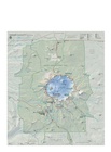
NPS crater-lake-map.jpg 2,467 × 2,873; 1.74 MB
-
NPS crater-lake-map.pdf 2,466 × 2,872; 10.45 MB
-
NPS crater-lake-precipitation-map.jpg 1,166 × 1,536; 291 KB
-
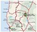
NPS crater-lake-regional-map.jpg 737 × 635; 107 KB
-
NPS crater-lake-regional-map.pdf 441 × 381; 114 KB
-
NPS crater-lake-seasonal-precipitation-map.jpg 1,507 × 1,156; 282 KB
-
NPS crater-lake-seasonal-temperature-map.jpg 1,507 × 1,156; 266 KB
-
NPS crater-lake-west-topo-map.pdf 3,056 × 4,058; 4.68 MB
-
Rim Drive map, Crater Lake National Park.JPG 390 × 357; 34 KB
-
Rim Village map, Comfort Station -4.JPG 520 × 281; 54 KB
-
Rim Village map, Plaza Comfort Station.JPG 561 × 309; 41 KB
