Category:Maps of Canyonlands National Park
Jump to navigation
Jump to search
United States national parks: Acadia · American Samoa · Arches · Badlands · Big Bend · Biscayne · Black Canyon of the Gunnison · Bryce Canyon · Canyonlands · Capitol Reef · Carlsbad Caverns · Channel Islands · Congaree · Crater Lake · Cuyahoga Valley · Death Valley · Denali · Dry Tortugas · Everglades · Gateway Arch · Gates of the Arctic · Glacier · Glacier Bay · Grand Canyon · Grand Teton · Great Basin · Great Smoky Mountains · Guadalupe Mountains · Haleakalā · Hawaii Volcanoes · Hot Springs · Indiana Dunes · Isle Royale · Joshua Tree · Kenai Fjords · Kings Canyon · Kobuk Valley · Lake Clark · Lassen Volcanic · Mammoth Cave · Mesa Verde · Mount Rainier · North Cascades · Olympic · Petrified Forest · Pinnacles · Redwood · Rocky Mountain · Saguaro · Sequoia · Shenandoah · Theodore Roosevelt · Virgin Islands · Voyageurs · White Sands · Wind Cave · Wrangell-St. Elias · Yellowstone · Yosemite · Zion
Wikimedia category | |||||
| Upload media | |||||
| Instance of | |||||
|---|---|---|---|---|---|
| Category combines topics | |||||
| Canyonlands National Park | |||||
U.S. National Park located in southeastern Utah near the town of Moab  Pohled na Green River | |||||
| Instance of | |||||
| Part of | |||||
| Location | San Juan County, Utah | ||||
| Visitor center | |||||
| Operator | |||||
| Heritage designation |
| ||||
| IUCN protected areas category | |||||
| Inception |
| ||||
| Highest point |
| ||||
| Area |
| ||||
| Visitors per year |
| ||||
| official website | |||||
 | |||||
Subcategories
This category has the following 2 subcategories, out of 2 total.
Media in category "Maps of Canyonlands National Park"
The following 33 files are in this category, out of 33 total.
-
Canyonlands National Park-Glen Canyon map.jpg 1,134 × 782; 249 KB
-
Canyonlands National Park.svg 1,000 × 1,000; 12 KB
-
Canyonlands-map.png 1,742 × 1,805; 535 KB
-
Canyonlands-map.svg 2,375 × 2,585; 2.78 MB
-
Elephant Hill Trailhead, The Needles, Canyonlands (29671537175).jpg 4,178 × 3,349; 4.54 MB
-
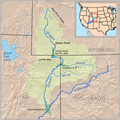
Greenutrivermap.png 500 × 500; 409 KB
-
HFCA 1607 People Volume 1 060.jpg (6578970d351c4a58a74fcdbd7f964050).jpg 5,231 × 7,930; 3.56 MB
-
LocMap Canyonlands National Park.png 280 × 183; 31 KB
-
Map of Canyonlands National Park with White Rim Road marked red.png 796 × 1,073; 330 KB
-
Map of Canyonlands National Park.jpg 2,831 × 3,693; 2.74 MB
-
Map of Canyonlands National Park.png 2,831 × 3,693; 1.79 MB
-
NPS canyonlands-horseshoe-canyon-map.gif 1,011 × 1,614; 128 KB
-
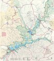
NPS canyonlands-interior-map.jpg 6,000 × 4,268; 9.7 MB
-
NPS canyonlands-island-in-the-sky-map.gif 1,288 × 1,960; 283 KB
-
NPS canyonlands-island-in-the-sky-map.jpg 892 × 1,114; 307 KB
-
NPS canyonlands-map.jpg 2,963 × 3,918; 1.8 MB
-
NPS canyonlands-map.pdf 2,539 × 3,358; 7.8 MB
-
NPS canyonlands-maze-map.gif 1,290 × 1,988; 280 KB
-
NPS canyonlands-maze-map.jpg 1,258 × 1,544; 471 KB
-
NPS canyonlands-national-park-map.jpg 3,369 × 4,537; 2.4 MB
-
NPS canyonlands-national-park-map.pdf 2,527 × 3,402; 14.69 MB
-
NPS canyonlands-needles-map.gif 1,290 × 1,948; 250 KB
-
NPS canyonlands-needles-map.jpg 870 × 792; 188 KB
-
NPS canyonlands-printable-map.gif 2,720 × 3,520; 785 KB
-
NPS canyonlands-printable-map.pdf 2,550 × 3,300; 518 KB
-
NPS canyonlands-simple-map.gif 2,686 × 3,508; 718 KB
-
NPS canyonlands-simple-map.pdf 2,518 × 3,289; 425 KB
-
NPS canyonlands-upheaval-dome-map.gif 965 × 605; 36 KB
-
NPS canyonlands-vegetation-map.jpg 3,860 × 4,829; 3.61 MB
-
NPS cave-spring-map.jpg 980 × 652; 107 KB
-
NPS glen-canyon-map.pdf 2,531 × 2,875; 7.78 MB
-
The Heart of Canyonlands National Park.jpg 12,960 × 9,472; 39.88 MB
-
Waynecounty ut.png 1,000 × 270; 18 KB


