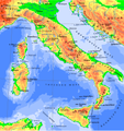
Category:Maps of the Italian Peninsula
Jump to navigation
Jump to search
Subcategories
This category has the following 4 subcategories, out of 4 total.
I
S
V
Media in category "Maps of the Italian Peninsula"
The following 9 files are in this category, out of 9 total.
-
1814 Rizzi-Zannoni Map of Italy - Geographicus - Italy-rizzizannoni-1814.jpg 2,573 × 6,000; 4.96 MB
-
Appenine Peninsula Bul Map.png 4,246 × 4,500; 2.02 MB
-
Italian Peninsula in Europe with lines.svg 680 × 520; 540 KB
-
Italian Peninsula in Europe.svg 680 × 520; 539 KB
-
Italian unification.gif 499 × 599; 219 KB
-
Italianpenisula.jpg 4,296 × 4,192; 2.28 MB
-
Italy 1853.jpg 9,032 × 6,464; 21.33 MB
-
Pictorial Map of Italy.1868.jpg 5,475 × 6,560; 33.5 MB
-
Salvator Oliva. Mediterranean. HM 2515. PORTOLAN ATLAS. Marseilles, 1619.B.jpg 2,330 × 2,215; 1.68 MB


