Category:Geological maps of Montana
Appearance
States of the United States: Alabama · Alaska · Arizona · Arkansas · California · Colorado · Connecticut · Delaware · Florida · Georgia · Hawaii · Idaho · Illinois · Indiana · Iowa · Kansas · Kentucky · Louisiana · Maine · Maryland · Massachusetts · Michigan · Minnesota · Mississippi · Missouri · Montana · Nebraska · Nevada · New Hampshire · New Jersey · New Mexico · New York · North Carolina · North Dakota · Ohio · Oklahoma · Oregon · Pennsylvania · Rhode Island · South Carolina · South Dakota · Tennessee · Texas · Utah · Vermont · Virginia · Washington · West Virginia · Wisconsin · Wyoming
Puerto Rico
Puerto Rico
Subcategories
This category has the following 6 subcategories, out of 6 total.
Media in category "Geological maps of Montana"
The following 35 files are in this category, out of 35 total.
-
Adel volcanics.jpg 1,661 × 1,808; 689 KB
-
Bakken Wells 2013.png 1,095 × 807; 374 KB
-
Boulder batholith geologic map.jpg 689 × 860; 148 KB
-
Boulder batholith location.jpg 712 × 779; 81 KB
-
Fig 12 Map showing preglacial river system of northern Montana.jpg 1,050 × 827; 113 KB
-
Fig 14 Map showing drainage of part of northern Montana at early Wisc stage.jpg 1,057 × 769; 124 KB
-
Fig 15 Map showing post glacial drainage system of part of northern Montana.jpg 1,076 × 844; 158 KB
-
Fig 16 Map showing pre-Glacial river system.jpg 1,438 × 1,085; 171 KB
-
Fig 17 Map showing drainage of no Montana.jpg 1,448 × 1,066; 203 KB
-
Fig 18 May showing drainage of Northern Montana.jpg 1,449 × 998; 175 KB
-
Fig 19 Map showing post-Glacial drainage system.jpg 1,407 × 1,048; 208 KB
-
Fig 4 Map of portions of southern Alberta and Northern Montana.jpg 854 × 918; 151 KB
-
Glacial lakes in Montana.jpg 745 × 470; 228 KB
-
GreatFallstectoniczone.jpg 603 × 511; 163 KB
-
Grouse Creek Block Location.jpg 563 × 523; 185 KB
-
Grouse Creek block location1.jpg 1,131 × 1,206; 565 KB
-
Judith River Formation (Montana) geology and stratigraphy.jpg 1,606 × 2,008; 554 KB
-
Map of Region of Great Falls, Montana (pg 88).jpg 3,746 × 2,149; 1.77 MB
-
NPS glacier-geologic-map.jpg 7,276 × 5,252; 9.24 MB
-
NPS little-bighorn-geologic-map.jpg 3,180 × 3,628; 2.01 MB
-
Powder-River-Map.jpg 412 × 444; 130 KB
-
Purcell and Rocky Mountain Trenches within the US.png 1,228 × 835; 122 KB
-
Shonkin Sag map.jpg 763 × 512; 209 KB
-
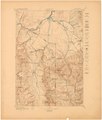
USGS GF-24 1-prnt.pdf 2,808 × 3,295; 3.99 MB
-
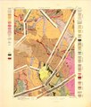
USGS GF-24 2-prnt.pdf 2,775 × 3,260; 4.09 MB
-
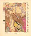
USGS GF-24 3-prnt.pdf 2,775 × 3,260; 4.98 MB
-
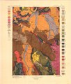
USGS GF-24 4-prnt.pdf 2,775 × 3,258; 5.04 MB
-
USGS Map with Sphinx Conglomerate Annotated.jpg 5,550 × 6,516; 4.12 MB
-
Williston Basin structure map.jpg 871 × 708; 86 KB
-
Williston Basin tectonic map.jpg 635 × 748; 83 KB
-
Yellowstone Caldera map-HE.jpg 3,072 × 2,479; 1.76 MB
-
Yellowstone Caldera map2 750px.JPG 750 × 600; 73 KB
-
Yellowstone Caldera map2.jpg 3,072 × 2,479; 2.42 MB

