Category:Maps of the Upper Peninsula
Jump to navigation
Jump to search
Media in category "Maps of the Upper Peninsula"
The following 23 files are in this category, out of 23 total.
-
1842TreatyOfLaPointe.jpg 1,650 × 1,200; 1.2 MB
-
1849 Land Survey Map of Michigan Upper Peninsula - Geographicus - Michigan-ls-1850.jpg 3,000 × 1,810; 964 KB
-
2015 Upper Peninsula Population Density Map.jpg 1,280 × 720; 69 KB
-
Central Upper Peninsula within Michigan's Upper Peninsula.jpg 1,280 × 720; 48 KB
-
Eastern Upper Peninsula within Michigan's Upper Peninsula.jpg 1,280 × 720; 53 KB
-
Escanaba-and-lake-superior-map.jpg 1,607 × 2,400; 989 KB
-
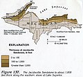
Jacobsville Sandstone Thickness.jpeg 373 × 346; 116 KB
-
KeweenawPeninsula.svg 446 × 365; 74 KB
-
Map of Michigan highlighting Copper Country.gif 1,176 × 1,444; 90 KB
-
MIMap-doton-Menominee.PNG 261 × 300; 13 KB
-
Michigan 12 1926 map.png 2,205 × 1,286; 95 KB
-
Michigan 28 map.png 2,172 × 1,333; 83 KB
-
MichiganCopperCountry.svg 446 × 365; 75 KB
-
MichiganCopperIsland.svg 446 × 365; 73 KB
-
MichiganCSTCounties.svg 534 × 605; 142 KB
-
MichiganUpperPeninsula.svg 441 × 411; 102 KB
-
UPmap.JPG 552 × 381; 31 KB
-
Upper Peninsula 2015 Population Density Map.jpg 1,280 × 720; 83 KB
-
Upper Peninsula counties map.svg 615 × 584; 1.84 MB
-
Upper Peninsula of Michigan.png 553 × 382; 20 KB
-
Upper peninsula Toledo War.png 553 × 382; 21 KB
-
UpperPeninsula.png 553 × 382; 8 KB
-
Western Upper Peninsula within Michigan's Upper Peninsula.jpg 1,280 × 720; 49 KB


