Category:Maps of the Tigris
Jump to navigation
Jump to search
Media in category "Maps of the Tigris"
The following 34 files are in this category, out of 34 total.
-
Barrages irakiens (cropped).png 377 × 241; 11 KB
-
Barrages irakiens.png 812 × 800; 162 KB
-
Bassin Tigre Euphrate.jpg 715 × 768; 203 KB
-
Changes in Tigris bed near Bagdad (1908-2010).svg 514 × 567; 188 KB
-
Culture ceramiche del Vicino Oriente nel medio Halaf - 5200-4500 a.C.jpg 3,820 × 2,900; 1.06 MB
-
Davids-kingdom.jpg 640 × 338; 54 KB
-
EB9 Tigris.jpg 1,268 × 999; 173 KB
-
Fırat-Dicle.png 507 × 513; 228 KB
-
Greater Israel map.jpg 1,109 × 656; 157 KB
-
MAP THE TIGRIS FROM KUT AL AMARA TO BAGHDAD.jpg 1,490 × 979; 196 KB
-
Near East topographic map with toponyms 3000bc-pt.svg 1,426 × 1,083; 10.04 MB
-
Neolitico ceramico, calcolitico e bronzo antico nel Vicino Oriente.jpg 3,814 × 2,900; 1.31 MB
-
RIVER TIGRIS BETWEEN ALI GHARBI AND SHUMRAN.jpg 1,616 × 832; 158 KB
-
Siti neolitici del Vicino Oriente.jpg 4,425 × 2,900; 1.14 MB
-
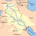
Tigr-euph de.png 1,000 × 1,005; 301 KB
-
Tigr-euph hr.png 1,000 × 1,005; 230 KB
-
Tigr-euph ku.png 1,000 × 1,005; 254 KB
-
Tigr-euph sl.png 300 × 300; 45 KB
-
Tigr-euph-ar.png 1,000 × 1,005; 229 KB
-
Tigr-euph-el.png 300 × 300; 20 KB
-
Tigr-euph-HE.png 300 × 300; 41 KB
-
Tigr-euph-ka.png 279 × 279; 43 KB
-
Tigr-euph-mk.png 1,000 × 1,005; 255 KB
-
Tigr-euph-no.png 1,000 × 1,005; 245 KB
-
Tigr-euph-sv.png 300 × 300; 46 KB
-
Tigr-euph.png 1,000 × 1,005; 264 KB
-
Tigre et Euphrate.jpg 2,592 × 1,914; 3.86 MB
-
Tigris and Euphrates Persian.png 1,080 × 1,074; 571 KB
-
Tributari del Tigri e dell'Eufrate (5000 aC).svg 739 × 816; 14 KB
-
Тигр-Евфрат мөрөн.png 1,000 × 1,005; 282 KB


