
Category:Geological maps of South Dakota
States of the United States: Alabama · Alaska · Arizona · Arkansas · California · Colorado · Connecticut · Delaware · Florida · Georgia · Hawaii · Idaho · Illinois · Indiana · Iowa · Kansas · Kentucky · Louisiana · Maine · Maryland · Massachusetts · Michigan · Minnesota · Mississippi · Missouri · Montana · Nebraska · Nevada · New Hampshire · New Jersey · New Mexico · New York · North Carolina · North Dakota · Ohio · Oklahoma · Oregon · Pennsylvania · Rhode Island · South Carolina · South Dakota · Tennessee · Texas · Utah · Vermont · Virginia · Washington · West Virginia · Wisconsin · Wyoming
Puerto Rico
Puerto Rico
Subcategories
This category has the following 7 subcategories, out of 7 total.
Media in category "Geological maps of South Dakota"
The following 11 files are in this category, out of 11 total.
-
 Badlands National Park geologic map.png 1,153 × 594; 235 KB
-
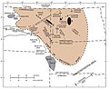
 Jewel Cave National Monument geologic map.png 779 × 513; 32 KB
-
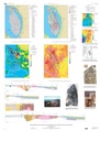 Maps showing Geology, Structure, and Geophysics of the Central Black Hills, South Dakota.pdf 6,450 × 8,512; 14.53 MB
-
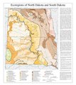 North Dakota South Dakota Level III and Level IV ecoregions USEPA.pdf 3,600 × 4,050; 977 KB
-
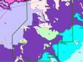
 NPS badlands-geologic-map-west.jpg 3,320 × 2,280; 1.66 MB
-
 NPS jewel-cave-geologic-map.jpg 3,414 × 2,304; 819 KB
-
 NPS mount-rushmore-geologic-map.jpg 2,460 × 2,863; 924 KB
-
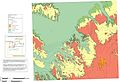
 NPS Wind Cave NP Geologic Map.png 794 × 596; 81 KB
-
 Traverse Gap and Big Stone Lake.gif 425 × 425; 77 KB
-
 Williston Basin structure map.jpg 871 × 708; 86 KB
-
 Williston Basin tectonic map.jpg 635 × 748; 83 KB


