Category:Geological maps of Ohio
Jump to navigation
Jump to search
States of the United States: Alabama · Alaska · Arizona · Arkansas · California · Colorado · Connecticut · Delaware · Florida · Georgia · Hawaii · Idaho · Illinois · Indiana · Iowa · Kansas · Kentucky · Louisiana · Maine · Maryland · Massachusetts · Michigan · Minnesota · Mississippi · Missouri · Montana · Nebraska · Nevada · New Hampshire · New Jersey · New Mexico · New York · North Carolina · North Dakota · Ohio · Oklahoma · Oregon · Pennsylvania · Rhode Island · South Carolina · South Dakota · Tennessee · Texas · Utah · Vermont · Virginia · Washington · West Virginia · Wisconsin · Wyoming
Puerto Rico
Puerto Rico
Subcategories
This category has the following 4 subcategories, out of 4 total.
*
- Mining maps of Ohio (1 F)
- Old geological maps of Ohio (14 F)
M
- Maps of the Utica Formation (10 F)
Media in category "Geological maps of Ohio"
The following 16 files are in this category, out of 16 total.
-
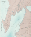
Berea Delta.png 505 × 608; 433 KB
-
Extent of Bedford Shale and Berea Sandstone - Ohio and N Kentucky.jpg 9,750 × 13,550; 17.12 MB
-
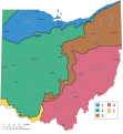
Geographic regions Ohio with numbers.svg 948 × 1,028; 870 KB
-
Geographic regions ohio.svg 650 × 870; 237 KB
-
Glacial geology of Crawford County, Ohio - DPLA - 1ebfe165887ce1436915b9bf35749887.jpg 1,275 × 1,650; 409 KB
-
Glacial geology of Huron County, Ohio - DPLA - cd6b4edcac019d5e764f3aeae611b0d8.jpg 1,275 × 1,650; 359 KB
-
Glacial Geology of Lorain County, Ohio - DPLA - f4973fa96a60bb36dc85f890adae1d79.jpg 1,275 × 1,650; 343 KB
-
Glacial geology of Marion County, Ohio - DPLA - 6bd00967451c1aa9368b21e7e1411707.jpg 1,275 × 1,650; 271 KB
-
Glacial geology of Morrow County, Ohio - DPLA - 603bcce9a4427237fd4889af74b379c7.jpg 1,275 × 1,650; 476 KB
-
Lake Monogahela.jpg 840 × 1,211; 287 KB
-
Marcellus Shale USGS.png 300 × 350; 78 KB
-
Ohio glacial geologic map.png 1,325 × 543; 630 KB
-
Utica Shale assessment - 01.jpg 1,324 × 1,026; 662 KB


