Category:Geological maps of Texas
Jump to navigation
Jump to search
States of the United States: Alabama · Alaska · Arizona · Arkansas · California · Colorado · Connecticut · Delaware · Florida · Georgia · Hawaii · Idaho · Illinois · Indiana · Iowa · Kansas · Kentucky · Louisiana · Maine · Maryland · Massachusetts · Michigan · Minnesota · Mississippi · Missouri · Montana · Nebraska · Nevada · New Hampshire · New Jersey · New Mexico · New York · North Carolina · North Dakota · Ohio · Oklahoma · Oregon · Pennsylvania · Rhode Island · South Carolina · South Dakota · Tennessee · Texas · Utah · Vermont · Virginia · Washington · West Virginia · Wisconsin · Wyoming
Puerto Rico
Puerto Rico
Subcategories
This category has the following 4 subcategories, out of 4 total.
Media in category "Geological maps of Texas"
The following 32 files are in this category, out of 32 total.
-
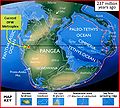
237 mya continental collision.JPG 429 × 387; 55 KB
-
94 mya Texas Geology.JPG 506 × 456; 67 KB
-
Anadarko Basin Geologic Cross Section.png 1,169 × 887; 152 KB
-
Archer City Formation map.png 4,688 × 4,638; 2.16 MB
-
Balcones, and the Mexia-Talco-Luling Fault Trends.png 771 × 561; 770 KB
-
Barnett Shale Map.png 850 × 1,100; 727 KB
-
Bulletin of the Geological Society of America (1917) (20449555995).jpg 3,272 × 2,304; 1.36 MB
-
Cretaceous Formations of Texas.JPG 711 × 386; 71 KB
-
Cretaceous Formations of the DFW Metroplex.JPG 756 × 407; 85 KB
-
Delaware Basin map.PNG 1,160 × 734; 123 KB
-
DFW Comanchean Gulfian Series.JPG 643 × 358; 64 KB
-
Eagle Ford outcrop map.jpg 216 × 193; 17 KB
-
Eagle Ford play footprint (16316823326).png 430 × 321; 139 KB
-
East Texas Basin geologic map.png 571 × 595; 84 KB
-
Edwards and Trinity Aquifers Map.png 649 × 592; 206 KB
-
Geologic Map for the Anadarko Basin.png 1,013 × 795; 194 KB
-
Geology map of Dallas.jpg 767 × 623; 222 KB
-
Haynesville Shale Map.pdf 1,650 × 1,275; 362 KB
-
Haynesville Shale Map.png 1,650 × 1,275; 667 KB
-
Llano Uplift geologic map v1.jpg 1,468 × 1,053; 745 KB
-
Map of major formations of the Permian Basin (34241207496).png 556 × 291; 106 KB
-
Map of Texas highlighting the Permian Basin.jpg 1,575 × 1,357; 464 KB
-
NPS guadalupe-mountains-geologic-map.jpg 5,105 × 3,680; 6.98 MB
-
PaloDuroCanyon geologic map.png 748 × 940; 771 KB
-
Permian Basin.jpg 480 × 552; 86 KB
-
Riogranderift localitymap.png 595 × 704; 58 KB
-
Smackover Formation areal extent.png 1,180 × 473; 820 KB
-
Structural boundaries in Texas.JPG 691 × 437; 89 KB
-
Texas seismicity map.pdf 1,800 × 1,350; 2.15 MB
-
Thickness contours of the Eagle Ford (16341024471).png 485 × 351; 155 KB
-
Val Verde Generalized Map.jpg 478 × 372; 36 KB


