Category:Geological maps of Washington (state)
Jump to navigation
Jump to search
States of the United States: Alabama · Alaska · Arizona · Arkansas · California · Colorado · Connecticut · Delaware · Florida · Georgia · Hawaii · Idaho · Illinois · Indiana · Iowa · Kansas · Kentucky · Louisiana · Maine · Maryland · Massachusetts · Michigan · Minnesota · Mississippi · Missouri · Montana · Nebraska · Nevada · New Hampshire · New Jersey · New Mexico · New York · North Carolina · North Dakota · Ohio · Oklahoma · Oregon · Pennsylvania · Rhode Island · South Carolina · South Dakota · Tennessee · Texas · Utah · Vermont · Virginia · Washington · West Virginia · Wisconsin · Wyoming
Puerto Rico
Puerto Rico
Subcategories
This category has the following 6 subcategories, out of 6 total.
F
H
M
V
Media in category "Geological maps of Washington (state)"
The following 50 files are in this category, out of 50 total.
-
Cascade Range geology detail.gif 832 × 828; 144 KB
-
Cascade Range geology detail.png 416 × 414; 32 KB
-
Centralia-Chehalis District faults GM-34.jpg 956 × 384; 113 KB
-
Channeled Scablands during flood.jpg 950 × 879; 179 KB
-
Channeled Scablands on map.jpg 450 × 339; 29 KB
-
Chuckanut outcrops.png 440 × 664; 81 KB
-
Columbia River Flood-Basalt Province.jpg 1,224 × 1,237; 1.48 MB
-
CRB-Yellowstone mantle plume model.jpg 3,789 × 4,069; 1.84 MB
-
Elwha river dams.gif 500 × 503; 19 KB
-
Fidalgo-map-brown-1977.png 603 × 506; 230 KB
-
Flickr - brewbooks - Swauk Formation Geological Map.jpg 537 × 655; 99 KB
-
Geofeatures-PacificNW.png 357 × 450; 180 KB
-
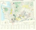
Geology of Washington state.png 1,847 × 2,096; 14.79 MB
-
Geothermal Resources of Washington 1981 R.pdf 7,618 × 6,433; 4.96 MB
-
Golfeto Willapa-South Bend-Raymond.jpg 594 × 338; 121 KB
-
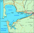
GraysHarbor.png 624 × 604; 62 KB
-
King County Geologic Map.jpg 1,380 × 890; 365 KB
-
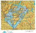
Lake Lewis Basin.jpg 720 × 540; 85 KB
-
Lakes-Washington-Oregon-9.GIF 960 × 720; 319 KB
-
Map of Washington, Oregon and Idaho geological deposits.jpeg 900 × 634; 315 KB
-
Metaline District geologic map.jpg 1,034 × 820; 236 KB
-
Mount Baker, Mount Shuksan, Washington State.png 7,680 × 4,320; 49.16 MB
-
Mount Rainier geology.png 1,683 × 1,711; 11 MB
-
Mount Rainier Osceola collapse.png 864 × 638; 458 KB
-
MSHtoutleareaedit.jpg 6,342 × 3,576; 17.8 MB
-
NEPTUNE Canada overview map.jpg 544 × 445; 220 KB
-
Noaa-archives map miller island 1983.jpg 639 × 479; 101 KB
-
NPS mount-rainier-geological-map-bedrock.jpg 3,256 × 3,832; 2 MB
-
OFR 99-311 fig48.gif 856 × 686; 110 KB
-
Oregon rotation.png 327 × 392; 79 KB
-
Oso landslide geomorphology map.png 1,139 × 750; 1.66 MB
-
Pendoreillerivermap.jpg 909 × 895; 1.01 MB
-
Physiographic regions Washington.svg 640 × 465; 387 KB
-
Puget Lowland basins and faults.png 358 × 546; 1,012 KB
-
Republic Graben, Washington.jpg 709 × 852; 132 KB
-
Satsop Hills inset map.png 372 × 304; 271 KB
-
SCF-terminus.png 312 × 423; 568 KB
-
Seattle Fault location.png 424 × 115; 19 KB
-
Seattle uplift B.png 424 × 424; 633 KB
-
Snoqualmie Valley faults.png 406 × 781; 265 KB
-
Southern Whidbey Island fault-1.png 406 × 361; 657 KB
-
Straight Creek Fault.gif 457 × 425; 33 KB
-
Straight Creek Fault.PNG 473 × 431; 51 KB
-
Sucia Island Map.png 1,168 × 882; 818 KB
-
Tacoma fault zone.png 533 × 217; 195 KB
-
USGS-PP1661d-fig22.png 340 × 411; 500 KB
-
Willamette Lowland basin-fill aquifer extent.gif 387 × 525; 24 KB
-
Yakima Fold Belt map.jpg 641 × 456; 150 KB


