Category:Geological maps of California
Jump to navigation
Jump to search
States of the United States: Alabama · Alaska · Arizona · Arkansas · California · Colorado · Connecticut · Delaware · Florida · Georgia · Hawaii · Idaho · Illinois · Indiana · Iowa · Kansas · Kentucky · Louisiana · Maine · Maryland · Massachusetts · Michigan · Minnesota · Mississippi · Missouri · Montana · Nebraska · Nevada · New Hampshire · New Jersey · New Mexico · New York · North Carolina · North Dakota · Ohio · Oklahoma · Oregon · Pennsylvania · Rhode Island · South Carolina · South Dakota · Tennessee · Texas · Utah · Vermont · Virginia · Washington · West Virginia · Wisconsin · Wyoming
Puerto Rico
Puerto Rico
Subcategories
This category has the following 13 subcategories, out of 13 total.
*
E
F
G
L
M
O
V
Media in category "Geological maps of California"
The following 47 files are in this category, out of 47 total.
-
Geologic map California.jpg 1,800 × 2,340; 792 KB
-
Bibliography of marine geology and oceanography, California coast (1955) (20181515159).jpg 3,764 × 2,738; 2.79 MB
-
CA ShakeOut Map.pdf 1,137 × 931; 996 KB
-
California Geomorphic Provinces.svg 733 × 830; 215 KB
-
California Gold Rush relief map.png 724 × 1,071; 991 KB
-
Carte geologique Californie.JPG 1,800 × 2,340; 468 KB
-
Cascade Range geology detail.gif 832 × 828; 144 KB
-
Cascade Range geology detail.png 416 × 414; 32 KB
-
Cinder Cone Lassen geologic map.png 373 × 535; 207 KB
-
Columbia River Flood-Basalt Province.jpg 1,224 × 1,237; 1.48 MB
-
DistributionMap.png 816 × 1,056; 27 KB
-
Features of basin.png 810 × 712; 433 KB
-
Generalized Geologic Map of Butte County, California.pdf 1,650 × 1,275; 192 KB
-
Geologic map of Vaca Mountains.jpg 640 × 531; 211 KB
-
Geological Map of the White Ledge Peak Triangle (Carpinteria Zoom).jpg 3,262 × 2,556; 7.67 MB
-
Geological Map of the White Ledge Peak Triangle.jpg 7,805 × 9,366; 44.08 MB
-
Geothermal areas in Lassen area.gif 632 × 437; 54 KB
-
Grass Valley Geologic Map.jpg 1,123 × 885; 332 KB
-
Great Valley Sequence map.gif 746 × 840; 121 KB
-
Humboldt County Geology Map USGS.jpg 1,905 × 1,926; 3.55 MB
-
Klamath Mountains map.gif 515 × 684; 33 KB
-
La basin location.png 818 × 632; 198 KB
-
Lake Manly system.gif 1,160 × 1,260; 207 KB
-
Lake Manly system.png 290 × 315; 16 KB
-
Map of Mount Shasta debris avalanche.png 600 × 889; 17 KB
-
MarysvilleButtesGasFieldGeologicMap.png 542 × 564; 290 KB
-
MountTehama-map.jpg 842 × 575; 434 KB
-
NorthernSanJoaquinValleyOilGasFields.png 1,035 × 599; 381 KB
-
NPS cabrillo-geologic-map.gif 1,634 × 1,934; 201 KB
-
NPS devils-postpile-geologic-map.jpg 4,259 × 2,904; 2.91 MB
-
NPS manzanar-geologic-map.gif 4,273 × 2,872; 932 KB
-
Of99-14 4a a.pdf 4,602 × 6,750; 8.72 MB
-
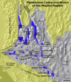
Pleistocene Lakes and Rivers of Mojave.png 545 × 631; 142 KB
-
Preliminary Mineralogical and Geological Map of the State of California, 1891.jpg 15,908 × 18,238; 144.78 MB
-
Report of the State Mineralogist (1892) (14759686646).jpg 3,855 × 2,608; 981 KB
-
Santa Rosa Geological Structure.png 1,214 × 749; 958 KB
-
Sfbay srt 1906108.jpg 540 × 458; 105 KB
-
ShakeAlert - example.jpg 735 × 1,652; 894 KB
-
The Geysers geologic map.png 787 × 916; 717 KB
-
USGS isoseismal map - 1857 Fort Tejon earthquake.gif 649 × 685; 33 KB
-
Wpdms shdrlfi020l owens river.jpg 300 × 300; 57 KB
-
Wpdms shdrlfi020l santa susana mountains.jpg 300 × 270; 44 KB


