Category:Geological maps of Yosemite National Park
Jump to navigation
Jump to search
United States national parks: Acadia · American Samoa · Badlands · Bryce Canyon · Canyonlands · Capitol Reef · Carlsbad Caverns · Congaree · Crater Lake · Cuyahoga Valley · Denali · Dry Tortugas · Everglades · Glacier · Glacier Bay · Grand Canyon · Grand Teton · Great Basin · Great Smoky Mountains · Guadalupe Mountains · Haleakalā · Hawaii Volcanoes · Hot Springs · Indiana Dunes · Isle Royale · Joshua Tree · Lake Clark · Lassen Volcanic · Mammoth Cave · Mesa Verde · Mount Rainier · Petrified Forest · Rocky Mountain · Saguaro · Shenandoah · Theodore Roosevelt · Virgin Islands · Voyageurs · White Sands · Wind Cave · Wrangell-St. Elias · Yellowstone · Yosemite · Zion
Media in category "Geological maps of Yosemite National Park"
The following 12 files are in this category, out of 12 total.
-
 Cathedral Peak Granodiorit.png 734 × 666; 375 KB
-
 General geologic map of Yosemite area.png 734 × 666; 725 KB
-
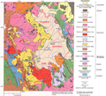
 Generalized geologic map of yosemite national park and vicinity.jpg 1,409 × 1,793; 1.15 MB
-
 Geologic map of Yosemite National Park and vicinity, California, with key and notes.jpg 15,427 × 11,799; 51.06 MB
-
 Geologic map of Yosemite National Park and vicinity, California, with key.jpg 11,107 × 11,171; 40.11 MB
-
 Map of Cathedral Peak Granodiorite.svg 743 × 696; 346 KB
-
 Map of Yosemite National Park.svg 746 × 646; 313 KB
-
 NPS yosemite-geologic-map.jpg 4,144 × 5,648; 7.23 MB
-
 NPS yosemite-recent-rockfall-map.jpg 1,004 × 435; 105 KB
-
 NPS yosemite-valley-geologic-map.jpg 4,900 × 2,704; 2.41 MB
-
 NPS yosemite-valley-glacial-geology-map.jpg 4,888 × 2,666; 2.06 MB
-
 NPS yosemite-valley-postglacial-geologic-map.jpg 4,890 × 2,694; 2.55 MB


