Category:Maps showing history of Southeast Asia
Jump to navigation
Jump to search
Subcategories
This category has the following 7 subcategories, out of 7 total.
C
L
M
P
T
V
Media in category "Maps showing history of Southeast Asia"
The following 49 files are in this category, out of 49 total.
-
Administrative Division of Siam in 1900.png 8,191 × 10,555; 67.59 MB
-
Asia (late 19th century- early 20th century).jpg 1,857 × 1,387; 773 KB
-
Asia and Islam.png 865 × 696; 527 KB
-
Bamboo Curtain.PNG 300 × 213; 6 KB
-
Bamboo Curtain.svg 360 × 280; 317 KB
-
Buddhist Expansion.svg 512 × 473; 749 KB
-
Budisma izplatība.svg 512 × 473; 784 KB
-
Carte chola.png 400 × 312; 6 KB
-
Colonial Boundaries in Southeast Asia.jpg 1,229 × 898; 220 KB
-
European Colonies in Southeast Asia.png 622 × 696; 136 KB
-
European colonisation of Southeast Asia.png 2,000 × 1,636; 392 KB
-
Hinduism Expansion in Asia de.svg 1,060 × 791; 845 KB
-
Hinduism Expansion in Asia-es.svg 512 × 382; 1.28 MB
-
Hinduism Expansion in Asia-hu.svg 512 × 382; 824 KB
-
Hinduism Expansion in Asia-id.svg 512 × 382; 779 KB
-
Hinduism Expansion in Asia-pt.svg 512 × 382; 826 KB
-
Hinduism Expansion in Asia-zh-hans.svg 512 × 382; 779 KB
-
Hinduism Expansion in Asia.svg 512 × 382; 769 KB
-
Indochina - Division territoriala (sègle XIII).png 753 × 1,147; 184 KB
-
Indochina - Division territoriala vèrs 1540.png 755 × 1,189; 174 KB
-
Khmer Empire 1203 Map (cropped).png 1,575 × 1,414; 1.75 MB
-
Khmer Empire Expansion (cropped).png 2,377 × 1,419; 442 KB
-
Khmer Empire Expansion (cropped1).png 1,956 × 1,419; 415 KB
-
Khmer Empire Expansion.png 2,377 × 1,665; 565 KB
-
Kingdom of Siam (Thailand) Map 1900 McCarthy.jpg 8,823 × 15,056; 39.21 MB
-
Mainland Southeast Asia 1100 CE (cropped).png 1,800 × 1,656; 2.66 MB
-
Mainland Southeast Asia in 1540 CE (cropped 2).png 1,705 × 1,504; 2.16 MB
-
Mainland Southeast Asia in 1540 CE (cropped 3).png 1,705 × 1,429; 1.92 MB
-
Mainland Southeast Asia in 1540 CE (cropped).png 1,800 × 1,656; 2.71 MB
-
Mainland Southeast Asia in 1540 CE.png 1,800 × 1,800; 2.75 MB
-
Mainland Southeast Asia in 700 CE (cropped).png 1,800 × 1,656; 2.67 MB
-
Mandalas1360-2.png 396 × 324; 31 KB
-
Mandalas1360.png 396 × 324; 20 KB
-
Map of French Indochina expansion.svg 675 × 970; 733 KB
-
Map of Siam (territorial cessions).svg 656 × 1,243; 760 KB
-
Map of Siam and French Indochina -by Milenioscuro- (modified Thai language).png 1,039 × 1,726; 586 KB
-
Map of Siam and French Indochina.svg 748 × 1,243; 1,014 KB
-
Map of the Rattanakosin Kingdom.svg 656 × 1,243; 686 KB
-
Map-of-southeast-asia 1400 CE km.PNG 791 × 1,114; 291 KB
-
Map-of-southeast-asia 900 CE km.PNG 791 × 1,114; 244 KB
-
Pan-Pan-guo-002.PNG 348 × 258; 62 KB
-
Sea Nomads distribution map.jpg 547 × 398; 55 KB
-
Siamvietnam1.jpg 900 × 731; 171 KB
-
Southeast Asian history (around 1540) ru.svg 776 × 1,138; 218 KB
-
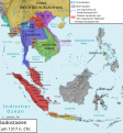
Southeastasia 1317 map de.png 2,501 × 2,688; 2.58 MB
-
Southeastasia 1317 map de.svg 1,070 × 1,150; 12.63 MB
-
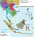
Southeastasia 1380 map de.png 2,500 × 2,687; 2.67 MB
-
Südostasien 1380.svg 1,070 × 1,150; 12.62 MB
-
Südostasien 1450.svg 1,070 × 1,150; 12.63 MB


