Category:Maps of Hennepin County, Minnesota
Jump to navigation
Jump to search
Counties of Minnesota: Aitkin · Anoka · Becker · Beltrami · Benton · Big Stone · Blue Earth · Brown · Carlton · Carver · Cass · Chippewa · Chisago · Clay · Clearwater · Cook · Cottonwood · Crow Wing · Dakota · Dodge · Douglas · Faribault · Fillmore · Freeborn · Goodhue · Grant · Hennepin · Houston · Hubbard · Isanti · Itasca · Jackson · Kanabec · Kandiyohi · Kittson · Koochiching · Lac qui Parle · Lake · Lake of the Woods · Le Sueur · Lincoln · Lyon · Mahnomen · Marshall · Martin · McLeod · Meeker · Mille Lacs · Morrison · Mower · Murray · Nicollet · Nobles · Norman · Olmsted · Otter Tail · Pennington · Pine · Pipestone · Polk · Pope · Ramsey · Red Lake · Redwood · Renville · Rice · Rock · Roseau · St. Louis · Scott · Sherburne · Sibley · Stearns · Steele · Stevens · Swift · Todd · Traverse · Wabasha · Wadena · Waseca · Washington · Watonwan · Wilkin · Winona · Wright · Yellow Medicine
Wikimedia category | |||||
| Upload media | |||||
| Instance of | |||||
|---|---|---|---|---|---|
| Category combines topics | |||||
| Hennepin County | |||||
county in Minnesota, United States | |||||
| Instance of | |||||
| Named after | |||||
| Location | Minnesota | ||||
| Capital | |||||
| Inception |
| ||||
| Population |
| ||||
| Area |
| ||||
| official website | |||||
 | |||||
Subcategories
This category has the following 6 subcategories, out of 6 total.
F
- Maps of Fort Snelling (7 F)
M
Media in category "Maps of Hennepin County, Minnesota"
The following 22 files are in this category, out of 22 total.
-
1933 Map of Hennepin County, Minnesota - DPLA - 12c2a50bb64f87aacb5c795e440388a8.jpg 6,760 × 6,288; 5.02 MB
-
1943-1944 Map of Hennepin County, Minnesota - DPLA - 40e31a0d7f7e8a7f813760b698fc3a64.jpg 6,778 × 6,323; 4.91 MB
-
2022 Hennepin County Attorney election.svg 800 × 878; 833 KB
-
Andersons Lake, Hennepin County, Minnesota (1860).png 824 × 832; 1,023 KB
-
Bloomington Ferry Trail Map-2.jpg 3,299 × 2,447; 755 KB
-
CSAH 81 map.svg 1,026 × 608; 1,009 KB
-
Fort Snelling Military Reserve - NARA - 117090475.jpg 4,800 × 6,270; 2.54 MB
-
Ftsnellingplan.png 1,531 × 1,000; 40 KB
-
Hennepin.png 299 × 326; 14 KB
-
LocationofRichlandMill.gif 300 × 287; 20 KB
-
Long Meadow Lake Trail Map OCAB closure Apr 16-2.jpg 5,099 × 3,127; 1.06 MB
-
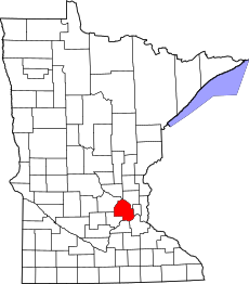
Map of Minnesota highlighting Hennepin County.svg 1,045 × 1,189; 67 KB
-
Military Reservation of Fort Snelling.png 1,351 × 2,444; 3.06 MB
-
Plan of Fort Snelling.png 1,394 × 2,420; 2.98 MB
-
Richfield hist boundaries.png 650 × 699; 50 KB
-
SPEEDWAY Field.gif 555 × 403; 10 KB
-
SPEEDWAY Field.svg 550 × 382; 621 KB
-
Wilkie Trail Map-2.jpg 3,233 × 2,449; 655 KB


