Category:Maps of Vanuatu
Jump to navigation
Jump to search
Countries of Oceania: Australia · Fiji · Federated States of Micronesia · Kiribati · Marshall Islands · Nauru · New Zealand · Palau · Papua New Guinea · Samoa · Solomon Islands · Tonga · Tuvalu · Vanuatu
Other areas: American Samoa · Clipperton Island · Cocos (Keeling) Islands · Cook Islands · French Polynesia · Guam · Hawaii · New Caledonia · Niue · Norfolk Island · Northern Mariana Islands · Pitcairn Islands · Tokelau · Wallis and Futuna – Partly: British overseas territories · Overseas France · Indonesia · French Southern and Antarctic Lands · United States Minor Outlying Islands
Other areas: American Samoa · Clipperton Island · Cocos (Keeling) Islands · Cook Islands · French Polynesia · Guam · Hawaii · New Caledonia · Niue · Norfolk Island · Northern Mariana Islands · Pitcairn Islands · Tokelau · Wallis and Futuna – Partly: British overseas territories · Overseas France · Indonesia · French Southern and Antarctic Lands · United States Minor Outlying Islands
Wikimedia category | |||||
| Upload media | |||||
| Instance of | |||||
|---|---|---|---|---|---|
| Category combines topics | |||||
 | |||||
Subcategories
This category has the following 19 subcategories, out of 19 total.
C
E
- ECHO Daily Maps of Vanuatu (11 F)
F
- Flag maps of Vanuatu (1 F)
G
L
- Location maps of Vanuatu (2 F)
M
O
P
S
T
Pages in category "Maps of Vanuatu"
The following 2 pages are in this category, out of 2 total.
Media in category "Maps of Vanuatu"
The following 45 files are in this category, out of 45 total.
-
20170410 NewCaledonia TCCook M.pdf 1,625 × 1,125; 641 KB
-
Admiralty Chart No 174 Plans in the New Hebrides, Published 1959.jpg 16,310 × 11,047; 20.64 MB
-
ECDM 20140313 World Events.pdf 1,625 × 1,125; 250 KB
-
ECDM 20140319 World Events.pdf 1,625 × 1,125; 844 KB
-
ECDM 20150108 TC ULA.pdf 1,625 × 1,125; 530 KB
-
ECDM 20150310 tropical cyclones.pdf 1,625 × 1,125; 999 KB
-
ECDM 20150312 PAM OLWYN.pdf 1,625 × 1,125; 471 KB
-
ECDM 20150325 World Events.pdf 1,625 × 1,125; 421 KB
-
ECDM 20150410 SOLO NewCaledonia.pdf 1,625 × 1,125; 854 KB
-
ECDM 20150929 Worldevents.pdf 1,625 × 1,125; 459 KB
-
ECDM 20160215 TC.pdf 1,625 × 1,125; 492 KB
-
ECDM 20160415 EQ Event.pdf 1,625 × 1,125; 771 KB
-
ECDM 20160503 World events.pdf 1,625 × 1,125; 594 KB
-
ECDM 20170505 TCDonna.pdf 1,625 × 1,125; 667 KB
-
ECDM 20180404 Australia-Fiji TCs.pdf 2,479 × 1,754; 1 MB
-
ECDM 20180409 Fiji TC.pdf 2,479 × 1,754; 829 KB
-
ECDM 20180430 South-Pacific TC-Season.pdf 2,479 × 1,754; 1,024 KB
-
ECDM 20190212 TC OMA.pdf 1,625 × 1,125; 772 KB
-
ECDM 20190219 TC OMA update.pdf 1,625 × 1,125; 499 KB
-
ECDM 20200406 TC HAROLD.pdf 1,625 × 1,125; 663 KB
-
ECDM 20200415 TC HAROLD.pdf 1,625 × 1,125; 720 KB
-
ECDM 20201214 TC-YASA.pdf 1,625 × 1,125; 515 KB
-
ECDM 20210201 SW Pacific TCs(1).pdf 1,625 × 1,125; 677 KB
-
Ecoregion AA0113.png 1,172 × 1,172; 1.45 MB
-
Flag-map of Vanuatu.svg 444 × 900; 91 KB
-
FLII Vanuatu.png 695 × 818; 42 KB
-
Homemade Map (23645849786).jpg 1,600 × 1,200; 1.08 MB
-
Iririki Vanuatu.JPG 1,903 × 1,071; 236 KB
-
Map OC-Melanesia Revised by Tom Emphasizing Vanuatu.PNG 500 × 500; 17 KB
-
Map of the location of the Teouma site on Efate Island, Vanuatu.tif 1,572 × 2,012; 933 KB
-
Map of Vanuatu Ru.png 2,000 × 2,521; 850 KB
-
Map of Vanuatu.jpg 1,041 × 1,328; 161 KB
-
Pacific Ocean laea Oceanian countries map.jpg 1,165 × 1,070; 542 KB
-
PAT - Vanuatu.gif 800 × 1,035; 39 KB
-
Population density of Vanuatu provinces.png 1,602 × 2,812; 165 KB
-
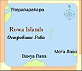
Rowa Islands.JPG 1,326 × 1,148; 358 KB
-
Vanuatu - DPLA - 7025063a58242953f4fc3b69a7958caa.jpg 2,560 × 3,278; 4.98 MB
-
Vanuatu disputed w1 countrymap.svg 1,000 × 1,000; 8 KB
-
Vanuatu DNI Solar-resource-map GlobalSolarAtlas World-Bank-Esmap-Solargis.png 1,842 × 2,605; 537 KB
-
Vanuatu GHI Solar-resource-map GlobalSolarAtlas World-Bank-Esmap-Solargis.png 1,842 × 2,605; 534 KB
-
Vanuatu map be.png 625 × 1,156; 51 KB
-
Vanuatu Population Density, 2000 (5457627526).jpg 2,507 × 3,265; 639 KB
-
Vanuatu Population Density, 2000 (6171923091).jpg 2,324 × 3,161; 518 KB
-
Vanuatu Regions map.png 1,500 × 2,771; 633 KB


