Category:Maps of Papua New Guinea
Jump to navigation
Jump to search
Countries of Oceania: Australia · Fiji · Federated States of Micronesia · Kiribati · Marshall Islands · Nauru · New Zealand · Palau · Papua New Guinea · Samoa · Solomon Islands · Tonga · Tuvalu · Vanuatu
Other areas: American Samoa · Clipperton Island · Cocos (Keeling) Islands · Cook Islands · French Polynesia · Guam · Hawaii · New Caledonia · Niue · Norfolk Island · Northern Mariana Islands · Pitcairn Islands · Tokelau · Wallis and Futuna – Partly: British overseas territories · Overseas France · Indonesia · French Southern and Antarctic Lands · United States Minor Outlying Islands
Other areas: American Samoa · Clipperton Island · Cocos (Keeling) Islands · Cook Islands · French Polynesia · Guam · Hawaii · New Caledonia · Niue · Norfolk Island · Northern Mariana Islands · Pitcairn Islands · Tokelau · Wallis and Futuna – Partly: British overseas territories · Overseas France · Indonesia · French Southern and Antarctic Lands · United States Minor Outlying Islands
Wikimedia category | |||||
| Upload media | |||||
| Instance of | |||||
|---|---|---|---|---|---|
| Category combines topics | |||||
 | |||||
Subcategories
This category has the following 28 subcategories, out of 28 total.
Pages in category "Maps of Papua New Guinea"
The following 2 pages are in this category, out of 2 total.
Media in category "Maps of Papua New Guinea"
The following 47 files are in this category, out of 47 total.
-
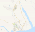 1200px Lae suburban map of Papua New Guinea.png 1,200 × 1,110; 265 KB
-
 Blanche Bay - NARA - 76059532.jpg 5,920 × 6,662; 4.6 MB
-
 Blanche Bay - NARA - 76059536.jpg 7,808 × 7,819; 7.68 MB
-
 Borneo final x.png 2,000 × 797; 469 KB
-
 FLII PapuaNewGuinea.png 1,294 × 880; 511 KB
-
 Huon Peninsula and the Straits.png 2,500 × 1,269; 1.48 MB
-
 Iles-de-Nouvelle-Guinee.png 1,200 × 809; 93 KB
-
 Kokoda trail location.svg 709 × 625; 30 KB
-
 Kokoda trail NE at top.jpg 212 × 610; 27 KB
-
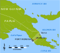
 Location Alotau.png 722 × 501; 143 KB
-
 Location of Bougainville redrawn.jpg 220 × 251; 60 KB
-

-
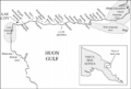
 Map Fortification Pt - Sio.PNG 1,601 × 2,514; 205 KB
-
 Map of Paedophryne localities 2.png 3,376 × 2,014; 3.29 MB
-
 Map of Pahoturi River languages.jpg 3,309 × 3,782; 758 KB
-
 Mapa da Língua Bukawa.png 812 × 551; 114 KB
-
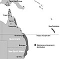 Melaleuca quinquenervia in Australia.jpg 768 × 757; 51 KB
-
 MilneBayLocation.jpg 315 × 365; 90 KB
-
 New guinea kokoda.PNG 1,164 × 974; 26 KB
-
 New guinea ok tedi mine.PNG 1,181 × 1,001; 25 KB
-
 New guinea tabubil.png 1,181 × 1,001; 16 KB
-
 New Guinea Tectonics.png 691 × 483; 166 KB
-
 New guinea.png 3,053 × 1,974; 497 KB
-
 NortheastNG Vitiaz Dampier.png 1,024 × 697; 457 KB
-
 PacificTheaterAug1942.jpg 1,199 × 873; 256 KB
-
 Papua New Guinea - DPLA - 3f11088872360af0d5772bd9e9051c42.jpg 2,548 × 3,276; 4.82 MB
-
 Papua New Guinea Base Map.png 1,108 × 697; 299 KB
-
 Papua New Guinea LLGs 2012.png 1,278 × 848; 28 KB
-
 Papua New Guinea LLGs.png 1,281 × 851; 38 KB
-
 Papua New Guinea location map showing Dampier Strait.jpg 640 × 385; 23 KB
-
 Papua New Guinea Population Density, 2000 (5457624890).jpg 2,508 × 3,264; 646 KB
-
 Papua New Guinea Population Density, 2000 (6172445918).jpg 2,397 × 3,161; 611 KB
-
 Papua New Guinea provinces by % of forest cover.png 3,000 × 2,500; 577 KB
-
 Papua New Guinea provinces by population density.png 3,000 × 2,500; 660 KB
-
 Papua New Guinea provinces by total population.png 3,000 × 2,500; 691 KB
-
 Papua new guinea Rabaul.jpg 845 × 406; 187 KB
-
 Papua New Guinea regions.png 696 × 469; 60 KB
-
 Papua new guinea.jpg 845 × 1,000; 120 KB
-
 PAT - Papua New Guinea.gif 1,090 × 800; 104 KB
-
 PNG Tok Pisin map.jpg 1,013 × 650; 92 KB
-
 Population density of Papua New Guinea provinces.png 4,715 × 3,079; 566 KB
-
 Salamaua-Lae.jpg 1,376 × 1,984; 631 KB
-
 Tami Islands and Huon peninsula.png 3,585 × 1,945; 12.88 MB
-
 Wareo location.jpg 315 × 365; 84 KB
-
 Wareo map.jpg 807 × 600; 383 KB
-
 Абелам.png 696 × 469; 38 KB
-
 ტორესიში საროტი.png 250 × 248; 38 KB


.jpg)
.jpg)


