Category:Maps of Melanesia
Jump to navigation
Jump to search

Wikimedia category | |||||
| Upload media | |||||
| Instance of | |||||
|---|---|---|---|---|---|
| Category combines topics | |||||
| Melanesia | |||||
subregion of the Pacific Ocean   | |||||
| Instance of | |||||
| Part of | |||||
| Location | Insular Oceania | ||||
| Located in or next to body of water | |||||
| Has part(s) | |||||
| Population |
| ||||
| Different from | |||||
 | |||||
Subcategories
This category has the following 5 subcategories, out of 5 total.
F
N
S
V
Media in category "Maps of Melanesia"
The following 47 files are in this category, out of 47 total.
-

-
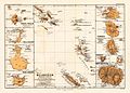 Melanesien (östliche Hälfte) 1870 Karte.jpg 2,372 × 1,700; 1.73 MB
-
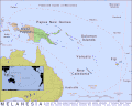
 Australia and Oceania Melanesia.jpg 2,873 × 1,969; 302 KB
-
 Australia and Papua are Melanesia.jpg 897 × 634; 500 KB
-
 Australos-mélanésiens.png 653 × 555; 17 KB
-
 DNA-Barcoding-for-Community-Ecology---How-to-Tackle-a-Hyperdiverse-Mostly-Undescribed-Melanesian-pone.0028832.s003.tif 2,049 × 2,036, 2 pages; 17.28 MB
-
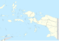 Indonesia Maluku-Western New Guinea adm location map.svg 1,472 × 1,033; 684 KB
-
 Karta PG Bismarck Archipelago Western Islands.png 725 × 475; 17 KB
-
 Karta PG Bismarck Archipelago.PNG 725 × 475; 16 KB
-
 Koppen-Geiger Map Melanesia future.svg 1,371 × 850; 1.22 MB
-
 Koppen-Geiger Map Melanesia present.svg 1,371 × 850; 1.24 MB
-
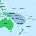
 MAP Eastern Melanesia.png 372 × 417; 22 KB
-
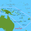 Map OC-Melanesia ar.PNG 500 × 500; 36 KB
-
 Map OC-Melanesia Revised by Tom Emphasizing Vanuatu.PNG 500 × 500; 17 KB
-
 Map OC-Melanesia.PNG 500 × 500; 12 KB
-
 Mapa Melanesia.png 952 × 796; 24 KB
-
 Melanesia ka.PNG 500 × 500; 15 KB
-
 Melanesia map (hy).png 497 × 500; 15 KB
-
 Melanesia map with track of the Endeavour.jpg 1,277 × 726; 313 KB
-
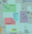 Melanesia regions map (fr).png 1,704 × 1,832; 632 KB
-
 Melanesia-map.JPG 800 × 555; 89 KB
-
 Melanesia.png 386 × 298; 8 KB
-
 Melanesian Cultural Area-de.png 500 × 500; 58 KB
-
 Melanesian Cultural Area.png 500 × 500; 97 KB
-
 Melanesian Spearhead Group.png 428 × 346; 8 KB
-
 NewBritain2022OSM.png 7,395 × 3,500; 16.12 MB
-
 Oceania UN Geoscheme - Carte de la Mélanésie.svg 900 × 520; 203 KB
-
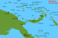
 Oceania UN Geoscheme - Map of Melanesia cropped.jpg 596 × 365; 39 KB
-
 Oceania UN Geoscheme - Map of Melanesia.svg 900 × 520; 388 KB
-
 Pacific Culture Areas (Philippines+Vanuatu Correction).svg 1,024 × 720; 558 KB
-
 Pacific Culture Areas AR.svg 1,024 × 720; 709 KB
-
 Pacific Culture Areas-ar.png 799 × 520; 211 KB
-
 Pacific Culture Areas-cs.png 872 × 567; 190 KB
-
 Pacific Culture Areas-de incl. Queensland and Peru.png 1,271 × 778; 306 KB
-
 Pacific Culture Areas-de incl. Queensland.png 1,731 × 1,125; 671 KB
-
 Pacific Culture Areas-de.png 872 × 567; 75 KB
-
 Pacific Culture Areas-eo.png 872 × 567; 186 KB
-
 Pacific Culture Areas-es.svg 1,278 × 700; 1.36 MB
-
 Pacific Culture Areas.jpg 872 × 567; 112 KB
-
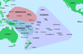
 Pacific Culture Areas.png 1,396 × 908; 666 KB
-
 Pacific Culture Areas.svg 1,024 × 720; 862 KB
-
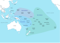
 Pacific Region Base Map.png 1,335 × 876; 303 KB
-
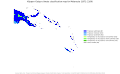
 PAT - Melanesia.gif 2,000 × 1,600; 254 KB
-
 Sandy Island New Caledonia 2.jpg 4,624 × 3,464; 1.76 MB
-
 Sandy Island New Caledonia.jpg 1,206 × 924; 639 KB
-
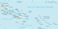 Solomon Islands CIA map.gif 630 × 320; 24 KB
-
 The Sexual Life of Savages in North-Western Melanesia - Fig. 4.png 2,067 × 3,410; 509 KB
%27_(11176259405).jpg)
_1870_Karte.jpg)


.png)

.png)


.svg)


